• Hello, please take a minute to check out our awesome content, contributed by the wonderful members of our community. We hope you'll add your own thoughts and opinions by making a free account!

Wintry Jan 15-16 Winter Storm Discussion & Obs

I know but I just thought this was “one of strongest CAD we’ve seen in a while” and now it doesn’t look like it.
1642091392154.png

He is showing a preliminary forecast of .25-.5" of ice in your area. I would say that would imply strong CAD.
 
Thru 72 I'd say once again the ensembles overall have a colder look, with more frozen precip (edit: colder than the Op still not the best track for central NC)
1642356000-O14Ds6MphI0.png

Those ensemble members really do look like a more classic Miller A/B hybrid distribution. So much better than the op. If the wave digs decently closer to gulf and transfers decently closer to the coast, I'm not sure why we wouldn't have distributions closer to those shown. 85 being the dividing line between snow....and then sleet/freezing rain as shown. Some mixing sure, but how cold this CAD is supposed to be, historically I'd expect more snow on the NW side of the 850 low. But what do I know...lol.
 
Looks like Canadian gonna pop off the coast of the Savannah area too. But I don't have those short of frames, so not sure.
 
I am just north of CLT in Huntersville. Looks to be a lot of IP or ZR around me based on the track and some soundings. Concerned for sure about losing power. If we can get that low to track a little further south or east it might change us to some more snow.
I’m just saying this based on typical Miller A climo, since that’s what the clear trend is.… I really don’t think you’re going to have a huge ice accrual up you way. Some ZR mixed in at times yes, but nothing to cause widespread damage. Typically the area of major ZR in a Miller A in the Carolinas is in a much more narrow area than what is being depicted on these ZR accumulation maps, and I see that setting up close to the Hwy 1 corridor . You typically will see a much wider area of sleet dominate, and there can be a lot of it.
 
Me too, man. I don’t want one grain of sleet. It’s close!

I’ve spoken to a few locals and they are saying lake toxaway could be one of the jackpot spots. One said if it were to stay all snow that we could see 18” safely. Don’t think I’d know what to do if I saw a foot of snow. Seems to be a great spot for lift and max QPF. I’m ready to get on the road!
 
I’m just saying this based on typical Miller A climo, since that’s what the clear trend is.… I really don’t think you’re going to have a huge ice accrual up you way. Some ZR mixed in at times yes, but nothing to cause widespread damage. Typically the area of major ZR in a Miller A in the Carolinas is in a much more narrow area than what is being depicted on these ZR accumulation maps, and I see that setting up close to the Hwy 1 corridor . You typically will see a much wider area of sleet dominate, and there can be a lot of it.
I'm in ballantyne, and I'm sure my weather will be similar to yours.. do you think we're going to have crippling freezing rain?
 
If someone in this area can find a way to stay all or mostly snow there’s going to be some big boy totals. Keep seeing lollipops in this area. NAM was concerning with temp profiles but from what I can remember in the past it’s a little amp happy towards the end of its range. View attachment 104985

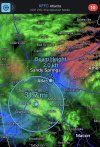
I live in that circle. I’ll keep a running report for y’all.
 
Back
Top