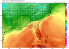
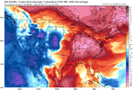
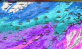
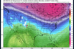
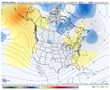
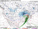
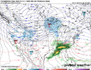
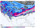
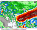
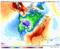
On Sunday I wouldn’t be surprised to see some onset sleet across the piedmont. HRRR with dew points in the 20s and temp around 35 when precip starts. Quickly changes to the coldest rain of the year though. Soggy wet amazing Sunday ahead ?
-
Hello, please take a minute to check out our awesome content, contributed by the wonderful members of our community. We hope you'll add your own thoughts and opinions by making a free account!
You are using an out of date browser. It may not display this or other websites correctly.
You should upgrade or use an alternative browser.
You should upgrade or use an alternative browser.
Pattern Jammin January 2023
- Thread starter Goose88
- Start date
CltNative90
Member
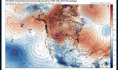
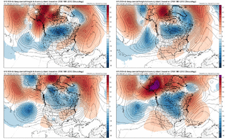
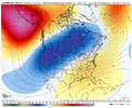
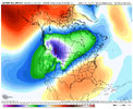
Yep. All we can do is speculate about what will happen in the long range, given knowledge about what has happened historically in similar background states. The models have shown us time and time again that they can turn on a dime, then do a complete 180 in the other direction. A very small error in the short term forecast, or even current conditions, can have a massive impact on the downstream. The science of forecasting is worlds away from being perfect. It’s what makes this hobby so rewarding at times, and so stressful and nerve wracking at others.It seems we might have a little too much confidence in the models, in regard to pattern changes, and and snow possibilities after 10 days. Even the ensembles can do pretty bad. Here is an example of the Gef as of 7 days ago compared to now. 7 days ago, (and even 3 or 4 days ago) it sure looked like the La nina Atlantic ridge was going to end winter for the foreseeable future. I am sure we will see the Atlantic ridge in total domination of our weather soon enough. we are his home field after all, but I think it is definitely way too early to call the fight either way.
one week ago 10 day forecast

this evolves to this in 5 days

the same time period forecast almost one week later
beginning 06z JAN 23

ending here

I personally try not to speak or think in absolutes about the long term pattern, and tend to be skeptical of others that do so, regardless of whether things are looking good or bad. Hold onto that glimmer of hope, but don’t get disappointed if nothing materializes. Enjoy weather for the beautiful and unpredictable thing it is. Its the only way to stay level headed if you live in the south and love cold and snow, especially in winters like this one.
Webberweather53
Meteorologist
One of the ugliest looking patterns (for cold/snow) I can remember in quite a while is probably on the way for the front 2.5-3 weeks or so of February. Not surprised by it at all though. Been saying this for weeks, you’re just asking to get torched when you have a La Niña superposed onto subseasonal convective anomalies over the Eastern Hemisphere.
We’ll likely have to wait until late Feb or early Mar to see something consistently decent
We’ll likely have to wait until late Feb or early Mar to see something consistently decent
Webberweather53
Meteorologist
Much like I did around this time in December (linked below), here's my general sentiment on the rest of meteorological winter.
Again, looking at the big, general picture, don't worry about any details this far out. Only concerned about the planetary-continental scale wave pattern evolution & tropical-extratropical subseasonal coupling processes, not individual storms, not rain/snow p-type maps, etc.
From a tropical forcing perspective & using weekly model forecasts + Nina climatology & analogs as a basic guide line (not actual forecast), this is what things generally look like to me. Tropical forcing will be very dominant over the next several weeks as the MJO &/or Kelvin Waves in the E Hem superposes onto La Nina (gets an assist from the SSWE in the form of an enhanced Brewer Dobson Circulation & we begin to approach the annual peak in MJO amplitude in Feb-Mar).
The big -EAMT event we saw this past week set this pattern evolution into motion and the Pacific jet retraction will get handed off & further reinforced by the MJO as we enter February, leading to a prolonged period of -PNA/SE ridge pattern in the first half-2/3rds of February.
Thus, I think we'll probably go from this central-western weighted trough & southern Canada vortex late month w/ occasional bouts of cold + an outside chance of a CAD event, to a more traditional -PNA in the first week of February that probably shuts down any real chance we have wintry weather, unless we see the 50-50 low go completely crazy like a few EPS & GEFS runs have hinted at.
Thereafter, as we get into the 2nd week of February, I suspect the SE US ridge will actually amplify + flex up the East Coast as the -PNA retreats further into western Canada, yielding a potentially very/unusually mild pattern for much of the E US (not just the SE US this time). I think this pattern will try to persist into at least the 3rd week of February (Feb 14-21), even as the MJO (or whatever comes of subseasonal tropical forcing) enters the West Pacific but by then, I believe we'll see the large-scale puzzle pieces begin to start shuffle around, eventually yielding a potential +EAMT &/or MJO-induced Pacific jet extension sometime around Feb 20th or so.
Eventually, I think that coupled with rapidly shortening jet wavelengths will cause a lot of reshuffling of the circulation pattern over the N Pacific + N America, allowing us to shake off this -PNA/SE ridge pattern sometime around the last week of February & transition to a favorable look for cold/snow right at the tail end of February &/or early March, a time of the winter where we tend to see the most big dog winter storms per capita.
Given that we're not only in a La Nina but would be closing in on a time of the year where the MJO tends to be the most amplified (& therefore slow), plus potential interaction with a SSWE &/or ENSO, there's a risk this overall timeline on the back end of February gets pushed back some closer to early March, but not favoring that scenario for now.
I think these RMM regression maps from Paul Roundy get the general idea generally right here.
Late January: (Very) marginal pattern for cold/snow w/ mean trough centered to our west w/ trough south of Greenland. Slight chance of a CAD event.
Early-mid February: Transition to a more canonical La Nina -PNA/SE ridge pattern w/ the SE ridge flexing up the East Coast, & getting warmer (anomaly wise) as time progresses during this period.
Late February: +EAMT &/or MJO-induced jet extension flips the Pacific pattern, pattern reshuffles over N America in response to that & seasonal changes to the jet stream. Favorable pattern for cold/snow tries to return during the last week of Feb or so.
Early March: A favorable pattern for cold/snow seems most likely to return during this time period. Fighting against increasingly unfavorable climo as early March turns into mid-March. Suspect after our "false spring" in early-mid February, actual spring may get put on hold for a bit this year once we flip the calendar to March.
https://www.atmos.albany.edu/facstaff/roundy/waves/rmmcyc/index200reg.html
View attachment 130404
View attachment 130414
Here are the JMA MJO composite OLRa & VP200a for each MJO as a rough reference guide to compare w/ against the extended GEFS above.
https://ds.data.jma.go.jp/tcc/tcc/products/clisys/mjo/composite.html
View attachment 130420
Generally feeling more confident about this than I was a few days ago when the threat of -NAO was looming in week 2.
Seems like a wave reflection event in the stratosphere over the N Pacific will put a stop to the -NAO attempt.
rburrel2
Member
Seems like you've already busted for late January. Unless something drastic changes in the modeling, the last week of January will average well below normal on temps.Generally feeling more confident about this than I was a few days ago when the threat of -NAO was looming in week 2.
Seems like a wave reflection event in the stratosphere over the N Pacific will put a stop to the -NAO attempt.
Edit: well below normal might be a stretch, but looks like -1 or -2C average departures.
RAH thinks there could be a (very) brief wintery period.On Sunday I wouldn’t be surprised to see some onset sleet across the piedmont. HRRR with dew points in the 20s and temp around 35 when precip starts. Quickly changes to the coldest rain of the year though. Soggy wet amazing Sunday ahead ?
Fast moving southern stream vort max will move into the southeastern
CONUS early Sunday morning ahead of a deepening longwave trough over
the southern MS Valley. Strong isentropic ascent and impressive
moisture advection (PW`s approaching 1-1.5 inches area-wide which is
above the 90-95th percentile and is actually approaching record
values in some areas) will allow for the development of widespread
stratiform rain across the area as a surface low develops and
deepens near the coast. As mentioned above, precip onset likely to
occur during the pre-dawn hours Sunday morning and quickly
overspread the entire forecast area by mid morning. In terms of
mixed precip potential right at the onset when temps will still be
in the low-mid 30s, wet bulb temps will be at or just below freezing
across the northern fringes of the forecast area Sunday morning.
However the lack of a strong surface high (and cold arctic air) to
the north, not to mention the lack of continued dry advection from
the north/northeast, suggests a very marginal environment for
freezing rain. Thus I will keep it out of the forecast. Temperatures
will ultimately rise above freezing just after daybreak and at
present there are more factors against forecasting freezing rain
than for it.
PoPs on Sunday were already at 100 percent and I see no reason to
change that whatsoever given today`s 12Z deterministic and
probabilistic guidance. Rainfall amounts have trended upward just a
bit with today`s runs with just shy of an inch of rain expected near
the Triad, and closer to 1.7 inches in the Coastal Plain (the areas
that need it most drought-wise). With widespread rainfall, cloud
cover, and subsequent in-situ cold air damming, temperatures will
struggle to reach 40 on Sunday in the western and central Piedmont.
To the east it`s a tougher forecast as some of the higher resolution
guidance shows a brief window where temps may climb into the 60s.
This would mainly be closer to the coast but the last few runs of
the NAM have also showed these temperatures across far southern
Sampson County and I drew in a small area of elevated temperatures
Sunday afternoon.
Me to. So glad I want be able to play Golf and its gonna rain on my time and not the companys time lol. Spring M-F and CAD on Sat/Sun seems like every week
Prime golf weather Sunday no one else on the course to hold you upMe to. So glad I want be able to play Golf and its gonna rain on my time and not the companys time lol. Spring M-F and CAD on Sat/Sun seems like every week
Webberweather53
Meteorologist
Seems like you've already busted for late January. Unless something drastic changes in the modeling, the last week of January will average well below normal on temps.
Edit: well below normal might be a stretch, but looks like -1 or -2C average departures.
Exactly which part of my forecast "busted" for late January? Isn't this exactly what's happening?
https://southernwx.com/community/threads/jammin-january-2023.1159/post-611067
"Once we get to/past Jan 10th ish, we should see more of a canonical El Nino/+PNA pattern return. We'll probably progressively step down from this super mild pattern to a seasonable one, that eventually becomes rather cool again as we move into mid-late January."
https://southernwx.com/community/threads/jammin-january-2023.1159/post-619644
"Late January: (Very) marginal pattern for cold/snow w/ mean trough centered to our west w/ trough south of Greenland. Slight chance of a CAD event."
"Thus, I think we'll probably go from this central-western weighted trough & southern Canada vortex late month w/ occasional bouts of cold + an outside chance of a CAD event, to a more traditional -PNA in the first week of February that probably shuts down any real chance we have wintry weather, unless we see the 50-50 low go completely crazy like a few EPS & GEFS runs have hinted at. "
rburrel2
Member
You’re quoting two different posts. Tbh, you’ve posted about 100 different times and flipped/flopped/hedged on your takes so many times it should be easy for you to find some quotes to fit your narrative no matter what outcome we get the rest of the winter.
My post was specifically referring to you saying late January would be marginal for cold air when it appears we will have plenty of cold air around.
My post was specifically referring to you saying late January would be marginal for cold air when it appears we will have plenty of cold air around.
Heelyes
Member
Highs in the low 50s in the forecast for the rest of the month, that's not cold. Not even marginal cold.You’re quoting two different posts. Tbh, you’ve posted about 100 different times and flipped/flopped/hedged on your takes so many times it should be easy for you to find some quotes to fit your narrative no matter what outcome we get the rest of the winter.
My post was specifically referring to you saying late January would be marginal for cold air when it appears we will have plenty of cold air around.
Flotown
Member
pattern not great but with cold air close wouldnt take but one well timed storm to ger someone in the southeast..like some have said so im not giving up....completely
Webberweather53
Meteorologist
You’re quoting two different posts. Tbh, you’ve posted about 100 different times and flipped/flopped/hedged on your takes so many times it should be easy for you to find some quotes to fit your narrative no matter what outcome we get the rest of the winter.
My post was specifically referring to you saying late January would be marginal for cold air when it appears we will have plenty of cold air around.
I'm quoting two different posts where I basically said the exact same thing, so this is just total nonsense. I was hopeful for my call for late Jan-Feb to bust w/ a -NAO, but it doesn't look like that's gonna happen. I was very open about this & tried my best to be "Mr. Positive" this past week, but the reality is this pattern sucks & is gonna suck even more when February comes around.
There isn't a legit storm signal or much in the way of fantasy snow/ice maps because this pattern is objectively very marginal for a storm.
Next question.
NoSnowATL
Member
TransNino impact on the weather.I'm quoting two different posts where I basically said the exact same thing, so this is just total nonsense. I was hopeful for my call for late Jan-Feb to bust w/ a -NAO, but it doesn't look like that's gonna happen. I was very open about this & tried my best to be "Mr. Positive" this past week, but the reality is this pattern sucks & is gonna suck even more when February comes around.
There isn't a legit storm signal or much in the way of fantasy snow/ice maps because this pattern is objectively very marginal for a storm.
Next question.
Jan88
Member
Some folks on here act like the models are etched in stone 10-16 days out news flash they are not.forecast r good out to 5-7 if your lucky depends on the season. The interaction between all these many variables is too complicated for current science I believe.yes it's come a long way but it's got a long way to go to be an exact science imo.It seems we might have a little too much confidence in the models, in regard to pattern changes, and and snow possibilities after 10 days. Even the ensembles can do pretty bad. Here is an example of the Gef as of 7 days ago compared to now. 7 days ago, (and even 3 or 4 days ago) it sure looked like the La nina Atlantic ridge was going to end winter for the foreseeable future. I am sure we will see the Atlantic ridge in total domination of our weather soon enough. we are his home field after all, but I think it is definitely way too early to call the fight either way.
one week ago 10 day forecast

this evolves to this in 5 days

the same time period forecast almost one week later
beginning 06z JAN 23

ending here

NBAcentel
Member
GoDuke
Member
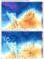
Idk where is it?Where’s the legit cold View attachment 130770
JHS
Member
I would not be shocked to see 75-80 somewhere before February 20. CAD may keep it from being along the i-85 corridor though.I'm quoting two different posts where I basically said the exact same thing, so this is just total nonsense. I was hopeful for my call for late Jan-Feb to bust w/ a -NAO, but it doesn't look like that's gonna happen. I was very open about this & tried my best to be "Mr. Positive" this past week, but the reality is this pattern sucks & is gonna suck even more when February comes around.
There isn't a legit storm signal or much in the way of fantasy snow/ice maps because this pattern is objectively very marginal for a storm.
Next question.
Don’t know anyone who’s called for legit cold for this time period. Maybe some of the usual twitter weenies actually. But I’m surprised we’re even getting average with how crappy of a pattern we’re suppose to be in. That’s a win in my book average in the heart of winter? I’ll take it for as long as we can keep it before we literally burn to a crisp in February. We’re going to be able to cook eggs on the asphalt!Where’s the legit cold View attachment 130770
rburrel2
Member
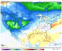
Where's the torch?Where’s the legit cold View attachment 130770
Blue_Ridge_Escarpment
Member
Looks like up near NW Canada lolWhere's the torch?
NBAcentel
Member
With that H5 patterns that showing up, sooner then laterWhere's the torch?
Torch for the win. If it isn’t gonna snow I will pass on the 34 degrees and rain.With that H5 patterns that showing up, sooner then later
Hey, what's our SER doing over the Baja? Get lost on 00z Goofus?


NBAcentel
Member
ATLwxfan
Member
With that H5 patterns that showing up, sooner then later
I mean everything shows up sooner than later.
Sent from my iPhone using Tapatalk
ATLwxfan
Member
The run to run changes on the GFS are comical
Sent from my iPhone using Tapatalk
Sent from my iPhone using Tapatalk
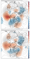
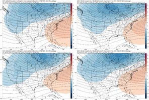
Past 4 runs .. pretty minute differences .. just a regular ole SER coming per expectationsGefs likely gonna have a stronger southeast ridge due to more Aleutian-GOA ridging View attachment 130779
NBAcentel
Member
Latest GFS kinda reminds me of last Feb. Had a few storms take the similar path showing up on the GFS. Difference though was last Winter, we had a great January so it didn’t sting as bad. Oh well. Weather going to do what the weather wants to do. Southeast ridge basically stiff arms every piece of energy NW of us.
Sheesh GFS keeps us fairly chilly even in this pattern with the amount of cold air right above our heads.. doesn’t take much for it to bleed over to parts of the SE. probably won’t be that stout as it’s 06z run shows but I bet those cold high pressures will throw wrenches in the SE tanning/pool pattern .. unless you live in Florida

