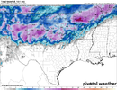
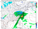
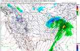
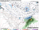
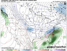
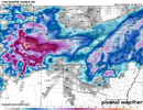
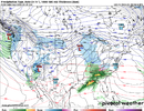
I see the 8-day 18ZGFS has begun the NW trend of the 12Z clipper. From Huntsville to Sue St Marie Michigan.
-
Hello, please take a minute to check out our awesome content, contributed by the wonderful members of our community. We hope you'll add your own thoughts and opinions by making a free account!
You are using an out of date browser. It may not display this or other websites correctly.
You should upgrade or use an alternative browser.
You should upgrade or use an alternative browser.
Pattern Jammin January 2023
- Thread starter Goose88
- Start date
ATLwxfan
Member
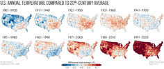
Normal (or average actually) temps are determined by an average of the past 3 decades of 10yr data sets. Currently using this span of time 1991-2020.
Think I have that correct but others here can confirm.
I mean maybe it’s recency bias but I don’t remember a winter in the last 10 where we spent an equal amount of time BN and AN. I am looking forward to the recalibration in 10 years when it doesn’t always have to look so orange and red.
Sent from my iPhone using Tapatalk
ATLwxfan
Member
It’s apps runner city on the ensembles, lots of rain in our future.
As long as the I-95 corridor gets jobbed, I am fine with this.
Sent from my iPhone using Tapatalk
Good need rain we know 5/15-9/1 will be a desertIt’s apps runner city on the ensembles, lots of rain in our future.
We just had a recalibration and dropped the colder 80s and we still spend most time above average. bUt GlObAl WaRmInG aInT rEaLI mean maybe it’s recency bias but I don’t remember a winter in the last 10 where we spent an equal amount of time BN and AN. I am looking forward to the recalibration in 10 years when it doesn’t always have to look so orange and red.
Sent from my iPhone using Tapatalk
And btw that last part isn't at anyone on this board. It's the non weather folk saying that on Twitter and FB when we set one cold record here and there but constantly smash heat records that get annoying
80s where just as warm as they where cold,if not more so.We just had a recalibration and dropped the colder 80s and we still spend most time above average. bUt GlObAl WaRmInG aInT rEaL
We get a east based mod- strong el nino next season,it will be a carbon copy of this one. Start preparing mentally now just to be safe.
NoSnowATL
Member
Is that the forecast?We get an east based mod- strong el nino next season,it will be a carbon copy of this one. Start preparing mentally now just to be safe.
Our averages went up when we dropped the 80s so they definitely were colder than the last 30 years.80s where just as warm as they where cold,if not more so.
- Joined
- Jan 2, 2017
- Messages
- 1,566
- Reaction score
- 4,279
I'm with you sir...sick of the rain! Nice day tomorrow and Saturday then it's riser and repeat.Just like every other Nina year...
At this point,
?
I'd take warm or cold dry.
We've had way too much rain.
I'm not an anti rain guy but,
This is too much.
I really wish we did unsmoothed averages that encompassed the sites life cycle and not a 30 year subset smoothed to make it pretty. Then you just update the averages as each day goes by. I mean why not just use a 30 year period for records as well and just ignore what happened previously. This stuff just irks meWe just had a recalibration and dropped the colder 80s and we still spend most time above average. bUt GlObAl WaRmInG aInT rEaL
And btw that last part isn't at anyone on this board. It's the non weather folk saying that on Twitter and FB when we set one cold record here and there but constantly smash heat records that get annoying
That would be a great way to do it I agree. Snowfall as well all the way back as far as records go. It would no doubt still show a rise in temps and decline in snow. ------------- shares the all time snow average vs 30 year average several times a year. All time is 5.8 and 30 year is 3.6. But I will say the last 30 years have probably made the warming and decreased snowfall look worse than it really is because we've dropped the 60s, 70s and 80s which seemed to be abnormally colder and snowier compared to the previous decades, all back to back.I really wish we did unsmoothed averages that encompassed the sites life cycle and not a 30 year subset smoothed to make it pretty. Then you just update the averages as each day goes by. I mean why not just use a 30 year period for records as well and just ignore what happened previously. This stuff just irks me
IndeedThat would be a great way to do it I agree. Snowfall as well all the way back as far as records go. It would no doubt still show a rise in temps and decline in snow. ------------- shares the all time snow average vs 30 year average several times a year. All time is 5.8 and 30 year is 3.6. But I will say the last 30 years have probably made the warming and decreased snowfall look worse than it really is because we've dropped the 60s, 70s and 80s which seemed to be abnormally colder and snowier compared to the previous decades, all back to back.
Did you move to Jonesville?Good need rain we know 5/15-9/1 will be a desert
They had more rain than me last summerDid you move to Jonesville?
ATLwxfan
Member
That is incredible! Why are we even here? Shut the whole thing down!
Sent from my iPhone using Tapatalk
It's approx. one bleepin' degree (F). Colors can be deceptiveThat is incredible! Why are we even here? Shut the whole thing down!
Sent from my iPhone using Tapatalk
RAH now going that way as well.Beautiful day ahead on Sunday!! View attachment 130679View attachment 130680
High temperatures Saturday are expected to be seasonable, with highs
in the upper 40s to mid 50s, with lows Sunday morning in the 30s.
High temps on Sunday will be difficult, with the expected in-situ
CAD airmass developing and resultant evaporative cooling effects on
temperatures. It`s possible the Triad may remain stuck in the mid to
upper 30s all day, with temps near 40 across the Triangle. Somewhere
across central NC (eastern/southeastern portion of the area likely),
expect a fairly tight temperature gradient, with a possible 20-25
degree temperature difference over a short distance. For now will go
with highs of around 40 across the northwest Piedmont to around 60
across the far east/southeast. Low are expected to be in the upper
30s to mid 40s Sunday night.
rburrel2
Member
End of season winter bang potential is legit
Stormlover
Member
Yep, and the heat island effect is being ignored.It's approx. one bleepin' degree (F). Colors can be deceptive
Brent
Member
Sunday looks miserable around here, temps in 30s with rain, wouldn't even rule out a few ip at onset. Doubt warm air makes much westward progress into a solid wedge either. Great day for football I guess
3k NAM at end of it's run had dews still in 20s as precip was arriving
3k NAM at end of it's run had dews still in 20s as precip was arriving
LukeBarrette
im north of 90% of people on here so yeah
Meteorology Student
Member
2024 Supporter
2017-2023 Supporter
rburrel2
Member
rburrel2
Member
Also interesting the jump the icon made from a cutter to much further south
For all of you young weather/snow enthusiasts, I highly recommend moving to Colorado before settling back in the Southeast. The snow is inevitable and the women are great?
I'm too old and I would miss the easy beach driveFor all of you young weather/snow enthusiasts, I highly recommend moving to Colorado before settling back in the Southeast. The snow is inevitable and the women are great?
Snowman63
Member
You’re in a good spot along with the Ozarks in Northern Arkansas for this storm.Winter alive and well here apparently. This could actually be our biggest snowstorm of the winter if it lines up right. The only accumulation was during the Christmas cold so far View attachment 130688
Brent
Member
Can anybody give me the eps and gfs ensembles snow matrix for Indianapolis Indiana and Fort Wayne Indiana..I’m going up there Tuesday to visit family and it seems like the storm might be a good hit there next week. If so it would be greatly appreciated.
Webberweather53
Meteorologist
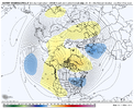
No real huge surprises here. Even the temperature probabilities in the CONUS are very close to historical La Nina climatology (~70-75% chance of above average temps in La Nina Februarys over the Carolinas).
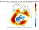
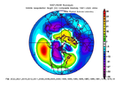
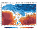
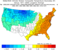
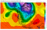
What small/unlikely chance we had of getting -NAO in week 2 to try & mute this La Nina pattern is dwindling away, likely because of wave reflection (in the stratosphere), as evidenced by a ridge anomaly near the NE Pacific + Alaska & a trough over the Baffin-Hudson Bay in the model trend plots.
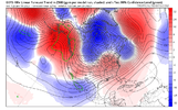


What small/unlikely chance we had of getting -NAO in week 2 to try & mute this La Nina pattern is dwindling away, likely because of wave reflection (in the stratosphere), as evidenced by a ridge anomaly near the NE Pacific + Alaska & a trough over the Baffin-Hudson Bay in the model trend plots.

Nomanslandva
Member
Can anybody give me the eps and gfs ensembles snow matrix for Indianapolis Indiana and Fort Wayne Indiana..I’m going up there Tuesday to visit family and it seems like the storm might be a good hit there next week. If so it would be greatly appreciated.

Model charts for USA (Snow depth) | ECMWF IFS HRES 0z/12z (15 days)
ECMWF IFS HRES 0z/12z (15 days) - Current model charts of parameter "Snow depth" for map "USA"
If you leave Model and Model run to Most Recent, you can go to Switch Members and tab through them. Decent free site to see individual members but lots of adds. You can zoom in to regions too. Oh yea, you can Change Parameter for other maps, but selection is limited.
I'll wait through the weekend before calling in the punter. But the window of opportunity for the last week of January is closing. Outside some onset Ice Sun and again Wed for far NW NC as well as some upslope snow squalls on the backside of some lows that will occur over the next 10 days for East Tn/ NC mtn western slopes. There's nothing to hang the ole hat on.
Just ran the CFS out through Feb 19 and its gets uglier as time marches on. Gonna take a late winter/ spring storm to bail us out now from the looks of it. 1993 and 1960 as well as Feb 28,2004 and several other years give hope. Most of the big late winter snows happen at the end of non inspiring winters it seems.
Just ran the CFS out through Feb 19 and its gets uglier as time marches on. Gonna take a late winter/ spring storm to bail us out now from the looks of it. 1993 and 1960 as well as Feb 28,2004 and several other years give hope. Most of the big late winter snows happen at the end of non inspiring winters it seems.

