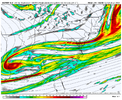
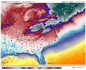
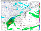
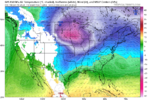
We've already got so many dishes on the table I'm not sure there's room for dinner at this point.That first and second storm shouldn’t be what we look for when we want a storm in the SE. those could be theoretically our table setters as after that second storm we get a good injection of cold air then. Then we look for energy that rounds the base of the trough or maybe some upper level energy to give us a chance at some snow or winter precip/ overrunning potential
-
Hello, please take a minute to check out our awesome content, contributed by the wonderful members of our community. We hope you'll add your own thoughts and opinions by making a free account!
You are using an out of date browser. It may not display this or other websites correctly.
You should upgrade or use an alternative browser.
You should upgrade or use an alternative browser.
Pattern Jammin January 2023
- Thread starter Goose88
- Start date
iGRXY
Member
It gets squashed but it was headed to glory.
Cary_Snow95
Member
Back the western ridge back to the west a little and give it a little room to breathe and that’s probably a nice hit
Pretty flat but the cold is a

Okay this is extremely interesting looking. This is about as perfect of a western ridge as you're going to get.
Snownut
Member
Really all we need is a good 35° Sfc temp and cold air aloft. Here in my neck of woods in upstate. Our biggest snows have never had the coldest of Air. I've seen very heavy snow here at 35-36°Get true artic air. She will go dry as a bone. That’s way it works
Sent from my SM-A526U using Tapatalk
Cary_Snow95
Member
Main takeaway right now is that we will have about a 4-7 day window from 1/27- 2/2 with the players on the field. After that the SE ridge probably wins out
Webberweather53
Meteorologist
If the Canadian Ensemble is to be believed + overall trends we’re seeing on NWP lately, next week’s -NAO stands a good chance to couple with the stratosphere and persist for a rather long time, possibly thru early to even mid March (?).
Even if we don’t snow, that kind of circulation change would have a realistic chance to put a damper on us torching in Feb (like we normally do in La Ninas) or at least make that period of time much shorter overall.
I really hope my call for a warm first half-2/3rds of February this year busts, that would be awesome ?
lexxnchloe
Member
Im looking at the GFS and it ends very warm with rain well into Canada. If this is just another 3 day cold then righr back to 10-20 above normal then the pattern still hasnt changed.Main takeaway right now is that we will have about a 4-7 day window from 1/27- 2/2 with the players on the field. After that the SE ridge probably wins out
Webberweather53
Meteorologist
Cary_Snow95
Member
Well like my post says, there is about a 4-7 day window where we have potential. Warm will come backIm looking at the GFS and it ends very warm with rain well into Canada. If this is just another 3 day cold then righr back to 10-20 above normal then the pattern still hasnt changed.
lexxnchloe
Member
I agree. Hopefully the people saying the pattern is actually going to change will be right. I just dont see it on the GFS.Well like my post says, there is about a 4-7 day window where we have potential. Warm will come back
Cad Wedge NC
Member
Dear Lord.... when has the GFS ever been right in that time-frame? Never.....I agree. Hopefully the people saying the pattern is actually going to change will be right. I just dont see it on the GFS.
SnowwxAtl
Member
OMG.. finally, someone said it! Whew, I can go back to work now!...#whambyDear Lord.... when has the GFS ever been right in that time-frame? Never.....
Thats the problem. Your looking at GFS. When you get the EPs and GEPS singing same tune, Its no aurgument who's right and whos wrong. Now the GEFS, would warrant caution. New Op GFS is garbage LR, beneath the old DGEXI agree. Hopefully the people saying the pattern is actually going to change will be right. I just dont see it on the GFS.
So, the GEPS has essentially the entire CONUS much below normal pretty much from day 5 to infinity. Do ensemble suites factor in 10Mb forecast conditions and the forecast effect of an SSWE in time?If the Canadian Ensemble is to be believed + overall trends we’re seeing on NWP lately, next week’s -NAO stands a good chance to couple with the stratosphere and persist for a rather long time, possibly thru early to even mid March (?).
Even if we don’t snow, that kind of circulation change would have a realistic chance to put a damper on us torching in Feb (like we normally do in La Ninas) or at least make that period of time much shorter overall.
I really hope my call for a warm first half-2/3rds of February this year busts, that would be awesome ?

Table Setter: Part DeuxWe've already got so many dishes on the table I'm not sure there's room for dinner at this point.
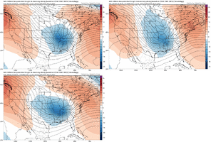
Hmmm, overall we have definitely become colder on the modeling post Jan 25, but I wish another model was in agreement with the CMC Ens. The GEFS and EPS show more of a cold shot then a fairly quick move to -PNA / SE Ridge. Hopefully, we can continue to trend better going forward and sneak something in the colder window here
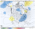
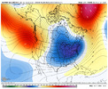
Here are comparison loops of GEFS / EPS / CMCE, first on Jan 29, then on Feb 2


Here are comparison loops of GEFS / EPS / CMCE, first on Jan 29, then on Feb 2


Brent
Member
SnowNiner
Member
Hmmm, overall we have definitely become colder on the modeling post Jan 25, but I wish another model was in agreement with the CMC Ens. The GEFS and EPS show more of a cold shot then a fairly quick move to -PNA / SE Ridge. Hopefully, we can continue to trend better going forward and sneak something in the colder window here
Here are comparison loops of GEFS / EPS / CMCE, first on Jan 29, then on Feb 2


Has there ever been a time when the CMC ensembles have led the way on a pattern change? Honestly, because I tend to ignore them.
Is there any forcing or background reasons to believe the strong Atlantic troughing on the CMC?
Webberweather53
Meteorologist
I’d personally give the GEPS -NAO scenario about a 25% chance or so of verifying.
Still seems somewhat unlikely to me, but there are a few things in its corner right now.
-The overall trend on NWP lately (remember we didn’t have much of an -NAO in the forecast a couple days ago & the GEPS was one of the first to jump on it for next week, while the GEFS has seemed late to the party.)
-The AAMa dip we saw this past week makes it easier for the ridge to retrograde over the top from the Urals, because planetary vorticity advection is more able to overcome background westerly advection by the jet stream itself.
-Being in a La Niña helps us in a big way to maintain this -NAO here, because through wave interference and more disjointed Pacific + Atlantic jet streams, La Niña actually mutes the canonical Indian Ocean >> +NAO teleconnection that models like the GEFS are showing (perhaps erroneously at that in this particular case)
See: https://agupubs.onlinelibrary.wiley.com/doi/full/10.1029/2019GL084683
In fact, I think each model’s depiction of the MJO and how they believe it teleconnects downstream have a lot to do with their disagreement with the -NAO in the extended. The GEFS suite may just have a harder time than other models handling the fact that this teleconnection is actually muted in La Ninas (?). It’s the kind of question I wish I had the computational resources for to investigate using the S2S reforecast database (linked below).
https://iridl.ldeo.columbia.edu/SOURCES/.ECMWF/.S2S/index.html?Set-Language=en
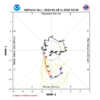
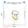
Notice in these MJO forecasts how much stronger the GEFS’s is. Although the EPS and CMET (GEPS) are similar, suggesting that this model teleconnection bias isn’t everything, it might be something
Will be closely watching how this all unfolds the next several days, because imho confidence has overall decreased somewhat for a warm early-mid Feb in the eastern US (although it remains probable-likely still).
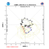


Well, the CPC most certainly incorporates it into their extended forecast. They throw the GFS into the mix out of patriotic pity at 25% of the blend.Has there ever been a time when the CMC ensembles have led the way on a pattern change? Honestly, because I tend to ignore them.
Is there any forcing or background reasons to believe the strong Atlantic troughing on the CMC?
The official 6-10 day 500-hPa height blend consists of 25% of Today's 0z GFS
Ensemble Mean centered on Day 8, 40% of Today's 0z European Ensemble Mean
centered on Day 8, and 35% of Today's 0z Canadian Ensemble Mean centered on Day 8
Climate Prediction Center - 6-10 and 8-14 Day Prognostic Discussions
The CPC issues the official U.S. 6 to 10 and 8 to 14 day outlooks. These outlooks illustrate the probabilities of having above, normal, and below normal temperature and precipitation for the 6 to 10 day period, respectively. The outlooks also include forecast 500 millibar heights for the 6 to...
www.cpc.ncep.noaa.gov
I would say it lead the way with the overall December pattern… at the very least it was in step with EPSHas there ever been a time when the CMC ensembles have led the way on a pattern change? Honestly, because I tend to ignore them.
Is there any forcing or background reasons to believe the strong Atlantic troughing on the CMC?
Last edited:
Cary_Snow95
Member
Let's hyperanalyze the happy hour GFS why don't we. Nice, wide, bowl shaped trough developing with cold pressing down


Cary_Snow95
Member
Close your eyes everyone and check back at 0zLet's hyperanalyze the happy hour GFS why don't we. Nice, wide, bowl shaped trough developing with cold pressing down

LukeBarrette
im north of 90% of people on here so yeah
Meteorology Student
Member
2024 Supporter
2017-2023 Supporter
Cary_Snow95
Member
This is probably going to rain to start then a big hit based off of early images
Cary_Snow95
Member
LukeBarrette
im north of 90% of people on here so yeah
Meteorology Student
Member
2024 Supporter
2017-2023 Supporter
LukeBarrette
im north of 90% of people on here so yeah
Meteorology Student
Member
2024 Supporter
2017-2023 Supporter
View attachment 130632
I love when the polar vortex is in Minnesota
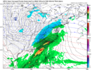
It’s a miss but this should be watched
If you take the giant Cinnabon out of the gfs it's probably a better look but that thing kind of screws it up for us
The arctic air behind this one is something serious! PV waiving hello at us!View attachment 130633
It’s a miss but this should be watched
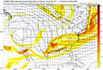
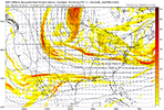
GFS represents what we're looking for really, with the wider, more bowl shaped trough, then look for the long-fetch of SW flow aloft into the 'cold' dome. A little less amplitude and a little less phasing of the trailing wave would get more folks involved, with a more west to east sliding system. Anyway, the bowl shaped trough look is a good starting point.

