-
Hello, please take a minute to check out our awesome content, contributed by the wonderful members of our community. We hope you'll add your own thoughts and opinions by making a free account!
You are using an out of date browser. It may not display this or other websites correctly.
You should upgrade or use an alternative browser.
You should upgrade or use an alternative browser.
Pattern Jammin January 2023
- Thread starter Goose88
- Start date
NBAcentel
Member
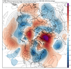
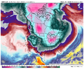
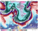
There’s that Arctic cutoff ridge againAt least some short lived cross polar flow here, View attachment 130573
That guy is the gift that keeps on giving. Looking at the eps plumes there were a handful and I mean the amount I can count on 1 hand that drove temps way down into the single digits teens. I hope we can get more support at 12zThere’s that Arctic cutoff ridge again
Last edited:
- Joined
- Jan 23, 2021
- Messages
- 4,602
- Reaction score
- 15,197
- Location
- Lebanon Township, Durham County NC
eps aint buying it
Been seeing that thing plastered there since Thanksgiving , It seems like.There’s that Arctic cutoff ridge again
Webberweather53
Meteorologist
This pattern is teetering on the knife’s edge between ? and amazing as we close out the month.
The -NAO trends we saw the last few days have mostly continued (save the GEFS which I suspect is out to lunch in that regard) & I still can’t help but be cautiously optimistic overall as result.
These -NAO/-PNA tug-of-wars are usually how you end up getting Cold Air Damming events/ice storms in the Carolinas & Virginia, and I suspect we may see a legitimate medium range signal for one crop up before long if things continue the way they have been
Eps plumes exploded this run after D10 with no real good clustering to give any help. I swear it looks like almost every 1-2 degrees from 30-70 is covered by a member some daysThis pattern is teetering on the knife’s edge between ? and amazing as we close out the month.
The -NAO trends we saw the last few days have mostly continued (save the GEFS which I suspect is out to lunch in that regard) & I still can’t help but be cautiously optimistic overall as result.
These -NAO/-PNA tug-of-wars are usually how you end up getting Cold Air Damming events/ice storms in the Carolinas & Virginia, and I suspect we may see a legitimate medium range signal for one crop up before long if things continue the way they have been
Wow, the Euro and GFS both have a storm for the 26th. That's just 9 days away. Of course the GFS is showing it as a bigger deal. Would feel better if this showed up on the 21st, though.
Webberweather53
Meteorologist
Eps plumes exploded this run after D10 with no real good clustering to give any help. I swear it looks like almost every 1-2 degrees from 30-70 is covered by a member some days
Very little margin for error here in this kind of pattern between getting severe weather or cold rain-icy CAD, esp if we see more polar blocking show up north of Alaska to steepen the height gradient even more across the east-central US.
The margin for error has shrunk even beyond the next week or two. We’ve made things really interesting in the long range by sticking a blocking high into the N Atlantic while trying to initiate a sudden stratospheric warming event at nearly the same time. If that block sticks around long enough to see this SSWE through, it may not go away until March
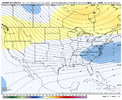
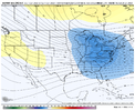
Think we need to stay patient here (always a fun activity) and wait until this "modeled" TPV drops into Hudson Bay, and then see if we can get less amplified waves running more west to east along the southern boundary of the trough, at a time when we should have more high pressure to our north, and a colder profile aloft and at the surface. Prior to that, it's going to be tough as the waves are going to be more amplified and running more SW to NE (more warm risks). Would also like to see recent improving trends continue, but one has to wonder if we are approaching our limits on improvements.
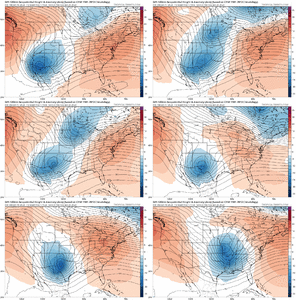
Applicable mages here are for Jan 25 to Jan 31 on the EPS...


Applicable mages here are for Jan 25 to Jan 31 on the EPS...


Last edited:
I suspect less patience is needed for our Alabama, Mississippi, Louisiana, and Tennesee crew.Think we need to stay patient here (always a fun activity) and wait until this "modeled" TPV drops into Hudson Bay, and then see if we can get less amplified waves running more west to east along the southern boundary of the trough, at a time when we should have more high pressure to our north, and a colder profile aloft and at the surface. Prior to that, it's going to be tough as the waves are going to be more amplified and running more SW to NE (more warm risks). Would also like to see recent improving trends continue, but one has to wonder if we are approaching our limits on improvements.
Applicable mages here are for Jan 25 to Jan 31 on the EPS...


Everyone thinks I live in Between because it's between Atlanta and Athens. Actually, it's because I live between the best winter weather chances when the cold is stubbornly stuck in NW Georgia or CAD systems that hammer NE Georgia and the Carolinas while enjoying my 33 and rain.
My untrained eye sees one brief window. Maybe 24-48hrs before it all relaxes outThink we need to stay patient here (always a fun activity) and wait until this "modeled" TPV drops into Hudson Bay, and then see if we can get less amplified waves running more west to east along the southern boundary of the trough, at a time when we should have more high pressure to our north, and a colder profile aloft and at the surface. Prior to that, it's going to be tough as the waves are going to be more amplified and running more SW to NE (more warm risks). Would also like to see recent improving trends continue, but one has to wonder if we are approaching our limits on improvements.
Applicable mages here are for Jan 25 to Jan 31 on the EPS...


Yeah… even though the Euro was not far off at all today at 12z, you would definitely like to see a bit more in the way of more west to east flow across the south. OTH if you get the right timing on the phase of that Euro storm, you get a great set up for a widespread snowstorm for the Carolinas and N GA… even with marginal temperaturesThink we need to stay patient here (always a fun activity) and wait until this "modeled" TPV drops into Hudson Bay, and then see if we can get less amplified waves running more west to east along the southern boundary of the trough, at a time when we should have more high pressure to our north, and a colder profile aloft and at the surface. Prior to that, it's going to be tough as the waves are going to be more amplified and running more SW to NE (more warm risks). Would also like to see recent improving trends continue, but one has to wonder if we are approaching our limits on improvements.
Applicable mages here are for Jan 25 to Jan 31 on the EPS...


Ron Burgundy
Member
I feel you, brother. Life on the I-20 corridor in GA is brutal. Eight years ago, I moved from just north of the 285/400 interchange to just south of it, and my snow totals have been cut about 30%. ?I suspect less patience is needed for our Alabama, Mississippi, Louisiana, and Tennesee crew.
Everyone thinks I live in Between because it's between Atlanta and Athens. Actually, it's because I live between the best winter weather chances when the cold is stubbornly stuck in NW Georgia or CAD systems that hammer NE Georgia and the Carolinas while enjoying my 33 and rain.
High 49 today. Already 24th wettest January on record here and a lot more to come.
Been an el nino winter here, most of it. Regardless of what official charts say. California getting drenched every 3 to 5 days
Been an el nino winter here, most of it. Regardless of what official charts say. California getting drenched every 3 to 5 days
Last edited:
ATLwxfan
Member
so your totals have been cut from 1" a year to .7" a year ?
0.7”!? Not sure ITP ATL has seen that much since January 2018.
Sent from my iPhone using Tapatalk
Ron Burgundy
Member
Depends on which part. On the north side we’ve probably gotten 3” total. Which, as I type that, is just damn depressing.0.7”!? Not sure ITP ATL has seen that much since January 2018.
Sent from my iPhone using Tapatalk
Sorry guys I'm not biting. That probably doesn't surprise most here. But until the teles improve I'm skeptical. NAO is neutral, AO is volatile, some deep negative members but more are positive. So neutral seems like a good bet for now. PNA falls off a cliff end of the month, very bad. Finally the MJO seems to want to make a run at phase 4. We can have most teles in our favor and still torch obviously but can we have most teles against us and end up cold? Probably not but we'll see.
Oh yeah, it’s coming, but trying to eek something out in 4-5 day period toward end of JanSorry guys I'm not biting. That probably doesn't surprise most here. But until the teles improve I'm skeptical. NAO is neutral, AO is volatile, some deep negative members but more are positive. So neutral seems like a good bet for now. PNA falls off a cliff end of the month, very bad. Finally the MJO seems to want to make a run at phase 4. We can have most teles in our favor and still torch obviously but can we have most teles against us and end up cold? Probably not but we'll see.
The teleconnections have actually improved their look the last couple days. IMO the opportunity for something to happen is sometime between the 22nd and 30th. There’s a period where the PNA is falling to around neutral and the MJO is high amp in phase 2… a small window that everything has to be timed right, but if it does the reward could be big. As for the NAO, i really like what I’m seeing there and think we may be able to go into an extended period of negative which as Webb mentioned could pay big dividends late in February as everything cycles back aroundSorry guys I'm not biting. That probably doesn't surprise most here. But until the teles improve I'm skeptical. NAO is neutral, AO is volatile, some deep negative members but more are positive. So neutral seems like a good bet for now. PNA falls off a cliff end of the month, very bad. Finally the MJO seems to want to make a run at phase 4. We can have most teles in our favor and still torch obviously but can we have most teles against us and end up cold? Probably not but we'll see.
iGRXY
Member
Earliest we could see the affects of that would be at best the end of week 2 into week 3 from the time of the SSWE event. More than like some time around week 4 so more than like towards the end of February into MarchWill the SSWE give us any prolonged cold in Feb anybody think?
ExactlyHigh 49 today. Already 24th wettest January on record here and a lot more to come.
Been an el nino winter here, most of it. Regardless of what official charts say. California getting drenched every 3 to 5 days
When we've been dry for 5 days my back yard is still like walking around on a wet sponge.
When we've had rain. My backyard is like a pond on a hill.
It's been much more El Nino like that not.
I never ever remember a La Nina this wet.
Which proves other drivers often drive sensible daily weather.
Six Mile Wx
Member
Snowing in Browsville hr 240 on euro op
Six Mile Wx
Member
Looks like the Euro model is down. I haven’t seen the 0z EPS control or mean come through.
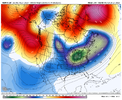
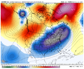
It looks to me like models are trending to a stronger Aleutian low during this timeframe which in turn is pumping up the western ridge.never thought I’d see the trend of having less dumping of energy out west. But this is what the euro has been showing for a while now. View attachment 130587
ATLwxfan
Member
The GFS gives us a seasonably cool few days with a suppressed look before cranking the ridge. The artic press just peters out.
Sent from my iPhone using Tapatalk
Sent from my iPhone using Tapatalk
iGRXY
Member


This is something where the players are on the field to score something of significance. Active southern jet with a cold press overtop.
Webberweather53
Meteorologist
iGRXY
Member
I still think western areas like TX, Arkansas, Northern Louisiana, Central/Northern Mississippi, West Tennessee, maybe Northern Alabama, and CAD favorable areas of NEGA, Upstate SC, and central/western NC have the best shot to score something in the next 2 weeks. Both also have an easier path to victory and more than 1 way to score right now. Either way the pattern favors big mix bag type of storms with large swaths of snow, sleet, and ZR if you're going to get something.
- Joined
- Jan 23, 2021
- Messages
- 4,602
- Reaction score
- 15,197
- Location
- Lebanon Township, Durham County NC
EPS sorta perked up around hour 288-312
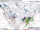
West TN scores biggly on Euro in 5 daysI still think western areas like TX, Arkansas, Northern Louisiana, Central/Northern Mississippi, West Tennessee, maybe Northern Alabama, and CAD favorable areas of NEGA, Upstate SC, and central/western NC have the best shot to score something in the next 2 weeks. Both also have an easier path to victory and more than 1 way to score right now. Either way the pattern favors big mix bag type of storms with large swaths of snow, sleet, and ZR if you're going to get something.
ATLwxfan
Member
I still think western areas like TX, Arkansas, Northern Louisiana, Central/Northern Mississippi, West Tennessee, maybe Northern Alabama, and CAD favorable areas of NEGA, Upstate SC, and central/western NC have the best shot to score something in the next 2 weeks. Both also have an easier path to victory and more than 1 way to score right now. Either way the pattern favors big mix bag type of storms with large swaths of snow, sleet, and ZR if you're going to get something.
Reeks of 37° and rain for I-20 corridor
Sent from my iPhone using Tapatalk

