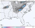
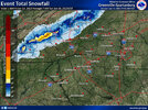
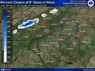
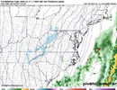
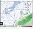
Hate it for them.Surely there's one of us in Bladen or Columbus county jacked right now
-
Hello, please take a minute to check out our awesome content, contributed by the wonderful members of our community. We hope you'll add your own thoughts and opinions by making a free account!
You are using an out of date browser. It may not display this or other websites correctly.
You should upgrade or use an alternative browser.
You should upgrade or use an alternative browser.
Pattern Jammin January 2023
- Thread starter Goose88
- Start date
- Joined
- Jan 23, 2021
- Messages
- 4,602
- Reaction score
- 15,197
- Location
- Lebanon Township, Durham County NC
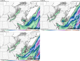
3k has three concentrations of accumulations:
One near Little Washington
One near Lejeune
One near Pawleys Island, SC
One near Little Washington
One near Lejeune
One near Pawleys Island, SC
Crazy weenie thought I know, but one or more ticks in this direction and that vorticity lobe may actually cut off and EMCF members 5&17 that BullCityWX posted become reality. Speaking of the EMCF ensembles, I find it interesting that there are still some intriguing members at such a short range.I mean I feel like we've seen much worse trends within 48 hrs... I'm not giving up on a flurry
View attachment 129941
Would someone please post the earlier ensemble panels while the system is further west? ?
Are we reeling in a 48 hour upper level low snow ?! To see a couple euro ensembles with legit snow accumulation this far out is definitely eye opening. Will this continue who knows but I know upper level lows have a mind of their own
At least we are gaining some momentum towards something happening. I'm skeptical with such mediocre temps we do a lot but there's some potential to over perform and the BL becomes irrelevant to a degree
Hate to be that guy, but one would think the precip shield might even be a little more expansive than being modeled (if the SLP is as close as currently depicted on the NAMs) So I'm gonna say we see it shift at least one more time before reality kicks us in the jingle bells
ATLwxfan
Member
I’ll leave this here for the pooh-pooh’ers and debunkers.
Sent from my iPhone using Tapatalk
Sent from my iPhone using Tapatalk
token flakes along the eastern piedmont/coastal plain probably has legs, upper level with definitely be cold enough. BL temps could be suspect but you already knew that.
question is how many nudges towards a more favorable orientation/tilt does do we have left in the tank, 48 hours out is pushing it
question is how many nudges towards a more favorable orientation/tilt does do we have left in the tank, 48 hours out is pushing it
2 but I need 3token flakes along the eastern piedmont/coastal plain probably has legs, upper level with definitely be cold enough. BL temps could be suspect but you already knew that.
question is how many nudges towards a more favorable orientation/tilt does do we have left in the tank, 48 hours out is pushing it
iGRXY
Member
Serious wedge here. Cross Anchor in southern Spartanburg county and on the Laurens county border is currently at 63. Spartanburg is 54 and here at the house it's 50 with serious fog and mist. If only it was about 28 instead with the moisture coming.
rburrel2
Member
Stormsfury
Member
View attachment 129953
Shame with this storm, we weren't far off from a good storm for our US-17 friends.
Trends this winter have been further west (by a lot lol) with several players so far this winter. I remember all those 70s and 80s storms that seemingly crop out of nowhere.
Who knows?
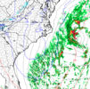
Have to love the expansiveness of this trend to cover more territory in NC. Have to see if it continues, levels off, or degrades away as we count down.Definite BL issues but the GFS continues to try and beef up moisture in the eastern sections
View attachment 129951

- Joined
- Jan 23, 2021
- Messages
- 4,602
- Reaction score
- 15,197
- Location
- Lebanon Township, Durham County NC
I had high hopes for a pattern change.
The last 36ish hours have been very discouraging though. CFS has dramatically warmed and the -PNA showing up on the modelling is just not good at all. If I dont see a change before Saturday, it may be time to punt further. If you look further out, however, the CFS is offering pretty chalk la nina climatology.
The last 36ish hours have been very discouraging though. CFS has dramatically warmed and the -PNA showing up on the modelling is just not good at all. If I dont see a change before Saturday, it may be time to punt further. If you look further out, however, the CFS is offering pretty chalk la nina climatology.
ATLwxfan
Member
Impressive resilient SER on 12z GFS after this weekend. Texas primed for the icebox at the end of the run. La Niña conditions going strong for us.
Sent from my iPhone using Tapatalk
Sent from my iPhone using Tapatalk
SnowNiner
Member
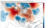
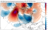
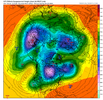
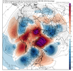
Long range on the EPS does not look good, imo. The ridge is too far west, with a positive tilt that tucks the cold nicely in the west where it always wants to be. Atlantic ridge is large and in charge keeping the cold away.
Jet is starting to retract west of HI, like @griteater warned. Starting to think tropical forcing smacks us again. I'm pretty weary of a pattern change right now. ?
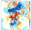
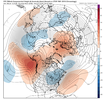
Jet is starting to retract west of HI, like @griteater warned. Starting to think tropical forcing smacks us again. I'm pretty weary of a pattern change right now. ?


Definitely know better than to take stock in the LR model outputs, but the end of the 12z GFS actually looks good to me. You would think there would be a lot of undercutting of the cold coming down from the NW. This is where a battle between the SER and very cold air could make for some interesting times.
Dew points on day 16:
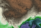
Dew points on day 16:

ATLwxfan
Member
Long range on the EPS does not look good, imo. The ridge is too far west, with a positive tilt that tucks the cold nicely in the west where it always wants to be. Atlantic ridge is large and in charge keeping the cold away.
Jet is starting to retract west of HI, like @griteater warned. Starting to think tropical forcing smacks us again. I'm pretty weary of a pattern change right now.
View attachment 129963
View attachment 129964
Not until Nina loosens it’s grip in March or April. The only thing worse than a warm winter is a cold spring.
Sent from my iPhone using Tapatalk
tennessee storm
Member
Maybe we go straight into springNot until Nina loosens it’s grip in March or April. The only thing worse than a warm winter is a cold spring.
Sent from my iPhone using Tapatalk
DobsonCityWx
Member
The pattern is so bad the ski resorts in Cali are closing because of too much snow.
- Joined
- Jan 23, 2021
- Messages
- 4,602
- Reaction score
- 15,197
- Location
- Lebanon Township, Durham County NC
Euro has less qpf for Saturday this run. We flew too close to the sun.
Yes but IS this where we are gonna land?I'd gladly take 5 more days of warmth if it meant we were going here and where this eventually would land.
You want a board wide overrunning winter storm? This will get you there
View attachment 129970View attachment 129971
Y'all buckle up now ya hear! lol
- Joined
- Jan 23, 2021
- Messages
- 4,602
- Reaction score
- 15,197
- Location
- Lebanon Township, Durham County NC
Y'all buckle up now ya hear! lol
if it's a weak el nino then lets ride ?
In some form yes, there are a number of possibilities on the table here. Like i said before I'd like this pattern a lot more if I was in MS, AL, LA, TN, VA where they can benefit from a displaced western ridge and slight SER response. For us in the Carolinas we need some suppression help whether it's from the pac ridge being east of models, a -nao, or pulling a cold vortex southeast and parking it north of the Great lakes. The op gfs was about the check the last 2 boxes to an extent.Yes but IS this where we are gonna land?
Euro is a classic track but cold air is meh
12z Euro - Only 10 days out!!! Mountain special..... We got time to work on temps east of the mountains.


