• Hello, please take a minute to check out our awesome content, contributed by the wonderful members of our community. We hope you'll add your own thoughts and opinions by making a free account!

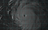
Tropical Hurricane Lee

At 70 west, it has to get a NE heading at some point there after to avoid a us landfall or disengrate.
This is true. My neighbor who is a retired meteorologist that worked for the NWS for 30 years says that 70W is always considered the benchmark and when they would start to get concern for an east coast threat. For what it’s worth, he also has some doubt that this ends up as just a fish storm. He says that while a trough does come through, it not a deep one and could very easily leave the storm behind.
 
This is true. My neighbor who is a retired meteorologist that worked for the NWS for 30 years says that 70W is always considered the benchmark and when they would start to get concern for an east coast threat. For what it’s worth, he also has some doubt that this ends up as just a fish storm. He says that while a trough does come through, it not a deep one and could very easily leave the storm behind.
Would he be talking about the "40/70 benchmark? That's a NOR'EASTER benchmark but doesn't really work with tropical storms further south.
 
Just looking across the operational models, the Euro would be the most concerning and would seem to carry the most potential for an EC strike. Everything else has a fairly deep trough along or approaching the eastern seaboard. If the storm slows down beyond what the Euro is showing, the potential for a SE hit goes up, IF the upper air pattern it's depicting is close to correct. Otherwise, it's a fish or maybe an extreme NE US hit. Still think it's 80% to miss the US.
 

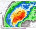
The red colors are nice, But I'm not really sure what the blue hashes are signaling then, I guess. I don't think they are just going to sit in place, waiting for the storm's arrival and be like, "Well, we would have kicked the storm out to sea, but since there's no signal for us, we'll just hang back and see what happens."F5WQfivXwAA09U3.jpg
 
Just looking across the operational models, the Euro would be the most concerning and would seem to carry the most potential for an EC strike. Everything else has a fairly deep trough along or approaching the eastern seaboard. If the storm slows down beyond what the Euro is showing, the potential for a SE hit goes up, IF the upper air pattern it's depicting is close to correct. Otherwise, it's a fish or maybe an extreme NE US hit. Still think it's 80% to miss the US.

One thing that does concern me a little about the Euro is, slow that ULL down and dig it SW and pump that ridge and slow the hurricane down a bit and you aren’t far from a Irma like outcome where the Bermuda ridge continues to become stronger and and track eeks southwest.

All this is pretty unlikely considering the EPS is much more in line with the GEFS. That said completely discounting an OP run is unwise.
Yeah, agreed. That's what I was seeing as well. But like you said, it's on an island.
 
Would he be talking about the "40/70 benchmark? That's a NOR'EASTER benchmark but doesn't really work with tropical storms further south.
No. He’s referring to the entire east coast, not just the southeast. Once a storm gets west of 70W, which is the longitude of Cape Cod, it has to turn east of due north at some point to avoid a US landfall.
 
There are so many factors to consider. If any of the major players in the setup are stronger, weaker, further North, South, East or West, faster, or slower it causes huge ramifications when trying to forecast a hurricane over a week out. Best we can do is look for trends, listen to experts as they weigh in, and discuss. Pretty fascinating when you think about it.
 
There are so many factors to consider. If any of the major players in the setup are stronger, weaker, further North, South, East or West, faster, or slower it causes huge ramifications when trying to forecast a hurricane over a week out. Best we can do is look for trends, listen to experts as they weigh in, and discuss. Pretty fascinating when you think about it.
Yep and exactly why NHC official forecast don't go out more than 5 days. Us nerds are the only one's that do that lol
 
Factor three to consider. A Big, very powerful hurricane will have a tendency to pump the ridge to the north once again like Irma.
Agreed, and big powerful canes have a tendency to bulldog through quite a few steering currents. I'm worried about the amount of posts here and on social that this thing is a guaranteed 'fish storm' when we now have more guidance zeroing in on the east coast. Writing storms off outside of a 7 day timeframe seems iffy at best. Having said all this, I do hope it stays away because if it holds together and makes landfall, somewhere is going to be horribly impacted.
 
Agreed, and big powerful canes have a tendency to bulldog through quite a few steering currents. I'm worried about the amount of posts here and on social that this thing is a guaranteed 'fish storm' when we now have more guidance zeroing in on the east coast. Writing storms off outside of a 7 day timeframe seems iffy at best. Having said all this, I do hope it stays away because if it holds together and makes landfall, somewhere is going to be horribly impacted.
The "fish storm" comments need to be made in context as well. If by fish someone means it misses the SE, ok, but if my fish they mean it misses all land masses, it's downright foolish.
 
The "fish storm" comments need to be made in context as well. If by fish someone means it misses the SE, ok, but if my fish they mean it misses all land masses, it's downright foolish.
There is also eastern Canada to consider too. Plenty of storms have missed the US but have gone on to landfall in Nova Scotia or especially Newfoundland.
 
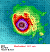
150 mph coming
ERROR IN NHC 3 and 4 day track error is 90 and 125 n miles, respectively.
NHC is on the south side of the envelope.

SCAR_Edited_Image_1831219901687947.jpg
 
Back
Top