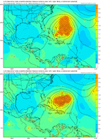
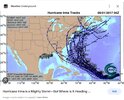
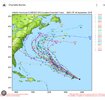
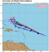
This is dumb but whateverFIFY..
-
Hello, please take a minute to check out our awesome content, contributed by the wonderful members of our community. We hope you'll add your own thoughts and opinions by making a free account!
You are using an out of date browser. It may not display this or other websites correctly.
You should upgrade or use an alternative browser.
You should upgrade or use an alternative browser.
Tropical Hurricane Lee
- Thread starter RBR71
- Start date
Downeastnc
Member
I imagine there will be a bunch of Gulfstream flights the next week or so as well..
Shaggy
Member
Those will be crucialI imagine there will be a bunch of Gulfstream flights the next week or so as well..
Shaggy
Member
Well.thats different
I’m getting serious Irma vibes.
Shaggy
Member
I'd be watching the ukmet if these west trends continue because it's been west the entire timeI’m getting serious Irma vibes.
I mentioned this yesterday. The UKIE sniffed out both Irma and Florence before other modeling caught on.I'd be watching the ukmet if these west trends continue because it's been west the entire time
Are the conditions similar to those storms?I mentioned this yesterday. The UKIE sniffed out both Irma and Florence before other modeling caught on.
Henry2326
Member
and none of those were right on how far south it would go
Henry2326
Member
lexxnchloe
Member
SW trend
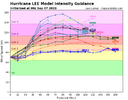
I notice those ukmet tracks are coming further north as their intensity guidance goes up...
the straggler ensemble members that are far west are probably wrong on the intensity of the storm
the straggler ensemble members that are far west are probably wrong on the intensity of the storm
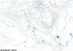
true,but if you look at 5h across can/us border, even back into sw us, energy is different looking. May,may not mean anything. Little wrinkles add up 5 days plus out. Lot of pieces to the jiggsaw puzzle before we get final picture. Could as easily wind up more east verse more west for all we know.I notice those ukmet tracks are coming further north as their intensity guidance goes up...
the straggler ensemble members that are far west are probably wrong on the intensity of the storm
and none of those were right on how far south it would go
The biggest issue here is while models may be better they still have the same issues with resolving the speed and strength of waves in the northern stream they had several years ago. If that wave over the SE on the Euro slows and shifts west, which happens nearly every time; the effects of track could be enormous. That all said, a phantom under modeled wave out of the north could do the same in the other direction.
Brent
Member
Irma(and Florence even...) also dove south of the track a lot which is something to watch for.. so far Lee hasn't but it's so far out still. I still lean heavily on the recurve side(I mean for starters I have highs in the 70s next week... A total pattern change from the last month) but we are talking day 9-10 and errors can be large
I would definitely wait to see more runs to see if the west trends continue because it could easily flip back east by morning
I would definitely wait to see more runs to see if the west trends continue because it could easily flip back east by morning
Last edited:
lexxnchloe
Member
About 30 miles south of 18z on ICON

accu35
Member
Wow!! That’s a pretty deep trough on the 0z Icon. That sharp north turn is very clear here
Brent
Member
Wow!! That’s a pretty deep trough on the 0z Icon. That sharp north turn is very clear here
Yeah it's interesting like it hits a brick wall
lexxnchloe
Member
Euro tonight. faster and a bit more west.

12z yesterday


12z yesterday

lexxnchloe
Member
Ends up hitting eastern Maine it appears.

Last edited:
NoSnowATL
Member
Boston to Maine should keep watching. Everyone else is safe.
What is the Korean saying today?
The GFS and Euro are just trough after trough as cyclones approach. Looks like they were a week or two too late.
The GFS and Euro are just trough after trough as cyclones approach. Looks like they were a week or two too late.
Last edited:
NoSnowATL
Member
We always sit and debate, but these hurricane models are almost always right. It will do exactly what they say it will do, curve out to sea.
I think this is a situation where we have to remember that the entire USA is not the Southeast. Mid-Atlantic into the NE area is still in play. The odds they are so far off this thing plows into FL, SC, or most of NC is pretty low at this point.
Unless the data input from reconnaissance flights changes what the models are showing, the East Coast from the Mid Atlantic south is probably safe. Interests further north should still pay attention to what's going on with Lee and where it may go.
We always sit and debate, but these hurricane models are almost always right. It will do exactly what they say it will do, curve out to sea.
Well here we have it, time to shut down the forum I guess or just regulate the posts to whining about lack of rain or heat.
EPS stabilized overnight with all members turning north and missing the EC south of NE. NE, especially Maine and SE Canada seem to be the point now but that's 10 days away, could still turn and miss everyone (except Bermuda). If there were to be any threat to anyone else along EC you'd see more uncertainty in track guidance today, not writing it off but highly doubt it
Eye becoming visible now, RI is approaching
JHS
Member
Just like 1995. We may get something yet though from the gulf like we did with Opal that year. The season may very well last longer than usual due to warm water temperatures.We always sit and debate, but these hurricane models are almost always right. It will do exactly what they say it will do, curve out to sea.
Last edited:
JHS
Member
That's true and they may have a big problem in about 7-10 days. More likely in Canada though. It is early yet but we may be done here in the southeast from the long track Atlantic storms unless one can get into the Carribean. The gulf is another story entirely and it is very possible that something forms there and comes in. ALL of us are still in play for tropical weather for a while, probably until late November.I think this is a situation where we have to remember that the entire USA is not the Southeast. Mid-Atlantic into the NE area is still in play. The odds they are so far off this thing plows into FL, SC, or most of NC is pretty low at this point.
Drizzle Snizzle
Member
Until late November lol. Most of the US doesn't have to worry about the tropics after Mid October, unless you're in South Florida. At least that's the way it seems to be in most years.That's true and they may have a big problem in about 7-10 days. More likely in Canada though. It is early yet but we may be done here in the southeast from the long track Atlantic storms unless one can get into the Carribean. The gulf is another story entirely and it is very possible that something forms there and comes in. ALL of us are still in play for tropical weather for a while, probably until late November.
I doubt we see anything deep into November in Gulf. Storms have a harder time holding together as sheer increases when the STJ becomes more active. I do think that development in the Western Caribbean and Gulf is definitely a strong possibility the rest of September and the first half of October.That's true and they may have a big problem in about 7-10 days. More likely in Canada though. It is early yet but we may be done here in the southeast from the long track Atlantic storms unless one can get into the Carribean. The gulf is another story entirely and it is very possible that something forms there and comes in. ALL of us are still in play for tropical weather for a while, probably until late November.
To me it looks like Idalia did a good job of lowering the SST's in the eastern gulf at least.I doubt we see anything deep into November in Gulf. Storms have a harder time holding together as sheer increases when the STJ becomes more active. I do think that development in the Western Caribbean and Gulf is definitely a strong possibility the rest of September and the first half of October.
Yes and with Franklin and Idalia last week and now Lee, the western Atlantic will be churned up good as well to help lower SSTs there.To me it looks like Idalia did a good job of lowering the SST's in the eastern gulf at least.

