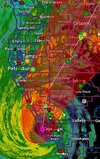
Live scanner feed from Lee County, FL, where Ft Myers is located. Calls for water rescues are coming in.
 www.broadcastify.com


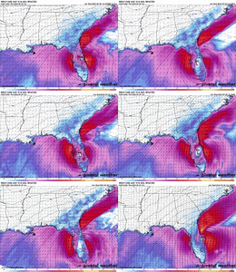
Yes… the hurricane models are more favoring the HHI to Charleston area and to be honest UK is the only that is gone much further north than that with a landfall at Myrtle Beach. The NAM and Icon are basically in the middleConsensus from the Hurricane models.
I learn to never dismiss any possibility, but that being said there’s not really any guidance that does that now. The trough is pulling away without grabbing Ian to take with it, so it’s gonna follow what steering there is, which is weak, but show an emergence into the Atlantic with a turn back to the NWIs it possible it can ride the convergence line out to sea and miss a 2nd landfall?
Yep, here is the 12Z recap for 2nd LF:Yes… the hurricane models are more favoring the HHI to Charleston area and to be honest UK is the only that is gone much further north than that with a landfall at Myrtle Beach. The NAM and Icon are basically in the middle

Live scanner feed from Lee County, FL, where Ft Myers is located. Calls for water rescues are coming in.
Lee County Fire and EMS — Broadcastify

Tomorrow morning ar 12z should give us a pretty good idea of what we are going to get. Uk is already offshoreI think euro is gonna keep going north and the northern camp will head a bit south and it'll be somewhere between Kiawah and Edisto. I still weigh the modelling that took this out into the atlantic more than the others as well but thats just me.
Likely because the worst part of the eyewall is on the west side so wait for that to rotate throughStorm seems far weaker than Michael at first take


Hazel hit Brunswick County NC, Holden Beach,Oak Island. October canes are the bestThat's about where Hurricane Hazel hit in 1954. For the really old timers in Eastern North Carolina, Hazel is still the benchmark that hurricanes is measured by.
Sad! Mandatory Evacs issued and ignored.Lots of water rescue calls coming in to Ft Myers area.


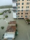 Just got this photo from my aunt/uncle’s place in Ft Myers/Naples. Looks like water is at least 6-8 ft high below. They do live right on the water. Fortunately, their condo is on the fourth floor. They aren’t there now but have a webcam installed.

What sort of structure are you in?Gas station near me is gone

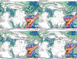
Oooooof! Couple more ticks East and Atlanta is dry!Can see the subtle NE ticks on the past few runs of the Euro. Could be windshield wiping and start ticking west in future runs...
View attachment 122438


We were once forecasted to get 3-5 inches and now almost nothing. Yikes.Oooooof! Couple more ticks East and Atlanta is dry!
A car lolWhat sort of structure are you in?


Yes, we saw that coming days ago due to the eastward tracks. Georgia's drought will not be relieved from this storm.We were once forecasted to get 3-5 inches and now almost nothing. Yikes.
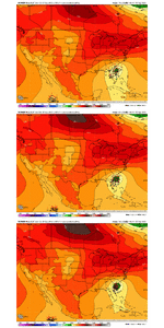
Probably going to have to wait until November to get rain in Atlanta. October is usually very dry. Atlanta is sitting at 0.99" for the month.Yes, we saw that coming days ago due to the eastward tracks. Georgia's drought will not be relieved from this storm.