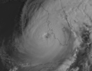
You’re correct about it bending to the left some and moving more due north. If it had continued the direction it was on yesterday evening the eastern eye wall might already be scraping the coastIan has been stubborn to even move much plus overnight he's definitely bent left. Almost due north.
-
Hello, please take a minute to check out our awesome content, contributed by the wonderful members of our community. We hope you'll add your own thoughts and opinions by making a free account!
You are using an out of date browser. It may not display this or other websites correctly.
You should upgrade or use an alternative browser.
You should upgrade or use an alternative browser.
Tropical Hurricane Ian
- Thread starter severestorm
- Start date
-
- Tags
- tropical
BHS1975
Member
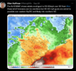
Bad radar return right? Only problem is I can find multiple 170+ around it….

Sent from my iPhone using Tapatalk

Sent from my iPhone using Tapatalk
Snow_chaser
Member
Anyone watching any live chaser feeds?
A slow crawl with the eyewall remaining offshore for much of the day is about the only way to mitigate some of the damage this storm is going to cause. Shallow, upwelling shelf waters and more time for dryer air to affect the core are about the only hope left.Ian has been stubborn to even move much plus overnight he's definitely bent left. Almost due north.
A few of these webcams from Sanibel & Captiva are still up ...
They literally updated the velocity scales on RadarScope to support higher wind valuesBad radar return right? Only problem is I can find multiple 170+ around it….

Sent from my iPhone using Tapatalk
severestorm
Member
Bad radar return right? Only problem is I can find multiple 170+ around it….

Sent from my iPhone using Tapatalk
Switched to Key West radar and looked in same area….woof

Sent from my iPhone using Tapatalk
Expect that number to go up as the day goes on.
severestorm
Member
100%, just amazed at the resiliency thus far.Expect that number to go up as the day goes on.
Yeah, watching some YT feeds. Reed, hurricanetrack and Max Olson. You can definitely see the wind and rain picking up.Anyone watching any live chaser feeds?
Snow_chaser
Member
Watching Brett Adair on livestormchasing and he’s in a parking deck in Punta Gorda and he just said they have closed off the parking garage and they are stuck where they are.
Triplephase93
Member
You’re right! North Port to Bradenton, looks money for eye scrapage!
Englewood!I’m not exactly sure where to go. Thoughts?
NoSnowATL
Member
Parking decks are closed by plastic gates. Drive through those SOB to save your life. Pay the $400 fine later.
Still has it at a Cat 4.SUMMARY OF 900 AM EDT...1300 UTC...INFORMATION
----------------------------------------------
LOCATION...26.1N 82.7W
ABOUT 60 MI...95 KM W OF NAPLES FLORIDA
ABOUT 70 MI...115 KM SW OF PUNTA GORDA FLORIDA
MAXIMUM SUSTAINED WINDS...155 MPH...250 KM/H
PRESENT MOVEMENT...NNE OR 15 DEGREES AT 10 MPH...17 KM/H
MINIMUM CENTRAL PRESSURE...937 MB...27.67 INCHES
They also upped the storm surge potential for some areas.
Peak Storm Surge Inundation has been increased for the following
locations:
* From Englewood to Bonita Beach...12-18 ft
* Charlotte Harbor...12-18 ft
* From Bonita Beach to Chokoloskee...8-12 ft
* From Chokoloskee to East Cape Sable...5-8 ft
Taylor C
Member
123830 2601N 08236W 6971 02605 9331 +227 +033 199036 038 033 001 00
Pressure down to 929-930 per recon.
Pressure down to 929-930 per recon.
Blue_Ridge_Escarpment
Member
Z
Zander98al
Guest
Doubt this will stay category 4. You'd have to be stupid to not upgrade. In a sense it's doing injustice to those in the path not knowing how strong it actually is. But I digress, pretty impressive storm.
Those 180mph wind velocity's radar picks up won't take much for something similar to be realized near the surface in terms of gusts, basically ef4 wind gusts.
Those 180mph wind velocity's radar picks up won't take much for something similar to be realized near the surface in terms of gusts, basically ef4 wind gusts.
RollTide18
Member
When I fell asleep this was a Cat 3, I wake up and Ian is almost a Cat 5, unbelievable
Snow_chaser
Member
Lol Brett is on the move, he said screw it, let’s go find some action.
severestorm
Member
Anyone watching any live chaser feeds?
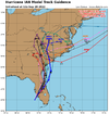
Lots consistency on these plots now
In the back of my mind yesterday I was thinking 50/50 shot Ian hits 150mph at his peak so the fact that it’s 155mph and possibly still strengthening is astonishing to me. Completely blew past my expectations. This is why I said a few days back intensity forecasts are complex and complicated to nail down.When I fell asleep this was a Cat 3, I wake up and Ian is almost a Cat 5, unbelievable
Anyone watching any live chaser feeds?
Live Storm Chasing
Watch live feeds as storm chasers try to see if their target verifies. Tornadoes, hurricanes, blizzards, and floods - we've got it all and more, live on our site and available as video on demand.
severestorm
Member
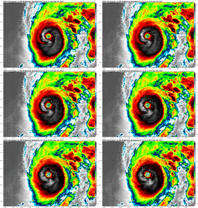
That is truly one of the most amazing things to see. I remember the same thing happened with Irma in 2017. Watching how quickly it fills back in as the winds turn is also impressive
DadOfJax
Member
Upwelling may become a real issue for the storms structure if this crawl continues. Also, if it crawls long enough, another ERC could occur right before landfall. These 2 things could be saving graces.
Belle Lechat
Member
- Joined
- Aug 29, 2021
- Messages
- 1,529
- Reaction score
- 1,215
Time : 122020 UTCTime : 115020 UTC
Lat : 26:01:48 N Lon : 82:45:36 W
CI# /Pressure/ Vmax
6.9 / 922mb / 137kts
Final T# Adj T# Raw T#
6.9 6.8 (-.2) 6.8 (-.2)
Lat : 26:04:11 N Lon : 82:49:11 W
CI# /Pressure/ Vmax
6.9 / 922mb / 137kts
Final T# Adj T# Raw T#
6.9 6.5 (-.3) 6.5 (-.3)
mydoortotheworld
Member
I imagined 140 max as dry air begins to penetrate the core and shear becomes a problem, but as per Twitter (@vortexjeff) Ian’s positioning near the trough was near perfect for continued rapid intensificationIn the back of my mind yesterday I was thinking 50/50 shot Ian hits 150mph at his peak so the fact that it’s 155mph and possibly still strengthening is astonishing to me. Completely blew past my expectations. This is why I said a few days back intensity forecasts are complex and complicated to nail down.
Belle Lechat
Member
- Joined
- Aug 29, 2021
- Messages
- 1,529
- Reaction score
- 1,215
thundersnow
Member
- Joined
- Dec 17, 2016
- Messages
- 109
- Reaction score
- 202
Only thing about upwelling is… I think that part of the Gulf is relatively shallow? I wonder if it’s even deep enough to pull up enough colder water to make a difference.Upwelling may become a real issue for the storms structure if this crawl continues. Also, if it crawls long enough, another ERC could occur right before landfall. These 2 things could be saving graces.
Bannerdude
Member
DadOfJax
Member
That is a good point. I've always wondered how shallow areas are effected, if at all, by a crawling storm. As the storm crawls, its got to be drastically pulling the warmth from the shallow waters, pulling it into the storm, and dumping much cooler water back in the form of rain. Maybe systems would have to practically sit for hours for this to be an issue?? While its not classic "upwelling" the effect would be the same. Any thoughts?Only thing about upwelling is… I think that part of the Gulf is relatively shallow? I wonder if it’s even deep enough to pull colder water up enough to make a difference.
BHS1975
Member
That is a good point. I've always wondered how shallow areas are effected, if at all, by a crawling storm. As the storm crawls, its got to be drastically pulling the warmth from the shallow waters, pulling it into the storm, and dumping much cooler water back in the form of rain. Maybe systems would have to practically sit for hours for this to be an issue?? While its not classic "upwelling" the effect would be the same. Any thoughts?
I think we saw that with Harvey and Florence.
Sent from my iPhone using Tapatalk


