Snow_chaser
Member
Watching a channel on roku called fox weather and they showing they just got 935 and 158 mph winds with gusts to 185?
Seems far southDustin, Cape Coral is where you want to be!
You need to get to a high rise hotel at least 2 floors up and use the building to shield yourself from the wind. Saying some prayers for youI’m not exactly sure where to go. Thoughts?
Heading through Florida's Amish country too
You need to get to a high rise hotel at least 2 floors up and use the building to shield yourself from the wind. Saying some prayers for you
You’re right! North Port to Bradenton, looks money for eye scrapage!Seems far south
Is there some hype, yep, but I don't know I'd call it sensationalizing. This is 2mph from being a catastrophic Cat 5 at landfall in Florida. Getting hype over basically a 60 mile wide EF3 tornado is hype worthy, it's a weather forum for crying out loud.
Seems to just be stating the facts. This thing is a beast and scary as hell.Total devastation wouldn't be sensationalizing either.
Sent from my iPhone using Tapatalk
Probably shear and such but in terms of internal mechanics this thing doesn’t give a ---- about shear. It’s too big at this point to have that effect it. It would affect satellite presentation though .. what’s under the hood is what matters.Why hasn't the eye cleaned up?
Sent from my iPhone using Tapatalk

It definitely has that look to it.Hmm....wonder if this verifies:
Posted just now
Isaiah_Wx CODE RED
@IsaiahHartzell2
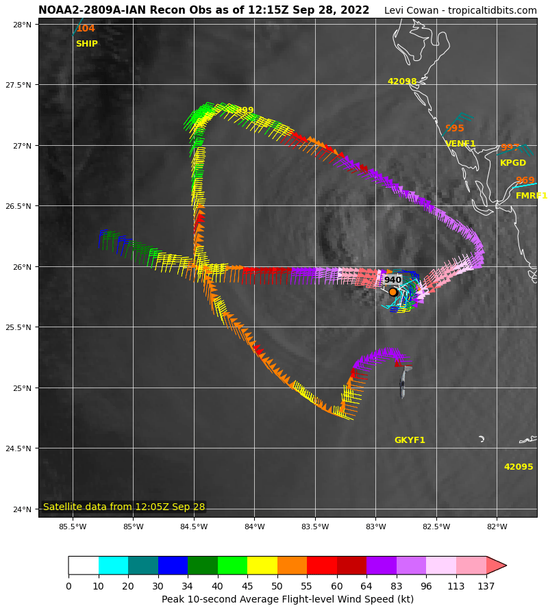
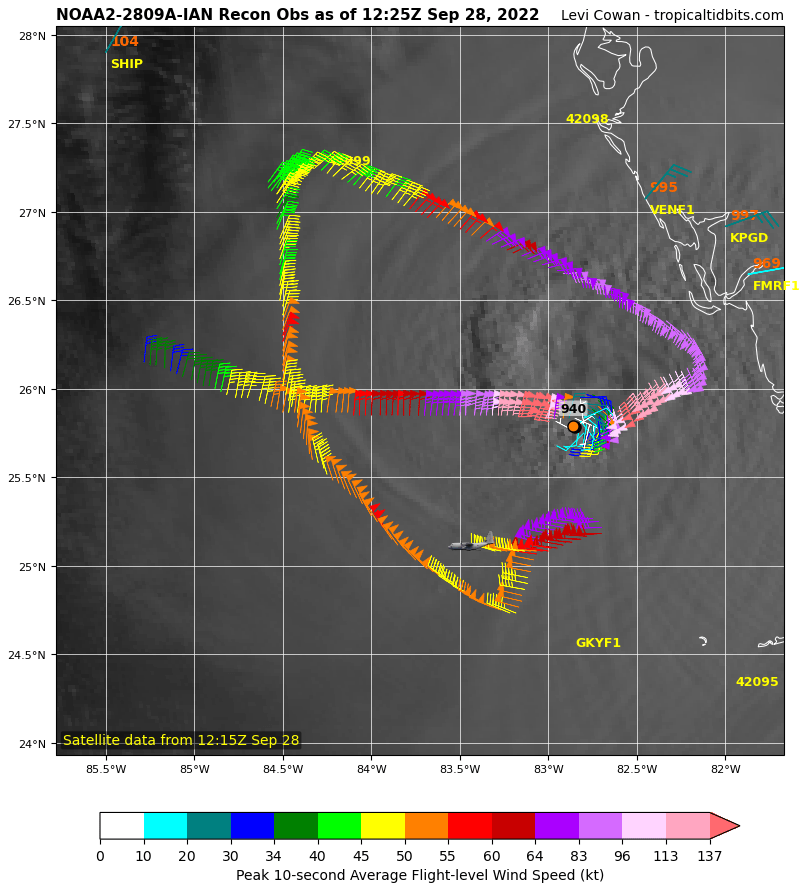
RECON has support for a 140 kt storm, 160 MPH, Cat. 5. The next plane is going in for another pass
and: 933.1 mb
Time : 115020 UTCTime : 112020 UTC
Lat : 25:59:23 N Lon : 82:41:59 W
CI# /Pressure/ Vmax
6.9 (+.1)/ 922mb (-3)/ 137kts (+2)
Final T# Adj T# Raw T#
6.9 (+.1) 7.0 7.0
Yep. It looks like Ian has nudged right up to CAT 5. I know there's an argument pressure is irrelevant, but I've always been of the mind that a CAT 5 needs to have a pressure at least in the 920s. Ian looks to make it shortly.Hmm....wonder if this verifies:
Posted just now
Isaiah_Wx CODE RED
@IsaiahHartzell2
RECON has support for a 140 kt storm, 160 MPH, Cat. 5. The next plane is going in for another pass
and: 933.1 mb
Takes a bit for the carcass of old inner eyewall to be burned outWhy hasn't the eye cleaned up?
Sent from my iPhone using Tapatalk


So it looks like he's a good measure stronger than advertised on the modelling valid at 12z today. Larger, stronger hurricanes are generally harder to turn, right? I wonder if this affects the next 48 hours.
I often wonder about that too. There isn't much difference as far as the damage that a strong Cat 4 with winds of 150 MPH causes compared to a minimal Cat 5. Both are going to be devastating and there are several examples of what were considered strong Cat 4 storms that were later reclassified to a Cat 5 after analysis of the effects of a storm on an area. I think a storm with winds of 150 MPH or above should receive a Cat 5 designation.I wonder why when these monster canes make it all the way up to 155 there seems to be a hesitancy to bump it the 2 mph to a cat 5? Michael was like that, made landfall at the time at 155 and then reclassified to a 5. I know the numbers have to support it, but it seems odd that they classify it that close to a 5.
