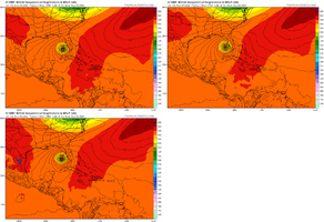
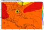
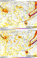
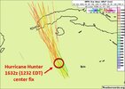
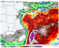
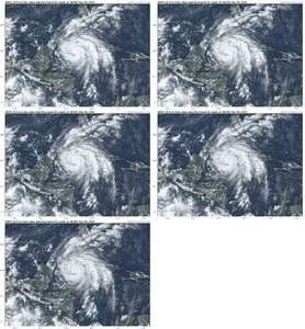
This the same NAM showing a 878mb cyclone in the GOM? Lol just sayinNAM was way west too on the 12Z run compared to the 06Z run.
-
Hello, please take a minute to check out our awesome content, contributed by the wonderful members of our community. We hope you'll add your own thoughts and opinions by making a free account!
You are using an out of date browser. It may not display this or other websites correctly.
You should upgrade or use an alternative browser.
You should upgrade or use an alternative browser.
Tropical Hurricane Ian
- Thread starter severestorm
- Start date
-
- Tags
- tropical
NoSnowATL
Member
Don’t hate the playa, hate the game.This the same NAM showing a 878mb cyclone in the GOM? Lol just sayin
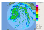
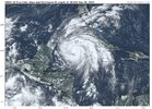
Hot towers once again right over the center, looking a little better inner core on vis sat and Cuban radar (just coming into sight), let's see if this deep convection can sustain.
Obviously different setups but this is very similar to Florence, Joaquin, and Hannah where relatively small changes in the 500mb flow make big differences in the ultimate track even within the D2-4 window.
DadOfJax
Member
The ensembles trend west today is undeniable. Where this thing crosses Cuba is going to play a big impact as well. If it continues west of a northerly track, and takes it time across the western tip of Cuba, its going to miss the effects of the trough almost entirely. It may even slow enough that it doesnt get shredded along the northern Gulf coast.....so much left to be ironed out!
Things that hold the most credence.. ensembles and hurricane models.. these ensembles are meant to build confidence on general agreement of where things are headed and hurricane models are built for .. well hurricanes.. things like the nam and operational models are really not much help in getting the clear picture
It slowing down will not have an impact on shears effects on the storm.. sheer and dry air will entrain into the system causing weakening to occur before hitting anywhere along the coast. Pretty confident about that.. earlier landfall at a closer location will mean a higher chance of getting a stronger storm to hit. If it slows down that will also create upwelling which will also help to weaken the storm.The ensembles trend west today is undeniable. Where this thing crosses Cuba is going to play a big impact as well. If it continues west of a northerly track, and takes it time across the western tip of Cuba, its going to miss the effects of the trough almost entirely. It may even slow enough that it doesnt get shredded along the northern Gulf coast.....so much left to be ironed out!
I am going to go with what this guy says about potential strength/intensification of this storm. It is and will get its act together, it makes no sense not to.. but we'll see I spose'.
It’s gonna get shredded. The trough aloft across the gulf actually gets stronger as the week progresses.The ensembles trend west today is undeniable. Where this thing crosses Cuba is going to play a big impact as well. If it continues west of a northerly track, and takes it time across the western tip of Cuba, its going to miss the effects of the trough almost entirely. It may even slow enough that it doesnt get shredded along the northern Gulf coast.....so much left to be ironed out!
The most interesting kind of tip where the models are showing their hand of what might be realistic is when both the icon and gfs really start dropping pressure in the GoM the system starts leaning right with its track as it feels the weakness and may be directed east of North by the 500-250 layer while a slightly weaker system may continue due north as the 700-500 flow is more S->N or even SSE->NNW
I am going to go with what this guy says about potential strength/intensification of this storm. It is and will get its act together, it makes no sense not to.. but we'll see I spose'.
The look of the storm on IR, looks like it just a matter of time.
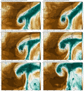
The more you unpack the 12z runs the more you see that there are some deep meteorological processes at play that really lean this left or right that are well above my head and far deeper than just looking at the model/ensemble mslp maps and drawing a conclusion
Just a few ?s I have:
Why do the icon and gfs drop sfc pressure west of FL? Is that why they turn E?
What's the deal with the convective explosion north of the Bahamas on the gfs/icon is that why they turn E?
Are the answers to the questions above why the cmc stays due north?
Why does the uk beat the WAR back so much the system gets into the Atlantic before resuming a northward motion?
How does the upper level system north of the islands racing west affect the track if at all?
DadOfJax
Member
Slowing down allows for retrograding of the cold front associated with the trough, minimizing the shear/dry air effects......by how much is the question. Maybe minimal, maybe not.It slowing down will not have an impact on shears effects on the storm.. sheer and dry air will entrain into the system causing weakening to occur before hitting anywhere along the coast. Pretty confident about that.. earlier landfall at a closer location will mean a higher chance of getting a stronger storm to hit. If it slows down that will also create upwelling which will also help to weaken the storm.
Just realized that the HMON maybe the worst and strongest landfall of any model yet in Florida with 120knts.
Probably not right, but shows how much location will impact landfall. The HWRF looks like it’s stalling and rotting across the NE GOM.
Probably not right, but shows how much location will impact landfall. The HWRF looks like it’s stalling and rotting across the NE GOM.
Stormsfury
Member
Downeastnc
Member
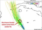
The Isle of Youth is gonna get scary close to having the center pass over it.....the NHC cone has the very western edge in the cone. Imagine things are going to get sporty there the next few hrs.
Cary_Snow95
Member
So many moving parts here.Just a few ?s I have:
Why do the icon and gfs drop sfc pressure west of FL? Is that why they turn E?
What's the deal with the convective explosion north of the Bahamas on the gfs/icon is that why they turn E?
Are the answers to the questions above why the cmc stays due north?
Why does the uk beat the WAR back so much the system gets into the Atlantic before resuming a northward motion?
How does the upper level system north of the islands racing west affect the track if at all?
Cary_Snow95
Member
2:00 PM EDT Mon Sep 26
Location: 19.7°N 83.0°W
Moving: NNW at 13 mph
Min pressure: 976 mb
Max sustained: 85 mph
Location: 19.7°N 83.0°W
Moving: NNW at 13 mph
Min pressure: 976 mb
Max sustained: 85 mph
This euro run is about worst case for Tampa
Cary_Snow95
Member
Yep slides slowly by just pushing everything right up into the bay. Never makes landfall but doesn’t really matterThis euro run is about worst case for Tampa
Started an inland impact thread since there is likely to be a widespread area of 3-5+ inch rain along with a low end tornado threat, and some gusty gradient winds
Tropical - Ian Ianland Thread
Long duration south to southeast flow, heavy rain, gradient wind, tornadoes will all spread well inland from the CoC with Ian discuss them here
southernwx.com
Henry2326
Member
NoSnowATL
Member
Maybe this time that look will actually happen.
Avalanche
Member
How will the topography on the western side of Cuba affect Ian?
Henry2326
Member
- Joined
- Jan 23, 2021
- Messages
- 4,603
- Reaction score
- 15,199
- Location
- Lebanon Township, Durham County NC
Western Cuba is pretty flat so it wont hurt it much.How will the topography on the western side of Cuba affect Ian?
Z
Zander98al
Guest
So when does this storm get the usual storm of the century/decade or whatever by media? Or has it already? Already see it. Historic Tampa Bay hurricane. storm surge of the century ?
smast16
Member
Venting as it nears the trough?Just a few ?s I have:
Why do the icon and gfs drop sfc pressure west of FL? Is that why they turn E?
What's the deal with the convective explosion north of the Bahamas on the gfs/icon is that why they turn E?
Are the answers to the questions above why the cmc stays due north?
Why does the uk beat the WAR back so much the system gets into the Atlantic before resuming a northward motion?
How does the upper level system north of the islands racing west affect the track if at all?
Posting here since most activity is here. Just made a site change. More details here: https://southernwx.com/community/threads/ignored-user-thread-changes.1131/
Please report errors/bugs to my inbox. Thanks
Please report errors/bugs to my inbox. Thanks
Moving at a good clip2:00 PM EDT Mon Sep 26
Location: 19.7°N 83.0°W
Moving: NNW at 13 mph
Min pressure: 976 mb
Max sustained: 85 mph
Ty for posting this. Even on NNW movement it might be on eastern end of guidance over Cuba.
Nerman
Member
Once it gets that look with bands and big dry slots in between bands, it never seems to fill in or congeal. We will see. And there will likely be a big band of precip that makes it into the Carolinas, hundreds of miles away from the center

