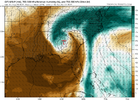
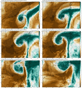
Long duration south to southeast flow, heavy rain, gradient wind, tornadoes will all spread well inland from the CoC with Ian discuss them here
Tropical Ian Ianland Thread
- Thread starter SD
- Start date
-
Hello, please take a minute to check out our awesome content, contributed by the wonderful members of our community. We hope you'll add your own thoughts and opinions by making a free account!
You are using an out of date browser. It may not display this or other websites correctly.
You should upgrade or use an alternative browser.
You should upgrade or use an alternative browser.
There is some really high end rain potential for us. Especially if the coastal front gets drawn inland and we can focus some convective bands on Saturday. The Euro is actually a respectable tornado threat for much of Ga/SC/SENC on Saturday and Sunday.I think a general 3-6” with locally higher amounts across NC is likely. We likely see models increase returns as we get closer. About 48 hours of moisture fetch from directly offshore
The one thing to watch will be the mid level dry punch. It'll cut down on totals but it may enhance the severe threat
There is some really high end rain potential for us. Especially if the coastal front gets drawn inland and we can focus some convective bands on Saturday. The Euro is actually a respectable tornado threat for much of Ga/SC/SENC on Saturday and Sunday.
The one thing to watch will be the mid level dry punch. It'll cut down on totals but it may enhance the severe threat

Agreed. This is just a firehose look. Like you said drag the front inland a bit and we get dumped on all Saturday afternoon. I could see someone getting a 10” lollipop given the dynamics here
The EURO just dropped over 5" here and pushing 4" in union. You're looking at individual model runs too much. You want the CAD dome for enhancement and a coverage. GFS has a reflectivity issue and feedback issues. I would be shocked if 4" isn't the average across the upstate with a lot of places getting more.That dry slot will keep amounts WAY down here. We need the 70 degree dewpoints back.
Glad someone caught itLong Live IanLand!
Yep. As a whole the NBM has only increased in rain amounts here per run; and I'm sure it's the same for everywhere else too.
Slower with the rain, weaker with the coastal troughThe CAD feature on the GFS seems to be a lot less now, I wonder what's going on?
Just looking at this from my backyard point of view, is this going to start Friday and go into Sunday? Or is it looking more like Saturday now for the start? Upstate sc.
We have no idea where it's even going yet, to be completely honest
Thursday night will start seeing bands likely coming up from the SE. Friday morning-Sunday morning/afternoon.Just looking at this from my backyard point of view, is this going to start Friday and go into Sunday? Or is it looking more like Saturday now for the start? Upstate sc.
We do need the rain here and it looks like Ian is going to supply it! I believe the wife and I might reconsider our plans to attend her home county fair on Saturday although I think it would be interesting to walk around in intermittent tropical downpours.
I'll take any rain at this point. I don't think it's rained since August.


