-
Hello, please take a minute to check out our awesome content, contributed by the wonderful members of our community. We hope you'll add your own thoughts and opinions by making a free account!
You are using an out of date browser. It may not display this or other websites correctly.
You should upgrade or use an alternative browser.
You should upgrade or use an alternative browser.
Tropical Hurricane Ian
- Thread starter severestorm
- Start date
-
- Tags
- tropical
Well dang lol. Seems models are struggling as steering currents are collapsing upon approach, could be crawling or just drifting idk. Seems we're getting a spread in tracks once again around D3-5
Henry2326
Member
That aligns with NHC's comment of uncertainty in dy 3 to 5.Well dang lol. Seems models are struggling as steering currents are collapsing upon approach, could be crawling or just drifting idk. Seems we're getting a spread in tracks once again around D3-5
smast16
Member
That's Fort Myers to Port Charlotte. Tampa Bay is the northern bay and would be on the N and W side with winds emptying the bay.Yep.....there is some indication in the spaghetti models of some movement toward the east coast of FL.
This 00z ICON model is devastating for Tampa Bay. Front and East quadrant into the bay...... geez
2nd LF in SC.
View attachment 122121
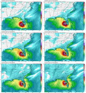
genuinely baffled on how the 12z models will run. shift east? shift west? i don't know. i have absolutely no read. i spent 20 minutes trying to find the synoptic difference on why the icon is doing what it's doing and didn't see it. steering based on vibes. good luck.
Maybe someone knows more about the intricates of the tech in the Icon. Would they have any reason to even want to spend the time/money/resources on programming a good tropical idea into it since it's Germany?
But, with that said, the UKMET and even NAM go across FL.. lol
DadOfJax
Member
Wont be surprised at all if it ends up in the panhandle....trends today should be telling....and so far, its west.Keep in mind it only runs out to 72 hrs, while it is west of it's previous track, it is heading N/NNE and would probably still end up in the big bend area of Fl. Just didn't want anyone to read that west shift as it heading towards Destin or something that far west.
HugeSnowStick
Member
And it very well might end up in Destin...Wont be surprised at all if it ends up in the panhandle....trends today should be telling....and so far, its west.
DadOfJax
Member
WOW.....exactly what I have been saying for days. This thing is going to miss every possible feature to get it to move east......it may sit in the gulf for days just meandering around.
BHS1975
Member
I just remember when the ukie powned all the other models with Florence which was very weak steering.
Sent from my iPhone using Tapatalk
Sent from my iPhone using Tapatalk
accu35
Member
It was little more than breezy, it destroyed my neighborhoodWhat system was that last year (Or two ago) that models kept inching west and west, and was progged to be a direct hit on NO. And It did, but it was just a naked swirl of low pressure and nothing more than a breezy day.
Wondering.
Honestly the UK has probably been the most consistent model the last couple days.I just remember when the ukie powned all the other models with Florence which was very weak steering.
Sent from my iPhone using Tapatalk
Stormsfury
Member
genuinely baffled on how the 12z models will run. shift east? shift west? i don't know. i have absolutely no read. i spent 20 minutes trying to find the synoptic difference on why the icon is doing what it's doing and didn't see it. steering based on vibes. good luck.
Icon seems to be a tick quicker with Ian and a touch slower with the longwave..or maybe putting too much stock in steering from the large ridge out west. It's wonky, not impossible, but wonky
Downeastnc
Member
I would not discount the models crossing Florida just yet....the system seems on the eastern side of track and.is moving north at a good clip...
Henry2326
Member
I remember.....Euro had it going against the gulf stream to Charleston. City shut down....not even a breeze or drop of water.I just remember when the ukie powned all the other models with Florence which was very weak steering.
Sent from my iPhone using Tapatalk
stboo6
Member
If this verified! Any guess on the implications for Ft Myers? I have a YOUNG daughter working/living in the historic district / riverwalk area. Sorry if this is banter! Worried mom!That's Fort Myers to Port Charlotte. Tampa Bay is the northern bay and would be on the N and W side with winds emptying the bay.
View attachment 122126
Stormsfury
Member
I remember.....Euro had it going against the gulf stream to Charleston. City shut down....not even a breeze or drop of water.
Have to correct you on that. We got winds and a light drizzle. A very cool 3 days with breezy, almost wedge like conditions lol
Tornadocane
Member
To my eyes, it appears that some Upper to Mid-Level Sheer is inserting dry air into the system, because Ian is sitting on the N and NW side of the Upper Level Anticyclone. Thus, dry air is circling into the system. I Imagine this is the reason Ian isn't deepening.
Henry2326
Member
I was in Goose Creek too. Thanks for the correction.Have to correct you on that. We got winds and a light drizzle. A very cool 3 days with breezy, almost wedge like conditions lol
It wasn't a major much less a minor....lol
Last edited:
It should be noted that the more this gets shredded, it would make sense for the to drift westward across the northern gulf. It would be a naked swirl, but it’s possible.
my guess is front orientation- the northeasterlies from the front are going to influence track. icon is faster (so less time expose to northeasterlies) and nam has the front orientation a little more n-s (so the surface winds have less of an easterly component)Icon seems to be a tick quicker with Ian and a touch slower with the longwave..or maybe putting too much stock in steering from the large ridge out west. It's wonky, not impossible, but wonky
Cary_Snow95
Member
Yep just saw that. And it’s still raining in these frames so that’s interestingI just realized the ICON wasn't exactly an outlier, the Ukie came inland south of Tampa, basically ran up the peninsula, exited briefly off the NE part of Fl and 2nd LF up the coast as very weak system but tons of rain. Curious to see if it shifts back west with it's 12z run. It and the Euro have diverged a little bit.


smast16
Member
Don't get all fussy, it wasn't Zeta.It was little more than breezy, it destroyed my neighborhood
It was Marco.

Henry2326
Member
smast16
Member
If this verified! Any guess on the implications for Ft Myers? I have a YOUNG daughter working/living in the historic district / riverwalk area. Sorry if this is banter! Worried mom
I used to live in Ft. Myers. I get it, but the best advice is to listen to her local NWS office in Tampa. They will give you the best information to make informed decisions. I can't make those calls for you.
https://www.weather.gov/tbw/
accu35
Member
That’s fine, but it was mentioned that it was Zeta. No worriesDon't get all fussy, it wasn't Zeta.
It was Marco.

To my eyes, it appears that some Upper to Mid-Level Sheer is inserting dry air into the system, because Ian is sitting on the N and NW side of the Upper Level Anticyclone. Thus, dry air is circling into the system. I Imagine this is the reason Ian isn't deepening.
Coming up and around the main cayman island area too. In theory, should filter out by tonight, but we shall see
Tornadocane
Member
my guess is front orientation- the northeasterlies from the front are going to influence track. icon is faster (so less time expose to northeasterlies) and nam has the front orientation a little more n-s (so the surface winds have less of an easterly component)
I agree with your point. I think the orientation and strength of shortwave troughs and ridges will have effects that the models might have trouble nailing down. I think that's the difference between the ICON and GFS depictions. It's noticeable on the 200Mb charts (Icon has limited maps).
Tornadocane
Member
Coming up and around the main cayman island area too. In theory, should filter out by tonight, but we shall see
Sure. In theory. I don't think it will all clear out given the strengthening vorticity signatures over the Yucatan and Central Gulf causing subsidence on the SSW to NNW Peripheries of Ian's peripheries. It certainly seems like the Outflow boundary has been disturbed.
It will strengthen, but RI? I feel like everyone has said it would RI way before this point in time. Even the Weather Channel Hurricane Expert has walked back a bit.
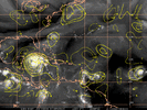
So let’s see if we have this correct, lol. (BTW. I want y’all to get your rain in the SE, I’m good at the moment here in FL) as the trof dips down and rotates thru
Faster into the GOM=eastbiund
Slower into the GOM =westbound
Faster into the GOM=eastbiund
Slower into the GOM =westbound
Henry2326
Member
Henry2326
Member
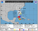
11 am......wonder what they are looking at. I'm baffled.
The track guidance has come into better
agreement during the first 72 h of the forecast period, and only a
minor eastward adjustment was made to the NHC track forecast in line with the multi-model consensus aids.
The track guidance has come into better
agreement during the first 72 h of the forecast period, and only a
minor eastward adjustment was made to the NHC track forecast in line with the multi-model consensus aids.
Brent
Member
NHC is more east than they ever have been lol. Let's not forget though they have models we don't see
Bannerdude
Member
DadOfJax
Member
NHC now on the eastern side of EPS guidance....watch for them to adjust to the west at some point today, especially if the GFS comes in west as well.
Henry2326
Member
That's not how they roll. They are very slow to make major adjustments especially to the GFS or Euro.NHC now on the eastern side of EPS guidance....watch for them to adjust to the west at some point today, especially if the GFS comes in west as well.
Tornadocane
Member
000
WTNT44 KNHC 261457
TCDAT4
Hurricane Ian Discussion Number 14
NWS National Hurricane Center Miami FL AL092022
1100 AM EDT Mon Sep 26 2022
The satellite presentation of Ian has improved this morning. Deep
convection has increased within the inner core during the past
several hours, with an expanding central dense overcast noted in
recent satellite imagery. The inner core structure continues to take
shape in radar data, although the eyewall still has a banded
appearance and remains open on the west side. Dropsonde data from
the NOAA and Air Force Hurricane Hunter aircraft indicate that the
minimum pressure has gradually fallen to about 980 mb, and the
initial intensity is raised slightly to 70 kt for this advisory.
DadOfJax
Member
On its way to possibly still shooting the gap, or just barely touching the western tip of Cuba, if that is extrapolated out.
Brent
Member
That's not how they roll. They are very slow to make major adjustments especially to the GFS or Euro.
And like I said above... They have other models we don't see. There's clearly more eastern models than west
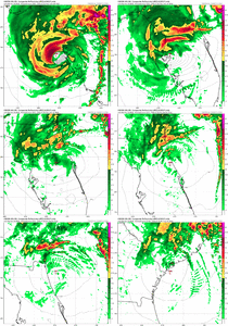
I'm still wondering if this might happen. I know UK, ICON and HMON aren't the most relied on models for most forecasters but stranger things have happened before.06z HMON - LF in Tampa, crosses FL, and LF in SC.
So now we have UK, Icon, and HMON with this crossing FL thing.
View attachment 122127

