-
Hello, please take a minute to check out our awesome content, contributed by the wonderful members of our community. We hope you'll add your own thoughts and opinions by making a free account!
You are using an out of date browser. It may not display this or other websites correctly.
You should upgrade or use an alternative browser.
You should upgrade or use an alternative browser.
Tropical Hurricane Ian
- Thread starter severestorm
- Start date
-
- Tags
- tropical
That would be my guess but you'd think there would be some level of shear and dry air encroaching.Venting as it nears the trough?
Michael_Ballew
Member
My school system moved the high school game and homecoming festivities to Thursday night. I'm assuming concerns over rain on Friday.
Sent from my SM-N960U using Tapatalk
Sent from my SM-N960U using Tapatalk
Nerman
Member
Henry2326
Member
NoSnowATL
Member
smast16
Member
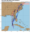
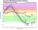
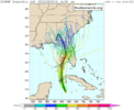
I can't be seeing this right. Did all the members initialize between 40 - 60 kts, when the system is already at 70 kts per the 2pm update? I don't see any 70kt hurricanes for 48 hrs on that plotting. There has to be a mix up on my end or every single member initialized too low.
brendan123
Member
First legitimate storm threat towards Florida during my freshman year at the University of Miami, but it doesn’t look like the impact in most of the Miami area will be much more than the typical breezy and rainy conditions that always occur during the rainy season (however there may be some slight storm surge, and combined with downpours, flooding could become an issue). UM hasn’t cancelled anything, but my friends at USF in Tampa and Florida State in Tallahassee say classes have been cancelled for the week. Miami appears like it’ll continue its lucky streak with this storm, but Tampa might not. A hurricane, even if it isn’t necessarily a major one, stalling just off the coast for days pushing surge and battering the coast with wind and rain is a worst case scenario for anywhere, especially in an area as vulnerable as Tampa/St. Pete.
accu35
Member
I expect another east shift in the cone later on. To many models are strongly agreeing with the NHC. Even though ens are west I just don’t know.
Something to chew on, the longer it bumbles around and doesn’t have a massive RIC, the more problematic it may end up for the area around Tampa should it go there. It *may* mean it is less likely to have a ERC before landfall and make it less likely for dry air to penetrate the core. This is something Harvey, Michael and Ida did. Wouldn’t mean much for areas north of there, but for areas south it may mean a big jump in intensity.
Stormsfury
Member
5pm, Ian 100 mph, 972mb pressure. NNW 13 mph.
Henry2326
Member
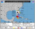
The NHC track forecast has again been adjusted slightly
eastward at 48-72 h, which follows the latest trends in the global
model guidance and lies near but just west of the multi-model
consensus aids.
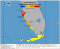
There is the danger of life-threatening storm surge along much
of the Florida west coast where a storm surge warning has been
issued, with the highest risk from Fort Myers to the Tampa Bay
region. Residents in these areas should listen to advice given by
local officials.
FORECAST POSITIONS AND MAX WINDS
INIT 26/2100Z 20.3N 83.2W 85 KT 100 MPH
12H 27/0600Z 21.7N 83.8W 105 KT 120 MPH
24H 27/1800Z 23.6N 84.0W 115 KT 130 MPH
36H 28/0600Z 25.3N 83.9W 120 KT 140 MPH
48H 28/1800Z 26.7N 83.5W 115 KT 130 MPH
60H 29/0600Z 27.5N 83.2W 100 KT 115 MPH
72H 29/1800Z 28.1N 82.9W 75 KT 85 MPH
96H 30/1800Z 30.1N 82.3W 45 KT 50 MPH...INLAND
120H 01/1800Z 33.5N 82.0W 25 KT 30 MPH...INLAND
Last edited:
Nerman
Member
There's a recon flight circling it now and 2 more on the way
accu35
Member
I think it’s safe to say west coast Florida this is your storm, congrats.
Henry2326
Member
Cary_Snow95
Member
Henry2326
Member
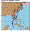
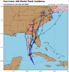
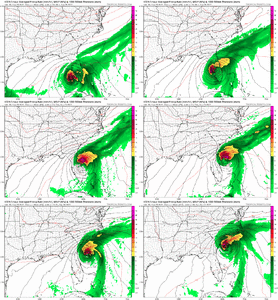
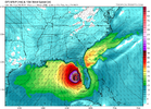
I don't know if I can watch 2 majors in one week.....we are a long way from that but now ICON is pushing for a Charleston LF which was also in the 18z spaghetti model.View attachment 122173
18z ICON ?

Shaggy
Member
Yeah it appears the icon got into someone's special gummy stash.View attachment 122173
18z ICON ?
I still can't figure out why some of these models go across FL and off the ATL coast.. but its enough of a signal.....
Blue_Ridge_Escarpment
Member
I actually feel sorry for it. Such a bad model.Yeah it appears the icon got into someone's special gummy stash.
JHS
Member
That would leave many of us out as far as rain goes and I have to wonder if it may be onto something. That was a big shift east.Yeah it appears the icon got into someone's special gummy stash.
Henry2326
Member
Today, it was the first to break to the east and shift across the state.I actually feel sorry for it. Such a bad model.
I'm not writing it off.
I mean.. Icon isn't exactly alone still. You can see a split camp on some of these ensemble runs of the major modeling too ....
Shaggy
Member
It's been an on and off again signal for the entire week. We occasionally get a wonky run to the east and there's always been the eastward camps in the ensembles. Looking at the 5pm track a 100 mile east adjustment puts it back in the Atlantic so we keep watching I guessI still can't figure out why some of these models go across FL and off the ATL coast.. but its enough of a signal.....
iGRXY
Member
Watch as we get closer and the WAR starts flexing and showing itself like it always does in the short range. That’ll all but put a nail in a reemergence in the Atlantic idea.
Cary_Snow95
Member
Shaggy
Member
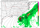
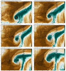
No major change on gfs out to 36 maybe a touch east
Not happening.View attachment 122173
18z ICON ?
Cary_Snow95
Member
I know I am one of the old dogs but damn, I miss John Hope this time of year.
Oddly enough the Euro actually had this exact track early on, I don't see it happening either but the fact it won't go completely away is interesting
You can already see the smallest sign of that on the 18z GFS… the WAR flexing at the last minute is as certain as death and taxesWatch as we get closer and the WAR starts flexing and showing itself like it always does in the short range. That’ll all but put a nail in a reemergence in the Atlantic idea.
I don’t know yet, my in house 18z MBY model run hasnt come in yet.I think it’s safe to say west coast Florida this is your storm, congrats.
Shaggy
Member
The gfs is heading that way before the big blocking high races in and shuts of the NE turn and turns it more NNW again just off the west coast of Florida.Oddly enough the Euro actually had this exact track early on, I don't see it happening either but the fact it won't go completely away is interesting
He was the best! DR Knabb is not that bad! Smart guy!I know I am one of the old dogs but damn, I miss John Hope this time of year.
Henry2326
Member
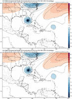
Yes, but stronger WAR would most likely mean stronger steering currents and a stronger hurricane would be apt to be steered NE around the stronger 500mb ridge.You can already see the smallest sign of that on the 18z GFS… the WAR flexing at the last minute is as certain as death and taxes
Not saying the Icon is correct but food for thought.

