• Hello, please take a minute to check out our awesome content, contributed by the wonderful members of our community. We hope you'll add your own thoughts and opinions by making a free account!

Tropical Hurricane Ian

It will be interesting to see which model is right. Euro 953mb over Hatteras or the GFS with nothing at all.
 
Couple of thoughts this morning...

- I was dismissive of the worthwhileness of model watching yesterday, but I wasn't expecting the short term model envelop for the track to become so tight. I think they're a good comparison tool to verify things at this point. So yeah I'm looking at models now.

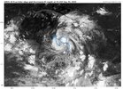
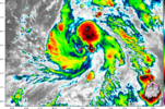
- Biggest near term Q to me is how the LLC behaves, nascent visible loops this morning should an elongated circulation with a general axis paralleling the deepest convection. Recon is currently screwing around out there:
recon_AF306-0209A-CYCLONE.png

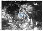
I've noticed that most ensembles had the LLC crossing 14 degrees of latitude of this point, I'm curious to know if that's just an artifact of the elongated circulation or whether that's a bona-fide south error. I'm hoping that recon will take a few passes to flesh this out. I also want to note that the 6z HWRF mapped this circulation pattern out really well. I think if there's any model that will nail the LLC's behavior, it's the HWRF.
hwrf_mslp_wind_09L_4.png

So yeah this morning I'm definitely on "will the LLC reform to the SW" alert. If that happens you can bake in some more intensification in the short term as well as some model errors to the south. Also, fun fact about the HWRF- it projects 9L to be in LLC hell for a solid 48 hours, something to pay attention to.

I'm staying away from any long term proclamations, in general I think this storm will continue to tug south of the model envelop which would translate to more western solutions verifying downstream, but that really depends on how it behaves today.
 
LLC looks like it's moving due north this morning. Will be interesting to see if it's an eddy in a larger gyre and gives up the ghost through the day to a new LLC more co located to the deep convection or if it runs away from the big convective mass to its SW
If that deep convection maintains you would think it would increase the likelihood of llc reforming under it or pulling it under it.

Also, btw recon is there now
 
Couple of thoughts this morning...

- I was dismissive of the worthwhileness of model watching yesterday, but I wasn't expecting the short term model envelop for the track to become so tight. I think they're a good comparison tool to verify things at this point. So yeah I'm looking at models now.

- Biggest near term Q to me is how the LLC behaves, nascent visible loops this morning should an elongated circulation with a general axis paralleling the deepest convection. Recon is currently screwing around out there:
recon_AF306-0209A-CYCLONE.png

I've noticed that most ensembles had the LLC crossing 14 degrees of latitude of this point, I'm curious to know if that's just an artifact of the elongated circulation or whether that's a bona-fide south error. I'm hoping that recon will take a few passes to flesh this out. I also want to note that the 6z HWRF mapped this circulation pattern out really well. I think if there's any model that will nail the LLC's behavior, it's the HWRF.
hwrf_mslp_wind_09L_4.png

So yeah this morning I'm definitely on "will the LLC reform to the SW" alert. If that happens you can bake in some more intensification in the short term as well as some model errors to the south. Also, fun fact about the HWRF- it projects 9L to be in LLC hell for a solid 48 hours, something to pay attention to.

I'm staying away from any long term proclamations, in general I think this storm will continue to tug south of the model envelop which would translate to more western solutions verifying downstream, but that really depends on how it behaves today.
Regarding the HWRF, it also went a bit further west as did the HMON from 6Z. While the HMON puts the low under the envelope faster, the HWRF keeps it exposed until early saturday where it reforms SW as mentioned. The globals seem to act like its mostly surrounded already or will be very soon, which might not be the case. If there's a lot of struggling/SW reformation, we're going to see a westward shift in the modeling some.
 
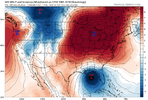
One of the things I'm watching, which I think is a main player, is the incoming trough. The modeling has it deeper and slower, which is accounting for the more northerly and eastern solutions that we're seeing now. Often in the winter, we see these troughs appear deeper out in time than they actually turn out to be. Usually, we're watching intently, looking for a phase or worrying about squash city.

Anyway, it will be interesting to see if we go back to a shallower trough scenario over the next couple of days. We certainly haven't seen much in the way of deep troughing lately. That has not been the trend. But the seasons are changing, so I guess we'll see
 
It will be interesting to see which model is right. Euro 953mb over Hatteras or the GFS with nothing at all.
The issue is how the two models handle the storm getting absorbed by the trough and what the result of it is. This is something that the Euro has done really well with in the past… it picked up on what would happen with Sandy 10 days out 2012 and ended up being right. If the Euro is onto something here about how deep and sharp that trough is, then it will likely be correct on the strength
 
6z v/s yesterdays 18z on EPS

View attachment 121845
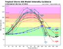
As has been my thinking the models continue to relocate the initialization of the storm further SW and there for the track long term does the same. You have an exposed LLC that is trying to relocate under the heaviest convection that continues to fire. As always you cant look at models 6-7 days away and not expect track changes, they WILL happen. As for models strength predictions they are UNDERDOING the strength forecast IMO by a long shot. Look at how much little shear is effecting this once it gets up into the NW Caribbean. Bath water, no shear, great ventilation = rapid intensification. This environment easily will facilitate a major hurricane. One much stronger than those euro ensembles are painting (999 mbs in this environment?!?! Not happening) 1663941665115.png
 
6z v/s yesterdays 18z on EPS

View attachment 121845
Captain obvious here but dang look at that west shift, you start getting it to cross western Cuba (flatter terrain) or shoot the gap and becomes a much bigger deal intensity wise. Little more spread too now, I mean dang some almost into Central America before it turns N
 
Last edited:
Captain obvious here but dang look at that west shift, you start getting it to cross eastern Cuba (flatter terrain) or shoot the gap and becomes a much bigger deal intensity wise. Little more spread too now, I mean dang some almost into Central America before it turns N
Yep...could be really bad for FL
 
Does anyone know how recon is doing this morning? Trying to get ready to fly out for my daughter’s fall break this afternoon. We are going to West Palm Beach area. Glad we already got a rental. Prayers this thing doesn’t go beast mode.
 
Captain obvious here but dang look at that west shift, you start getting it to cross eastern Cuba (flatter terrain) or shoot the gap and becomes a much bigger deal intensity wise. Little more spread too now, I mean dang some almost into Central America before it turns N
You mean western Cuba. Do you guys think that west turn into Carolina’s is possible?
 
Back
Top