-
Hello, please take a minute to check out our awesome content, contributed by the wonderful members of our community. We hope you'll add your own thoughts and opinions by making a free account!
You are using an out of date browser. It may not display this or other websites correctly.
You should upgrade or use an alternative browser.
You should upgrade or use an alternative browser.
Tropical Hurricane Ian
- Thread starter severestorm
- Start date
-
- Tags
- tropical
So that's right up the road from me and I've heard good things about it, never had any myself, but had no idea it was that expensive. Yeah let us know if that was worth it or not lol holy smoke!Today I drove from Richmond to Raleigh for my uncles 60th birthday. My uncle likes whiskey so I thought, I’ve been meaning to try this place out for a while, let’s go to Weldon Mills Distillery for a bottle?
Yo. That bottle of whiskey was 116 dollars. I hope it’s grade A whiskey because I’ll tell you what, if I knew it cost that much, I wouldn’t of gotten it! Just an fyi in case anyone tries to pull the same move.
I’m in my hotel room now ingesting everything. First of all it doesnt look *great* that convection collapsed, but it happens. Way more worried about the inconsistent depiction on recon charts, I thought something more mature would peek out by now.
Henry2326
Member
Henry2326
Member
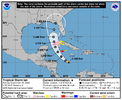
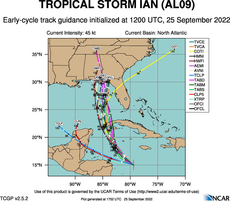
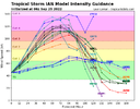
FORECAST POSITIONS AND MAX WINDS
INIT 25/0900Z 14.9N 78.8W 45 KT 50 MPH
12H 25/1800Z 15.7N 80.0W 55 KT 65 MPH
24H 26/0600Z 17.3N 81.7W 70 KT 80 MPH
36H 26/1800Z 19.1N 83.1W 90 KT 105 MPH
48H 27/0600Z 21.0N 84.1W 105 KT 120 MPH
60H 27/1800Z 23.0N 84.6W 115 KT 130 MPH
72H 28/0600Z 24.8N 84.8W 120 KT 140 MPH
96H 29/0600Z 27.5N 84.6W 105 KT 120 MPH
120H 30/0600Z 29.8N 83.9W 80 KT 90 MPH
Last edited:
Henry2326
Member
Tropical Storm Ian Discussion Number 9
NWS National Hurricane Center Miami FL AL092022
500 AM EDT Sun Sep 25 2022
Bands of deep convection have developed primarily over the
northern portion of Ian's circulation overnight, however data from
an Air Force Reserve reconnaissance aircraft show that the low- and
mid-level centers of the tropical storm have not yet become in
better alignment. The Air Force plane essentially performed a
low-level invest-like mission at about 2500 ft and found an
east-southeast to west-northwest elongated area of light
and variable winds that is located to the southeast of the mid-level
center seen in infrared satellite imagery. Given the time spent
searching for the low-level center, the aircraft did not fully
sample the northern portion of the circulation where the strongest
winds are likely located. Therefore, the initial intensity is held
at 45 kt, which is in line with the latest subjective and objective
satellite estimates. It should be noted that the advisory position
is a compromise between the low- and mid-level centers as it is
quite likely that a new low-level center will form closer to the
convection and the mid-level center very soon.
Due to the current lack of center definition, the initial motion
estimate is a somewhat uncertain 285/10 kt. The track forecast
philosophy remains unchanged, with Ian forecast to move around the
western periphery of a subtropical ridge located over the western
Atlantic. Ian is forecast to turn northwestward later today,
passing near or southwest of the Cayman Islands on Monday, and
approach western Cuba on Monday night or early Tuesday. While the
models agree on the overall scenario, there are still significant
differences regarding the exact track of the storm, especially
after 72 hours. Even with the addition of the NOAA G-IV synoptic
surveillance dropsonde data and additional upper-air balloon
releases across much of the United States, the spread in the
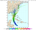
guidance has not narrowed from before. The UKMET and ECMWF models
continue to hold firm along the eastern side of the guidance and
show a track into west-central Florida, while the GFS and HWRF
remain one the western side, taking the Ian into the central or
western Florida panhandle. The updated NHC track continues to
split these differences and remains closest to the TVCA multi-model
consensus, and the latest GFS ensemble mean. The new track is very
similar to the previous advisory. With the cross-track spreading
remaining between 200-220 n mi at days 4 and 5, it cannot be
overstated that significant uncertainty remains in Ian's long-range
prediction. Another NOAA G-IV synoptic surveillance mission is
already underway collecting data around the storm which will
hopefully reduce some of the model spread.
Ian remains within an environment that appears quite conducive for
strengthening. Once the circulation become more vertically
coherent, low vertical wind shear conditions and high ocean heat
content are expected to allow for rapid intensification while Ian
moves over the northwestern Caribbean Sea. The Deterministic to
Probabilistic Statistical Rapid Intensification Index (DTOPS) once
again calls for a 90 percent chance of rapid strengthening during
the following 48- and 72-hour forecast periods. The NHC intensity
forecast calls for rapid intensification to begin later today, and
forecasts Ian to be a major hurricane when it nears western
Cuba in about 48 hours. The latest official intensity forecast
shows a similar peak intensity around 72 h over the southeastern
Gulf of Mexico as the previous advisory.
After that time, a significant increase in southwesterly shear is
predicted by the global models, and weakening is forecast to occur
while Ian approaches the Florida coast. Despite the reduction in
intensity, Ian is likely to have an expanding wind field and will be
slowing down by that time, which will have the potential to produce
significant wind and storm surge impacts. Users are urged
to not focus on specific forecast intensities in the 4- and 5-day
forecasts and instead focus on the potential hazards Ian may
produce across portions of Florida.
All those synoptic flights and balloon launches didn't sway the Europeans at all. Idk seems we see this so many times, additional data and yet models still don't align, gonna be interesting because in this situation a 150 miles east at approach is far more serious problem. Also dang it looks rough this morning, fact is models gonna struggle until there is a definitive stacked center
Shaggy
Member
The fact we are still not tracking a well-defined center is surprising to me. Figure we have another 24 to 36 hours before models settle thus outAll those synoptic flights and balloon launches didn't sway the Europeans at all. Idk seems we see this so many times, additional data and yet models still don't align, gonna be interesting because in this situation a 150 miles east at approach is far more serious problem. Also dang it looks rough this morning, fact is models gonna struggle until there is a definitive stacked center
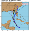
Looking at the cone from the NHC, it really is pretty narrow for a few days out, especially for a storm that is forecast to slow down forward speed as it approaches the coast. As you said though 150 miles difference east and west is a huge difference because of the location. I think the NHC is right to pretty much split the difference with a path going into the Big Bend area. Keep in mind we’re in the time frame now that the NHC has done absolutely great with forecast tracks over the last few years.All those synoptic flights and balloon launches didn't sway the Europeans at all. Idk seems we see this so many times, additional data and yet models still don't align, gonna be interesting because in this situation a 150 miles east at approach is far more serious problem. Also dang it looks rough this morning, fact is models gonna struggle until there is a definitive stacked center
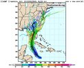
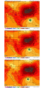
Actually little surprised at number of eps members still come off east coast of FL and then come back for 2nd lf. Guess that's the least likely but not completely off the table yet either
This storm has been taking its time establishing a well defined center and until this happens, it will be difficult for the models and meteorologists to get a definite idea on the track and potential impacts it might have in the eastern Gulf and points further north. Right now almost all bets are still on the table as far as intensity and where landfall will eventually occur. The NHC has been the most consistent so far and if I had to put my chips on the table I would go with their forecast.The fact we are still not tracking a well-defined center is surprising to me. Figure we have another 24 to 36 hours before models settle thus out
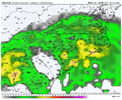
06z ICON very euro like.
It appears recon has finally found a defined center. Weak sauce with no strong winds anywhere near the COC for now.


So that's right up the road from me and I've heard good things about it, never had any myself, but had no idea it was that expensive. Yeah let us know if that was worth it or not lol holy smoke!
Today I drove from Richmond to Raleigh for my uncles 60th birthday. My uncle likes whiskey so I thought, I’ve been meaning to try this place out for a while, let’s go to Weldon Mills Distillery for a bottle?
Yo. That bottle of whiskey was 116 dollars. I hope it’s grade A whiskey because I’ll tell you what, if I knew it cost that much, I wouldn’t of gotten it! Just an fyi in case anyone tries to pull the same move.
I’m in my hotel room now ingesting everything. First of all it doesnt look *great* that convection collapsed, but it happens. Way more worried about the inconsistent depiction on recon charts, I thought something more mature would peek out by now.
Raleigh ain't the same city where Barney Fife stayed at the Y on the Andy Griffith Show anymore. The cost of living has skyrocketed in recent years due to the growth and influx of newcomers with big wallets. It's hard to believe that I used to know people who made their own inebriating beverages and now these local distilleries that have popped up everywhere like weeds on a lawn are charging that much for liquor.So that's right up the road from me and I've heard good things about it, never had any myself, but had no idea it was that expensive. Yeah let us know if that was worth it or not lol holy smoke!
NoSnowATL
Member
Yea the GFS is on a island. This girl is going east!06z ICON very euro like.
DadOfJax
Member
NopeYea the GFS is on a island. This girl is going east!
LickWx
Member
Why?Nope
iGRXY
Member
This is simply not true lolololYea the GFS is on a island. This girl is going east!
Blue_Ridge_Escarpment
Member
Came west of the 0Z ICON run.06z ICON very euro like.
NoSnowATL
Member
Shhhh…. Reverse psychologyThis is simply not true lololol
Until this thing starts sustaining convection, tracking will be a nightmare. It could be tugged by any large convective plumes that form.
Because he lives west. You can pretty much tell where someone lives without even looking based on where they think the storm is going. LolWhy?
It’s because it’s not going east lolBecause he lives west. You can pretty much tell where someone lives without even looking based on where they think the storm is going. Lol
ForsythSnow
Moderator
East west east west, let's not resort to one worders or one liners that add nothing to the discussion.
smast16
Member
Look how most don't or barely attain hurricane strength.
Are we going to have a failure to launch, where Ian takes so long to organize it doesn't have enough time?
Based on recon and satellite presentation, for the first time, the storm finally has stacked its COC.
It'll be interesting to see how long it takes to intensify given the near-perfect atmospheric conditions given that the center is still so broad.
It'll be interesting to see how long it takes to intensify given the near-perfect atmospheric conditions given that the center is still so broad.
Been that way for a few daysEast west east west, let's not resort to one worders or one liners that add nothing to the discussion.
Yesterday's gfs runs had this in the low to mid 990s by now. All hail the king womp oof
Drizzle Snizzle
Member
Hard to believe it's going to be a major hurricane tomorrow night.Yesterday's gfs runs had this in the low to mid 990s by now. All hail the king womp oof
BHS1975
Member
Yesterday's gfs runs had this in the low to mid 990s by now. All hail the king womp oof
You think the euro has a better handle on this one?
Sent from my iPhone using Tapatalk
BHS1975
Member
Hard to believe it's going to be a major hurricane tomorrow night.
The ocean is stupid warm. Needs a decent core to take advantage though.
Sent from my iPhone using Tapatalk
I don't think any of them do until we have a real center and consolidated system. There's more and more consistency and agreement for the FL peninsula track vs through the gulf into the western panhandle but consistency can be wrongYou think the euro has a better handle on this one?
Sent from my iPhone using Tapatalk
If it can ever resolve its own internal issues it'll have a good charge to go bonkers but its in no hurry to do soHard to believe it's going to be a major hurricane tomorrow night.
Bingo!!Until this thing starts sustaining convection, tracking will be a nightmare. It could be tugged by any large convective plumes that form.
Well if the the hurricane models are to be believed, the epic collapse at the northern gulf will be as incredible as the future RIC. Latest HWRF is “probably” still a hurricane with a completely exposed center and the HMON is a 45-50knt TS.
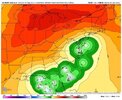
GFS looks way west of the other models and the NHC forecasted track. Also looks like we still don't know if it will stay inland when it makes landfall or go out to sea and possibly back into NC.
too much competing energy right now.
Hurricane suite says EURO is bonkers.
