-
Hello, please take a minute to check out our awesome content, contributed by the wonderful members of our community. We hope you'll add your own thoughts and opinions by making a free account!
You are using an out of date browser. It may not display this or other websites correctly.
You should upgrade or use an alternative browser.
You should upgrade or use an alternative browser.
Tropical Hurricane Ian
- Thread starter severestorm
- Start date
-
- Tags
- tropical
Shaggy
Member
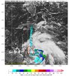
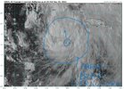
satellite is rapidly improving if you ask me. Cloud field is filling in and expanding and banding is really looking better.We should also now have a definitive center for the models to lock on to.
Drizzle Snizzle
Member
Good news for Atlanta. Looks like I'll be able to go to the Braves game next Saturday.
Uh, I wouldn’t count on that. Other models are further west.Good news for Atlanta. Looks like I'll be able to go to the Braves game next Saturday.
iGRXY
Member
Will be interesting to see how quick high schools move their games Friday because you know it’s coming. I see a lot of Thursday games coming
Friday might still be a washout. Looks like there might be a doubleheader Saturday or SundayGood news for Atlanta. Looks like I'll be able to go to the Braves game next Saturday.
GeorgiaGirl
Member
Uh, I wouldn’t count on that. Other models are further west.
Yeah, my thought when I was watching the GFS was "if it plays out this way, there's a zero percent chance the Braves will be playing on Friday."
I think that actually might be a reasonable track to look for too.
JHS
Member
Goes in near Tampa on the Euro
It’s interesting the Euro continues to stick with the Tampa landfall for the past few days.
BHS1975
Member
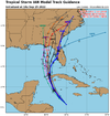
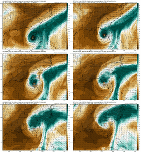
Euro still eastern track with landfall on W Central FL coast. It's slight east of yesterday's 12z, slight west of its 0z but basically minimal changes in track
View attachment 122062
Ukmet agrees. I wouldn't bet against that combo.
Sent from my iPhone using Tapatalk
AgreedUkmet agrees. I wouldn't bet against that combo.
Sent from my iPhone using Tapatalk
It’s interesting the Euro continues to stick with the Tampa landfall for the past few days.
If its 12z ensemble members and mean are just east of the Op I’d give it even more weight vs a central Panhandle type solution. Euro and UK are pretty close inside day 5 and that’s a potent combo as mentioned.
Brent
Member
Very hard to go against the Euro especially if the other models are starting to shift east. Just my thoughts. I'm not getting rain from this either way ?
This may be the long feared Tampa strike if it actually goes off
This may be the long feared Tampa strike if it actually goes off
Henry2326
Member
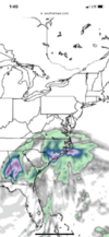
Euro says front misses Ian pretty handily , just want to level-set on what East means. It does not mean much if any opportunity for him to get in to the ATL, atleast per this run. Kinda stalls in the SE for a couple days before lifting out through the OH Valley—>NE. We would have several days of onshore flow, don't see much SVR verbatim. N GA and W NC would be spots for greatest flood potential.
Dry air getting deep into the circulation on the Euro even off of central FL. Calling a major landfall there may be a risk now.
Henry2326
Member
NoSnowATL
Member
Ron Burgundy
Member
Considering the name of our NWS office is “KATL” I don’t consider that a failure to understand basic English.Yeah, those who are wishcasting to their areas made it shown based off of their ineptitude to understand basic English!
I'm feeling it...."east"
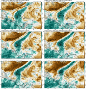
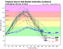
NHC usually plays it close to the TVCN/X so I could see them shifting east a smidge with landfall near Crystal River FL at 5pm, and dialing back on intensity. In 120hrs, we are going to have a 1030mb HP centered in central NY State, not buying solutions that take Ian straight up in to it. Steering currents should break down for him somewhere in the vicinity of N FL / C GA, before an exit just west of the Apps. I'm a little east for landfall and little west for exit, I think the 12Z Euro at the upper levels did a very nice job, including handling of the hybrid CAD.
weatherboyy
Member
i agreeView attachment 122069
Think Tampa to Cedar Key is most likely but I still see a lot of storm tracks west.
Those tracks are close again to taking Ian out to sea once it crosses Florida before hitting eastern North Carolina. This storm has definitely moved east again as far as the forecast tracks and models. I feel like I'm watching windshield wipers going back and forth on a windshield trying to keep up with these forecast changes.
I’m going with the NHS forecast. Major that weakens prior to landfall! Hopefully a lot of rain for the SE!
Henry2326
Member
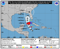
FORECAST POSITIONS AND MAX WINDS
INIT 25/2100Z 16.2N 80.3W 40 KT 45 MPH
12H 26/0600Z 17.3N 81.5W 50 KT 60 MPH
24H 26/1800Z 19.2N 82.9W 70 KT 80 MPH
36H 27/0600Z 21.1N 83.7W 90 KT 105 MPH
48H 27/1800Z 23.0N 84.2W 105 KT 120 MPH
60H 28/0600Z 24.8N 84.4W 115 KT 130 MPH
72H 28/1800Z 26.2N 84.4W 110 KT 125 MPH
96H 29/1800Z 28.3N 84.0W 85 KT 100 MPH
120H 30/1800Z 31.0N 83.0W 50 KT 60 MPH...INLAND
Brent
Member
From the new discussion
Strong
southwesterly shear develops over Ian by 72 h related to interaction
with an upper-level trough, and the structure of the cyclone could
significantly degrade before landfall given these hostile
conditions.
Strong
southwesterly shear develops over Ian by 72 h related to interaction
with an upper-level trough, and the structure of the cyclone could
significantly degrade before landfall given these hostile
conditions.
Downeastnc
Member
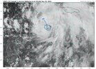
Look way better on vis than IR lol....looks pretty NNW if that is the actual center....still sloppy.
My money is right where the NHC has the center in the big bend. Just makes sense with the strengthening western ridge and the trof's speed/axis at this point. I mean, technically Mid FL around Tampa Bay and inland is still in the crosshairs too. But somewhere in that zone from there and the big bend is happening at this point.
These NHC guys are smart as hell and have so much experience/tools for this type of thing.
Edit: and the big bend area is almost the best for all of us who don't care for the severe aspects. tons of shear and rapid weakening into a strung out mess into a colder air mass causing rain to completely blossom. I wouldn't worry about a dry slot at this point.. but yeah a ton of dry air does look to get ingested into the storm's center... which helps weaken it thankfully also
Last edited:
Absolutely… the NHC has done a great job the last few years of forecasting landfall locations. There’s been a number of storms that they were within 30 miles 5 days outMy money is right where the NHC has the center in the big bend. Just makes sense with the strengthening western ridge and the trof's speed/axis at this point. I mean, technically Mid FL around Tampa Bay and inland is still in the crosshairs too. But somewhere in that zone from there and the big bend is happening at this point.
These NHC guys are smart as hell and have so much experience/tools for this type of thing.
Edit: and the big bend area is almost the best for all of us who don't care for the severe aspects. tons of shear and rapid weakening into a strung out mess into a colder air mass causing rain to completely blossom. I wouldn't worry about a dry slot at this point.. but yeah a ton of dry air does look to get ingested into the storm's center... which helps weaken it thankfully also
accu35
Member
Storm slowing down towards Tampa and creeping north?
iGRXY
Member
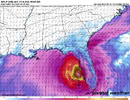
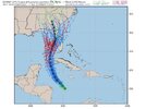
GFS definitely further east but is still heading straight for the big bend of Florida. To me that has the best bet of LF as of right now
iGRXY
Member
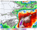
GFS returns are so trash man. It’s a shame it has this much of an issue painting a true reflectivity outside of 3 days.
Cary_Snow95
Member

