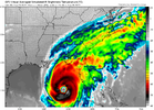
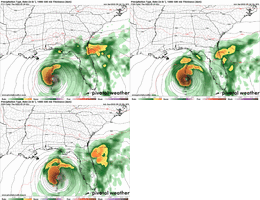
Tropical Storm Ian Discussion Number 8
NWS National Hurricane Center Miami FL AL092022
1100 PM EDT Sat Sep 24 2022
A NOAA G-IV Hurricane Hunter jet flew a surveillance around and
across Ian at high altitude earlier this evening and dropped
several dropsondes near the estimated center. The surface winds
from the instruments suggested that Ian had an elongated surface
circulation from northwest to southeast, but one dropsonde in
particular had a lower pressure than the others, which helped to
located the center. Some new convection has been forming near this
location recently, which provides a little more confidence in the
estimate. The minimum pressure has fallen to 1002 mb, a consensus
of satellite intensity estimates suggests that the maximum winds are
now near 45 kt.
The track forecast reasoning remains unchanged, with Ian expected
to curve around the western periphery of the Atlantic subtropical
ridge through the 5-day forecast period. There has also been
little change in the individual model solutions--the ECMWF remains
on the eastern side of the guidance envelope and the GFS remains on
the western side. Since there has been no significant change in
the guidance, the new NHC track forecast is very similar to the
previous one through day 3, although it has been nudged slightly
westward (again) on days 4 and 5 over the eastern Gulf of Mexico in
the direction of the TVCN and HCCA consensus aids.
Ian is now in an environment of low shear and high atmospheric
moisture and over waters of high ocean heat content. Once the
circulation becomes vertically stacked, which should be soon, these
conditions favor rapid intensification (RI) while Ian moves over
the northwestern Caribbean Sea. Several RI indices support this
scenario, with the Deterministic to Probabilistic Statistical Rapid
Intensification Index (DTOPS) in particular showing a greater than
90 percent chance of RI during the ensuing 48- and 72-hour forecast
periods. The NHC official forecast explicitly shows RI beginning
on Sunday, with Ian predicted to peak at category 4 intensity over
the eastern Gulf of Mexico in about 3 days.
By days 4 and 5, global models are leaning toward a scenario where
Ian enters into an environment of very strong southwesterly shear,
and weakening is therefore expected while Ian approaches the coast
of the Florida panhandle. That said, Ian is likely to have an
expanding wind field and will be slowing down by that time, which
will have the potential to produce significant wind and storm surge
impacts despite any potential weakening. Users are urged to not
focus on specific forecast intensities in the 4- and 5-day forecasts
and instead focus on the potential hazards Ian may produce across
portions of Florida.
Key Messages:
1. Ian is expected to produce heavy rainfall and instances of flash
flooding and possible mudslides in areas of higher terrain,
particularly over Jamaica and Cuba. Flash and urban flooding is
possible with rainfall across the Florida Keys and Florida peninsula
through mid next week. Additional flooding on rivers across
northern Florida and parts of the Southeast cannot be ruled out.
2. Hurricane or tropical storm conditions are expected on Grand
Cayman beginning early Monday.
3. Ian is forecast to be a major hurricane when it passes near or
over western Cuba, and there is increasing confidence in a
life-threatening storm surge and hurricane-force winds in portions
of western Cuba beginning late Monday. Hurricane and tropical
storm watches are now in effect for much of western Cuba.
4. Ian is expected to remain a major hurricane when it moves
generally northward across the eastern Gulf of Mexico during the
middle of next week, but uncertainty in the long-term track
and intensity forecast is higher than usual. Regardless of Ian’s
exact track and intensity, there is a risk of dangerous storm
surge, hurricane-force winds, and heavy rainfall along the west
coast of Florida and the Florida Panhandle by the middle of next
week, and residents in Florida should ensure they have their
hurricane plan in place, follow any advice given by local officials,
and closely monitor updates to the forecast.
FORECAST POSITIONS AND MAX WINDS
INIT 25/0300Z 14.7N 77.7W 45 KT 50 MPH
12H 25/1200Z 15.3N 79.3W 55 KT 65 MPH
24H 26/0000Z 16.6N 81.0W 70 KT 80 MPH
36H 26/1200Z 18.3N 82.5W 85 KT 100 MPH
48H 27/0000Z 20.1N 83.7W 100 KT 115 MPH
60H 27/1200Z 22.0N 84.5W 115 KT 130 MPH...OVER WEST TIP OF CUBA
72H 28/0000Z 23.9N 84.9W 120 KT 140 MPH...OVER WATER
96H 29/0000Z 27.2N 84.8W 115 KT 130 MPH
120H 30/0000Z 29.6N 84.1W 80 KT 90 MPH
