• Hello, please take a minute to check out our awesome content, contributed by the wonderful members of our community. We hope you'll add your own thoughts and opinions by making a free account!

Tropical Hurricane Ian

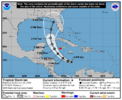
CMC/GFS makes landfall then a turn back west? Something to keep an eye on if this happens sooner than later.
 
Satellite imagery indicates that showers and thunderstorms have
increased and are showing signs of organization tonight with a
well-defined low pressure system located over the central Caribbean
Sea about 100 miles north-northeast of Curacao. Even though the
upper-level wind environment is currently only marginally favorable,
only a small additional increase in organization would result in the
formation of a tropical depression later today.
 
ICON, GFS, CMC, all close to Euro now but none ots as it either rides up spine of Fl and EC or gets just off coast and bends back west for 2nd LF. Back to a SE soaker for now
 
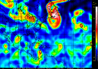
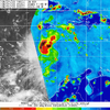
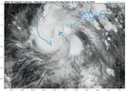
Still sheared system but appears more easterly shear and you can see some of the deep convection expanding north. This is very close to being a TD or TS

IMG_20220923_020745.gif
 
ICON, GFS, CMC, all close to Euro now but none ots as it either rides up spine of Fl and EC or gets just off coast and bends back west for 2nd LF. Back to a SE soaker for now
Worst case for us would be it coming off Florida and keeping a due north heading and not crashing right back on shore. Long shot but it's what it would take to be a wind producer. Rain and tornados is another story. Plenty of time for things to change.

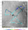
Winder when they are start running more Gulfstream missions.
 
2:00 am


1. Central Caribbean Sea:
Satellite imagery indicates that showers and thunderstorms have
increased and are showing signs of organization tonight with a
well-defined low pressure system located over the central Caribbean
Sea about 100 miles north-northeast of Curacao. Even though the
upper-level wind environment is currently only marginally favorable,
only a small additional increase in organization would result in the
formation of a tropical depression later today. The system is
expected to continue moving west-northwestward at 10 to 15 mph
across the central and western Caribbean Sea. Locally heavy
rainfall and gusty winds are likely to affect northwestern
Venezuela, the ABC island chain, and northeastern Colombia through
Friday. Interests in Jamaica, the Cayman Islands, and western Cuba
should closely monitor the progress of this system.
* Formation chance through 48 hours...high...90 percent.
* Formation chance through 5 days...high...90 percent.
 
You can see the trough slowing down and getting deeper (hints why it looks like even without the cane we are going to be quite chilly especially for this time of year). This is what is veering it so sharp to the northeast. The thing is, the deeper and angling of the trough the more it’ll pull the storm back to the NW once in the Atlantic making the coast of SC and NC prime for a 2nd landfall and for it to drift further inland. The tough will absorb it as it’s exiting out and ridging builds over top. That makes potential flooding for wherever a 2nd landfall potentially is even a bigger issue as the you’re going to get more moisture output on the northern side from the incoming trough and pulling the hurricane in a elongated position that the models aren’t going to pick up and with ridging building overtop, this thing would almost certainly start slowing down once inland.

The globals are all showing this right now but it is all dependent on the the depth and positioning of the trough. CMC is the western track of this happening, GFS is right in the middle, and EURO is the eastern track. As the Mets in here said the EURO maybe having this thing a bit too far to the north and east initially because it’s making the storm stronger and deeper earlier which throws everything off down stream for our neck of the woods. Fiona is going to keep this thing under wraps for at least another 48 hours from northerly shear which will tug the center further south. Biggest thing to watch is where those hurricane spaghetti plots are going as the NHC really basis their track on them and right now they’re favoring a bit more westerly track vs the EURO but overall the same general idea. This would make a 2nd landfall likely around the low country of SC Potentially.

But remember we are roughly 8 days away from this thing really getting near a landfall and a center truly hasn’t formed yet so it’s all guessing at this time. And as a side note, this isn’t winter and we can get troughs that deep in the fall and it’s actually a little easier to get models honed in on them vs winter based on overall pattern and upper dynamics where there’s a ton of moving parts compared to the end of summer and fall type patterns.
 
Last edited:
NAM will be useless like it always is for hurricanes until the 11th hour. You’re going to see the NAM be the furthest northernly and easterly track Because the NAM has a real issue with making hurricanes worst case scenarios and be on the lookout for sub 900mb NAM runs as that’s its absolute favorite thing to do. The stronger this thing is earlier, the more north and east it’s going to go and the NAM is going to do what the NAM does and paint the worst hurricane imaginable. Seen it time and time again
 
NAM will be useless like it always is for hurricanes until the 11th hour. You’re going to see the NAM be the furthest northernly and easterly track Because the NAM has a real issue with making hurricanes worst case scenarios and be on the lookout for sub 900mb NAM runs as that’s its absolute favorite thing to do. The stronger this thing is earlier, the more north and east it’s going to go and the NAM is going to do what the NAM does and paint the worst hurricane imaginable. Seen it time and time again

The 12k NAM is pretty good for track and strength less than 48hrs out.


Sent from my iPhone using Tapatalk
 
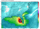
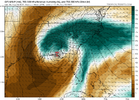
Ukmet ( below) GFS and Canadian 0Z all demolish the bay area of Tampa Bay. Get the right side of the eye, head on up into the bay, worst case scenario. Euro Op was LF south of there, Charley like.

I'm watching this from selfish standpoint for my Backyard. CAnadian and GFS give me good rains. Euro keeps me dry with its track up EC. 6z GFS not gonna get it done, so on to the 12z. Should be a 950 mb storm on 1st landfall. If it stayed west of Florida up into big bend area for 1st landfall, would no doubt sub 930mb LF.

UKMET
500hv.us_se.png


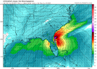
GFS
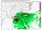
prateptype_cat.us_se.png
 
6z GFS says it stays offshore with not 1 drop of fain for ANY of us unless you live within 20 miles of the coast. Fla gets slammed.
 
  • Haha
Reactions: SD
Back
Top