packfan98
Moderator
Can you provide a link to their page? I might be interested in purchasing their services.Thanks. No, it is a paid for service.
Can you provide a link to their page? I might be interested in purchasing their services.Thanks. No, it is a paid for service.
Can you provide a link to their page? I might be interested in purchasing their services.

This isn't funny anymore
I know some were feeling glum about the winter the past few days but it's not over til the fat lady sings, I definitely feel much better & more confident to go about saying that we could see a turnaround in late February & March given how the pattern is evolving and the fact that HM is on board with this idea. Amy Butler here just reminds us yet again that the models can't properly simulate tropopshere-stratosphere interactions and in concert w/ tropical forcing over the Pacific which favors disruption of the PV and a -NAO (with the -NAO lagging phases 6-7 of the MJO by a few weeks), the GEFS is beginning to sniff out a potentially significant -AO crash on the horizon.
View attachment 3833
View attachment 3832


Good point, However, one also should be wary about GEFS AO predictions as they have been biased way too negative recently:
For example, here was the 1/26/18 GEFS AO prediction:
View attachment 3834
So, the 1/26/18 GEFS 14 day prediction had the AO to be in the -1 to -2 range about now. However, we're currently nearing +1 and rising in the shorter term meaning a miss by -2 to -3! Also, check out today's GEFS prediction:
View attachment 3835
Note the mean AO over the last 4 months has been 0.0081 or essentially 0/straight neutral. However, note the bottom graph (14 day prediction), which has been mainly negative and has averaged -0.7194. So, the 14 day prediction has had a negative bias of 0.7194 + 0.0081 or a -0.73 AO bias. So, I'm advising extra caution about GEFS based -AO predictions.

Similar to the GFS's MJO biases, these stereotypical tendencies in the GFS aren't always applicable and should not be immediately broad-brushed to every situation. In this case, I think that notion holds true because there's a very clear change in the stratosphere, tropical forcing & concomitant equatorward progression of -AAM that supports a substantial dip in the AO in the longer term, in mid-late January this wasn't necessarily the case because the large-scale forcing wasn't as favorable. Models usually don't properly simulate stratosphere-troposphere interactions and the EPS is also on board w/ a -AO surge in the coming weeks. Sure you can claim the GEFS might be overzealous in its depiction of the AO and it probably is to an extent but there's very legitimate support to a -AO stint later in the month. When you stick the MJO in the Pacific, the AO & NAO usually dip negative 1-2 weeks afterwards due to the impact of diabatic heating on the extratropical circulation pattern and wave fluxes and the PV split is only going to augment this. The support for this idea from HM only lends more confidence
View attachment 3837
I wonder why they have more often cooled Europe than NA ?I hope HM and you end up right as I don't want it to stay warm through the end of the month. I am assuming most of the next 2 weeks will be warm preceding what may or may not occur late month. I am keeping in mind (what MDA said) that these SSW have more often cooled Europe than N.A.
Good point, However, one also should be wary about GEFS AO predictions as they have been biased way too negative recently:
For example, here was the 1/26/18 GEFS AO prediction:
View attachment 3834
So, the 1/26/18 GEFS 14 day prediction had the AO to be in the -1 to -2 range about now. However, we're currently nearing +1 and rising in the shorter term meaning a miss by -2 to -3! Also, check out today's GEFS prediction:
View attachment 3835
Note the mean AO over the last 4 months has been 0.0081 or essentially 0/straight neutral. However, note the bottom graph (14 day prediction), which has been mainly negative and has averaged -0.7194. So, the 14 day prediction has had a negative bias of 0.7194 + 0.0081 or a -0.73 AO bias. So, I'm advising extra caution about GEFS based -AO predictions.


Here's leads and lags of the NAO, Atlantic Ridge, and Scandinavian blocking pattern wrt each phase of the MJO from Cassou (2008).
https://www.nature.com/articles/nature07286
Notice the -NAO peaks about 2 weeks ish after a phase 6 MJO event.
View attachment 3840
View attachment 3838
View attachment 3843
Here's another piece from Shao, Song, & Li in 2016 that simplifies the arguments presented in the aforementioned study.
http://www.lasg.ac.cn/mjo-workshop/ppt/poster/Poster-sxl.pdf
View attachment 3839
Here's a nice chart from ECMWF that shows the probability of a particular phase of the NAO based on where the MJO is located and the associated leads/lags. Almost 50% of the time we observe a negative NAO after a Pacific MJO (Phase 6-7) event.
View attachment 3842
There's a multitude of studies on this topic that delve into the MJO-AO/NAO relationship, I'll just post a few here, strongly suggest reading these, they're well worth your time and not terribly technical
http://onlinelibrary.wiley.com/doi/10.1002/qj.2917/abstract
https://journals.ametsoc.org/doi/pdf/10.1175/JCLI-D-15-0502.1
https://journals.ametsoc.org/doi/pdf/10.1175/2008JCLI2515.1
Webb,
So, are you predicting based on what you posted that ~two weeks after this past MJO phase 6 event (1/28-2/1) that there will be a -NAO? That would be around 2/11-15, which the GEFS still has as solidly +NAO and the GEFS over the last 4 months has on average had a -0.34 NAO bias at forecast day 14. The bias at day 10/7 has been -0.27/-0.15.
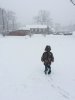
Congrats ! Maybe another round of wintry precip for you this weekend ?oh hey a winter weather advisory for freezing rain
Not all! I'm well within the metro but there was a sharp cutoff to my south.Half of ATL is north of I-20. ALL of ATL was dry holed in Feb 2015, we didn't see a thing.
The GFS never gets me to freezing or below over the next 14 days. Clap to the thread title being very wrong.Congrats ! Maybe another round of wintry precip for you this weekend ?
I love how the models are warmer now, and there’s no artic outbreak for us.
Well the title of the thread was right for some areas. North GA and the Carolinas had some ice recently. Brent may have ice tonight and then again this weekend. And of course its snowy and cold here in Indiana.I love how the models are warmer now, and there’s no artic outbreak for us.
You need a jobWell the title of the thread was right for some areas. North GA and the Carolinas had some ice recently. Brent may have ice tonight and then again this weekend. And of course its snowy and cold here in Indiana.
I'll come shovel your driveway. $50.You need a job
Not all! I'm well within the metro but there was a sharp cutoff to my south.
Give it time. We are still in the first week of February.It’s okay that it is wrong. I agree at the end of January things were semi looking that way, but February doesn't look like it is going to be freezing, and ferocious anymore.
I never get snow, so I can't help you there! And if it does, it only sticks on the grass!I'll come shovel your driveway. $50.
Snowstorms where it only sticks on grass is my favorite kind of snow. You get to see the beauty of the snow but arent stuck inside !I never get snow, so I can't help you there! And if it does, it only sticks on the grass!
Could not agree more; just trying my level best to help preserve someone else's sanity while still being realistic ...While a fair point, we now have the calendar working against us. If we get into a better pattern it is going to be 2/20 or later, leaving roughly 3 weeks of prime climo time left for even the upper South. I'm not writing off that 3 week period, but that's basically all we have left of true winter outside of a rather anomalous later March storm.
We’ve been pretty cold up here also with a few flurrie events this past week. Rest of this week looks cold until the weekend. Hopefully the gfs is wrong because it does show some very warm temps next week.Well the title of the thread was right for some areas. North GA and the Carolinas had some ice recently. Brent may have ice tonight and then again this weekend. And of course its snowy and cold here in Indiana.


View attachment 3846
The cold air is there. It just doesn't want to pay us a visit. Folks, get ready. February is about to be a real burner. Time to break out the sunscreen. I'm sorry
While a fair point, we now have the calendar working against us. If we get into a better pattern it is going to be 2/20 or later, leaving roughly 3 weeks of prime climo time left for even the upper South. I'm not writing off that 3 week period, but that's basically all we have left of true winter outside of a rather anomalous later March storm.
Forecast hour 312... book itView attachment 3846
The cold air is there. It just doesn't want to pay us a visit. Folks, get ready. February is about to be a real burner. Time to break out the sunscreen. I'm sorry
Oh please, you really believe that will turnout like that? WowView attachment 3846
The cold air is there. It just doesn't want to pay us a visit. Folks, get ready. February is about to be a real burner. Time to break out the sunscreen. I'm sorry