• Hello, please take a minute to check out our awesome content, contributed by the wonderful members of our community. We hope you'll add your own thoughts and opinions by making a free account!

Pattern ENSO Updates

This past October's East Pacific Warm Water Volume anomaly was 6th highest on record, in moderate El Nino territory if you use ranked percentiles, and was about 1 standard deviation above average. Also worth mentioning it was only superseded by moderate or strong El Ninos (1997-98, 1982-83, 2015-16, 2002-03, & 1991-92).
A weak or moderate central Pacific El Nino is the most likely outcome for this winter.
Screen Shot 2018-11-06 at 8.13.31 AM.png
 
This past October's East Pacific Warm Water Volume anomaly was 6th highest on record, in moderate El Nino territory if you use ranked percentiles, and was about 1 standard deviation above average. Also worth mentioning it was only superseded by moderate or strong El Ninos (1997-98, 1982-83, 2015-16, 2002-03, & 1991-92).
A weak or moderate central Pacific El Nino is the most likely outcome for this winter.
View attachment 7208
Agree the location (3.4) of warmest water is now pretty well established, only the final strength is to be determined and I still think a strong El Nino is unlikely
 
EL NIÑO/SOUTHERN OSCILLATION (ENSO)
DIAGNOSTIC DISCUSSION

issued by
CLIMATE PREDICTION CENTER/NCEP/NWS
and the International Research Institute for Climate and Society
8 November 2018

ENSO Alert System Status: El Niño Watch


Synopsis: El Niño is expected to form and continue through the Northern Hemisphere winter 2018-19 (~80% chance) and into spring (55-60% chance).

ENSO-neutral continued during October, despite widespread above-average sea surface temperatures (SSTs) across the equatorial Pacific Ocean [Fig. 1]. All four Niño regions showed increased SST anomalies in October, with the latest weekly values near +1.0°C in the Niño-4, Niño-3.4 and Niño3 regions, and +0.2°C in the Niño-1+2 region [Fig. 2]. Positive subsurface temperature anomalies (averaged across 180°-100°W) also continued [Fig. 3], due to the persistence of above-average temperatures at depth across the eastern half of the equatorial Pacific Ocean [Fig. 4]. However, atmospheric convection remained slightly suppressed near the Date Line and over Indonesia [Fig. 5]. Low-level westerly wind anomalies were observed over the eastern Pacific during October, while weak upper-level westerly wind anomalies were present over the far western Pacific. The traditional and equatorial Southern Oscillation indices were near zero. Despite the above-average ocean temperatures across the equatorial Pacific Ocean, the overall coupled ocean-atmosphere system continued to reflect ENSO-neutral.

The majority of models in the IRI/CPC plume predict a Niño3.4 index of +0.5°C or greater to continue through the rest of the fall and winter and into spring [Fig. 6]. The official forecast favors the formation of a weak El Niño, with the expectation that the atmospheric circulation will eventually couple to the anomalous equatorial Pacific warmth. In summary, El Niño is expected to form and continue through the Northern Hemisphere winter 2018-19 (~80% chance) and into spring (55-60% chance; click CPC/IRI consensus forecast for the chance of each outcome for each 3-month period).
 
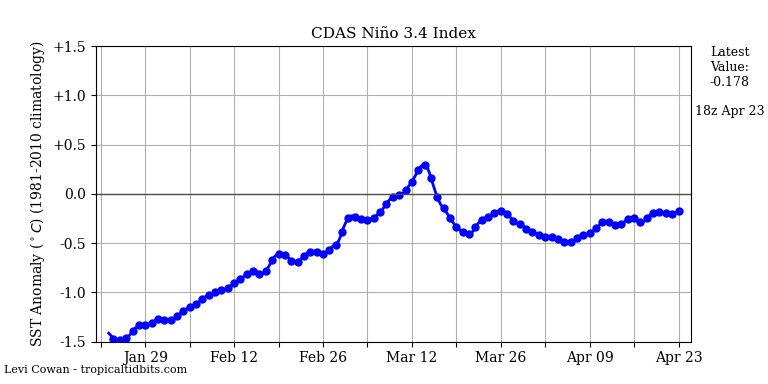
Note that Tidbits and TAO/Triton buoys have recently both cooled considerably back into weak El Nino territory:

https://www.tropicaltidbits.com/analysis/ocean/nino34.png

https://www.pmel.noaa.gov/cgi-tao/c...=on&script=disdel/lat-lon-5day-disdel-v75.csh

The OHC hit a whopping +1.58 in Oct.:
http://www.cpc.ncep.noaa.gov/products/analysis_monitoring/ocean/index/heat_content_index.txt

OHCs usually peak before SSTs and often in Oct. Since Oct, it has cooled back slightly. Based on all of this, I predict that Oct's +1.58 will turn out to be the peak monthly OHC.

The last weekly 3.4 SST was considerably cooler at +0.8 after a prior week peak of +1.2. Based on history, there's a pretty high chance that the peak weekly for this fall/winter will end up being no warmer than +1.6, which would mean no strong Nino for the warmest trimonthly. If we were to get up to a +1.6 weekly peak, the corresponding trimonthly peak would likely be only in the +1.2 to +1.3 range. If the +1.2 peak were to hold, the trimonthly peak could end up only in the high end weak to low end moderate Nino range near +0.9 to +1.0.

The autumn OLR has been quite unusual:

http://www.cpc.ncep.noaa.gov/data/indices/olr

Note the 2nd table's anomaly of +6.8. Every other El Nino since at least 1976 had a -Oct anomaly:

1976: -6.3
1977: -1.3
1979: -3.9
1982: -25.8
1986: -9.5
1987: -16.1
1991: -6.9
1994: -6.5
1997: -37.6
2002: -20.4
2004: -2.5
2006: -14.1
2009: N/A
2014: -0.8
2015: -21.4
2018: +6.8

Perhaps this is a sign that the Nino peak will end up only weak? Any thoughts?
 
Larry,
Is that a concern ... I'm not connecting the dots.
Thanks!
Phil

Well, I think we'll end up with at least a weak El Nino per tri-monthlies, regardless. I'm trying to see if others more knowledgeable about OLR centered around the dateline (as the table is) feel any special dots need connecting.
 
Nino 3.4 is down to 0.7 C.

It’s looking more and more likely that El Niño will peak near the border of weak/moderate. Whereas the very warm subsurface peak would appear to support a solid moderate, something seems to be holding it back. Is that due to there still being -AAM, which is normally associated with La Niña? Is it related to the still +OLR near the dateline as of October, which is also usually associated more with La Nina. Come to think about it, are the -AAM and +OLR directly related?

Anyway, weak to low end moderate Niño peaks, when combined with a -NAO and +PDO, have historically lead to some of the coldest SE US winters on record similar to what JB and the Pioneer model is forecasting. Then again, I don’t know if any of these very cold weak Niño winters had a -AAM at least early on. Does anyone have a link to AAM monthly history? TIA as I can’t find it.

**11/25 Edit: Although right about the Oct +OLR, I was wrong in thinking there was still a -AAM as that actually switched to +AAM in Oct and is now strongly +AAM.
 
Last edited:
Nino 3.4 warmed a whopping 0.6 to +1.3! Unless I missed one, this ties the largest warming in one week back to 1990!
 
Last edited:
Nino 3.4 cooled in Mon's update from +1.2 to +1.0. Tidbits and buoy map agree it has cooled. Maybe the 1.3 of 2 weeks back will end up as the weekly peak. If so, the trimonthly peak will likely be only slightly warmer than +1.0, if at all. So, borderline weak/moderate peak would be the case. Also, the buoys look more west based now.
 
Last edited:
Niño 3.4 warmed very slightly to +1.1. It looks increasingly likely that the +1.3 of a few weeks ago will be the weekly peak when considering the OHC being well below the Oct high and the persistent +SOI of the last few weeks. Also, it looks the most west based yet. It is never a bad thing to have a borderline weak/moderate west based Niño peak following La Niña for SE winter prospects. We’ll see what cards the SE is dealt in Jan-mid March but I remain optimistic for an interesting pattern to return by no later than mid Jan. I’m guessing it will start pretty early in Jan. I’m saying this despite the surpringly warm new Jamstec DJF outlook.
 
Last edited:
Back
Top