• Hello, please take a minute to check out our awesome content, contributed by the wonderful members of our community. We hope you'll add your own thoughts and opinions by making a free account!

Tropical 2024 Tropical Thread Reboot

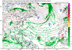
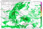
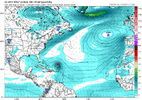
Pwats in the Atlantic are way BN again as the azores high pumps in Sal and continental air. It gets shifted west as Ernesto recurve so day 7-10 might be a better opportunity
The way the MT is configured is allowing massive amounts of dust to pour in
 
People are starting to come up with reasons why the season cant get going


More East Pac activity


That should be the ATL

View attachment 150141


The season has been going. ACE is up to 51, which compares to a 1991-2020 average of only 16 and is 3rd highest for the date since 1951! 51 is not much below 50% of the full season avg since 1991 of 61. Climowise, Aug 17th is on avg only at 13% of the total season ACE.

IMG_0146.png
 
Do you remember hearing a lot about SAL back in the 90s/80s or even early 2000s?

It seems to be a major issue almost every year nowadays.

I think its more a matter of having satellites now that can easily see and track SAL....it tends to peak from May to mid Aug and is probably why the hurricane season tends to ramp up around the same time it tends to abate, the science was not there to really understand this till the last 10 or so years when the technology got good enough to really track it.

The dust this year has been some of the worse on record ( which only go back less than 20 yrs ) and its been enough to keep the MDR and CV regions shut down...some of the modeling I have seen shows breaks in it but it still looks rather potent for the next few weeks.

We’ll see what occurs in the MDR later. But the MDR to this point hasn’t actually been shut down with already two TCs that formed E of the Caribbean that each later became a NS (and actually a H). These two occurred by August 9th. Having two by Aug 9 ties the highest number of E of Caribbean TCs that lead to a NS since at least 1995. The avg # of these during this period was only 0.8. So, it was at 250% of average.
 
From LC


I had to address the hurricane forecast, since quite a few forecasters, professional and otherwise, have been writing about the "tropical cyclone season" being over. This is simply not true! We have had five named systems so far, three of which became hurricanes, and one of which reached major status. The most active part of the tropical period is usually from now until September 10, then again in the first week of October. Widespread warm waters, a vast decrease in shearing wind profiles as the Saharan Heat Ridge bulges north, and some very interesting ITCZ impulses suggest a string ramping up of the storm output. There are still dangers to the Gulf of Mexico (see the dent/weakness in the heat ridge on the maps) as well as chances for damaging wind circulation hitting the East Coast. It's far from over, folks!
In other words LC is saying “season cancel” season is cancelled. But in the meantime while I keep reading “season cancel” season stuff, I feel the need to wish everyone “season cancel” season’s greetings!
 
Wasn’t Florence the last Cape Verde hurricane to make it to the US?
I'm not the best with tropical systems since I'm too far inland to take much interest in them other than big rains depending on track. But I would say just from observation it seems 90% or more Cape Verde hurricanes recurve. The infamous Hugo was one obviously. But if you're on the SE coast and want your house wrecked by a hurricane it seems to me you'd be better off rooting for something to form further east. Or even in the gulf and cross over Florida and up the east coast like Charley. But maybe my memory is 100% wrong but seems like most true Cape Verde storms are fish storms
 
I'm not the best with tropical systems since I'm too far inland to take much interest in them other than big rains depending on track. But I would say just from observation it seems 90% or more Cape Verde hurricanes recurve. The infamous Hugo was one obviously. But if you're on the SE coast and want your house wrecked by a hurricane it seems to me you'd be better off rooting for something to form further east.

Or even in the gulf and cross over Florida and up the east coast like Charley. But maybe my memory is 100% wrong but seems like most true Cape Verde storms are fish storms

I’m near the US coast and don’t want anything to do with any nearby hurricanes. I prefer folks to not lump me in with those who want them. The last thing I want is this huge headache, much less the dangers to my community. Not everyone who posts a lot about the tropics is actually rooting for these monsters. I post a lot about all kinds of wx (forecasting or obs) whether I want it or not. I had more than enough of a headache from Debby just from a partially flooded garage.

So, although the early season has been active in terms of ACE and hurricanes, I’m not emphasizing that because I’m happy about it. I’m emphasizing it because I like to talk about what has actually happened in comparison to history. Nothing would make me happier than to see no more US H landfalls this season.

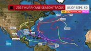
I define a CV storm as one that becomes a TD E of 50W in the MDR. Based on that, Elsa of 2021 was the last to landfall on the CONUS. Before that was Laura of 2020.
 
Last edited:
gefs_2024-08-18-06Z_336_50_258_0_350_MSLP_Surface_tracks_lows.png


ButNoneWereThereSpongebobGIF.gif
ecens_2024-08-18-00Z_240_50_258_0_350_MSLP_Surface_tracks_lows.png

Now we're seeing things... But for NC, Nothing for here!
 
Worrying what the models show 300 hours away is a futile endeavor. The gfs could t figure out Debby wasn't going all the way back to Alabama. The season is rolling forward and it's gonna do whatever it is going to do and the models won't know every minute of a 364 hour run. Sit back and watch
Kind of like winter weather predictions 5 months out based off of models when models struggle 1 day out!
 
Ben Noll says the SST's are primed for action but debby and ernesto were on the struggle bus the entire way across the ATL and the whole basin is struggling to even develop a weak depression. SST's are only important if the season has other factors aligned.


Over AFrica there is a 1001mb low that in an average season would likely develop considering its peak but its already too far north and devoid of convection in the dry stable air

A whole lot more to it than SST’s!
 
Hurricane Isaias? wasn't a cape V cane? originating off the west coast of Africa?
 
Back
Top