• Hello, please take a minute to check out our awesome content, contributed by the wonderful members of our community. We hope you'll add your own thoughts and opinions by making a free account!

Tropical 2024 Tropical Thread Reboot

Depending on *Models* is akin to depending on AI for a (future), Weather outcomes..

As OLD Computer Coders used too say..


Garbage in, Garbage out..

Better off reading Farmers Alamac, or; depending on Wooly worms predicting winter..
Forecaster(s) AND, Hence Meteorology/Technology in general, is just isn't there yet Folks..

Too Many variables..
Pray for a quite season & Early Fall..
Im not praying for a quiet season. Wilmington is already the King of Quiet year round
 
Hurricane Isaias? wasn't a cape V cane? originating off the west coast of Africa?
It depends on how one defines it. I happen to define a CV storm as one that is first designated a TC E of 50W in the MDR. Isaias didn’t become a TC until within the Caribbean. I don’t know that there’s one official definition or that CV storm/cane is even an official designation.
I do believe that a majority of NS for all years combined (not every year though) have origins coming off Africa, but I’m not 100% sure.
 
I’m near the US coast and don’t want anything to do with any nearby hurricanes. I prefer folks to not lump me in with those who want them. The last thing I want is this huge headache, much less the dangers to my community. Not everyone who posts a lot about the tropics is actually rooting for these monsters. I post a lot about all kinds of wx (forecasting or obs) whether I want it or not. I had more than enough of a headache from Debby just from a partially flooded garage.

So, although the early season has been active in terms of ACE and hurricanes, I’m not emphasizing that because I’m happy about it. I’m emphasizing it because I like to talk about what has actually happened in comparison to history. Nothing would make me happier than to see no more US H landfalls this season.

I define a CV storm as one that becomes a TD E of 50W in the MDR. Based on that, Elsa of 2021 was the last to landfall on the CONUS. Before that was Laura of 2020.
No not you, I've read your posts long enough to know you don't want anything to do with a hurricane. But it's clear some do. And I get it, I really do. Weather enthusiasts want to be in the middle of the action regardless of the danger or impact to the community. After all the weather doesn't care what we want and our wishes in no way determines the outcome.

I was mainly stating the ones who do may want to stop just focusing on the Cape Verde region because I would think odds are against them that it would landfall on the SE coast north of Florida. I know you are great with stats. Am I at least somewhat correct saying 90% or more of those recurve? Seems like the Caribbean and the Gulf are far more dangerous for the US when it comes to landfalls. Seems like Matthew in 2016 formed in the Carribean west of the islands before causing mass evacuations on the east coast.
 
Seems like the Caribbean and the Gulf are far more dangerous for the US when it comes to landfalls. Seems like Matthew in 2016 formed in the Carribean west of the islands before causing mass evacuations on the east coast.
Flip a coin , you may have ODDS in your favor..
 
No not you, I've read your posts long enough to know you don't want anything to do with a hurricane. But it's clear some do. And I get it, I really do. Weather enthusiasts want to be in the middle of the action regardless of the danger or impact to the community. After all the weather doesn't care what we want and our wishes in no way determines the outcome.

I was mainly stating the ones who do may want to stop just focusing on the Cape Verde region because I would think odds are against them that it would landfall on the SE coast north of Florida. I know you are great with stats. Am I at least somewhat correct saying 90% or more of those recurve? Seems like the Caribbean and the Gulf are far more dangerous for the US when it comes to landfalls. Seems like Matthew in 2016 formed in the Carribean west of the islands before causing mass evacuations on the east coast.

Matthew reminds me of something else I forgot to say. Like for Matthew I’d be evacuating, regardless, if another storm like that was just threatening a direct hit here from right off the water. So, I wouldn’t even experience it and the evacuation, itself, would be a royal PITA/huge inconvenience to put it mildly. Then I’d have to return to deal with any potential damage, which is quite common due to trees, alone, as well as loss of food, etc. If there’s to be another, I’d much rather have another Debby to another Matthew. I’m still a “wx enthusiast”/hobbyist or else I wouldn’t be here. Not all want to be in the middle of danger and potential devastation to one’s house!

We know it doesn’t matter where one focuses, since like you implied, the wx doesn’t care what’s focused on, what someone does or doesn’t want, etc. Regarding the % that recurve away from the CONUS, it is lower than 90% when looking at all TCs that form E of 50W. It’s closer to 75-80%. But it’s a little lower in La Niña and a bit higher in El Niño. It is a little lower in Jul-Aug and higher in Oct.
 
Last edited:
No not you, I've read your posts long enough to know you don't want anything to do with a hurricane. But it's clear some do. And I get it, I really do. Weather enthusiasts want to be in the middle of the action regardless of the danger or impact to the community. After all the weather doesn't care what we want and our wishes in no way determines the outcome.

I was mainly stating the ones who do may want to stop just focusing on the Cape Verde region because I would think odds are against them that it would landfall on the SE coast north of Florida. I know you are great with stats. Am I at least somewhat correct saying 90% or more of those recurve? Seems like the Caribbean and the Gulf are far more dangerous for the US when it comes to landfalls. Seems like Matthew in 2016 formed in the Carribean west of the islands before causing mass evacuations on the east coast.

That's the thing though all the big hitters inland especially wind wise in NC in my life have been long track Cape Verde type storms...Hugo, Bertha, Fran, Floyd, Florence, Isabel etc....we actually tend to not get hit hard by close forming systems or we get sloppy systems that have been interacting with a lot of land at least inland in NC. The immediate coast can get hit hard from home grown systems but typically they don't do much away from the coast outside of rainfall
 
That's the thing though all the big hitters inland especially wind wise in NC in my life have been long track Cape Verde type storms...Hugo, Bertha, Fran, Floyd, Florence, Isabel etc....we actually tend to not get hit hard by close forming systems or we get sloppy systems that have been interacting with a lot of land at least inland in NC. The immediate coast can get hit hard from home grown systems but typically they don't do much away from the coast outside of rainfall
Oh absolutely. The ones that do make it to the east coast are some of the most destructive on record. I need to look up and see if Hazel and Gracie in the 1950s were CV hurricanes. That was an active period. Some say the Carolina's and GA are long overdue for another Hazel or Hugo. Especially GA
 
Matthew reminds me of something else I forgot to say. Like for Matthew I’d be evacuating, regardless, if another storm like that was just threatening a direct hit here from right off the water. So, I wouldn’t even experience it and the evacuation, itself, would be a royal PITA/huge inconvenience to put it mildly. Then I’d have to return to deal with any potential damage, which is quite common due to trees, alone, as well as loss of food, etc. If there’s to be another, I’d much rather have another Debby to another Matthew. I’m still a “wx enthusiast”/hobbyist or else I wouldn’t be here. Not all want to be in the middle of danger and potential devastation to one’s house!

We know it doesn’t matter where one focuses, since like you implied, the wx doesn’t care what’s focused on, what someone does or doesn’t want, etc. Regarding the % that recurve away from the CONUS, it is lower than 90% when looking at all TCs that form E of 50W. It’s closer to 75-80%. But it’s a little lower in La Niña and a bit higher in El Niño. It is a little lower in Jul-Aug and higher in Oct.
A lot of people think they want direct impacts from a strong storm until they have to live without amenities for a few weeks. I lived through Fran and Super Typhoon Bart, it sucks. We all are fascinated by these storms but calling a season a bust or record breaking early is just wrong. That said I hope none have to deal with serious impacts going forward!
 
A lot of people think they want direct impacts from a strong storm until they have to live without amenities for a few weeks. I lived through Fran and Super Typhoon Bart, it sucks. We all are fascinated by these storms but calling a season a bust or record breaking early is just wrong. That said I hope none have to deal with serious impacts going forward!
Based on current trends that seems quite likely. Since we dont have winter here im back to waiting 11 months till late July for weather. I hope and pray the seasonal forecasts next season are for a dead season.
 
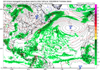
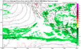
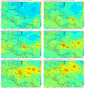
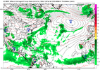
If the GFS/Euro end up verifying well, there could be as many as 4 straight Tahiti SLPs of 1019+ during Aug 19-22. I’d be very surprised if there isn’t at least one. Keep in mind that higher Tahiti pressure is favored during developing La Niña. There hasn’t been even a single day of 1019+ since 2010!


Tahiti SLP 1019+ since 1991:

1019.55: 1994 (Aug)

1019.1, 1019.44: 1996 (June)

1019.3: 1998 (Aug)

1019.28: 1999 (Aug)

1019.24: 2010 (July)

1019.44, 1019.61, 1019.78, 1019.59, 1019.14: 2010 (Sep)

1019.05: 2010 (Sep)


-So, there have been only 13 days of Tahiti SLP of 1019+ over the last 33 years with the record high being 1019.78 (Sep of 2010).

- This shows there’s been only one time when there were more than two days in a row of that (Sep of 2010). That was during the longest streak on record, 5 days.

- This shows that all were during June-Sep with a mean date of Aug. That makes sense because that’s during their winter, when sfc cold high pressures are at their highest SLP of the year.

- There is a decent correlation between high Tahiti SLP periods and an active Atlantic tropics mainly 1-3 weeks afterward. That jibes well with the idea of an active Atlantic sometime between very late this month and mid Sep.
That may be right but at some point the models are going to have to start showing something

1724093645152.png


Also, the MT remains upside down with waves way too far north. We could have a wave coming off the coast with a 960mb low associated with it and it would choke on dust at 20N
 
Last edited:
This is from a forecaster from another board. His first sentence says it all. We are blowing thru the peak of the season bone dry everywhere.

wxman57 wrote:It's amazing that we're approaching the peak of the season in 3 weeks and the models are not showing any significant development over the next two weeks. Some here are resorting to finding a possible storm in an odd ensemble member or two. Typically, about half the storms develop prior to Sept. 10th. We might be able to squeeze out another 2-3 named storms by then, making the total 7-8 named storms for the first half of the season (with Sept. 10 as the mid-point). It's going to be hard to reach even 20 named storms unless September turns out to be extremely active with 8-10 named storms and October is equally active. ACE is another story. A single long-tracked major hurricane can generate 50-60 ACE points, so we could be "hyperactive" ACE-wise but a little above normal numbers-wise. I know how quickly the tropics can switch "on", though, but my numbers are now 19/8/5 and that may be a bit too high.

Numbers don't really matter, though. What matters is where the storms track. For now, the Bermuda high is weaker than predicted. We can track waves moving across the MDR, but they're having trouble generating convection due to dry, sinking air. Will this suddenly change over the next 2-3 weeks? The year started off as I suspected, with a long-tracked strong hurricane tracking across the Caribbean. After Beryl, though, things changed. Debby recurved over the NE Caribbean, and other waves just can't generate convection in the MDR.

Those of you in the NE Caribbean, like Luis, are certainly not "out of the woods", as conditions across the MDR will likely become more favorable eventually. Just because waves can't maintain convection in the Caribbean now doesn't mean Gulf Coast residents are safe from any hurricane threat. I've seen many convectionless waves move across the Caribbean suddenly blow up into hurricanes near the Yucatan and move north into the coast. I keep telling my team to track all waves moving across the MDR and Caribbean, as they can blow up in the NW Caribbean and become a "surprise" hurricane in the Gulf.

Let's hope for the best (fewer storms and a reduced risk) but always prepare for the worst.
57 is a very well respected Houston met. with several decades of experience with tropical. But he does tend to be a bit conservative. I’m guessing based on Euro weeklies guidance, Niña climo, and record warm SSTs that there will be 3-4 new NS by 9/15 with 3 as a H (2 of those 3 could be MHs at peak and ACE then up to ~115-20.
 
Back
Top