• Hello, please take a minute to check out our awesome content, contributed by the wonderful members of our community. We hope you'll add your own thoughts and opinions by making a free account!

Tropical 2024 Tropical Thread Reboot

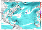
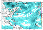
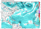
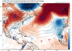
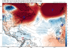
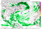
If the GFS/Euro end up verifying well, there could be as many as 4 straight Tahiti SLPs of 1019+ during Aug 19-22. I’d be very surprised if there isn’t at least one. Keep in mind that higher Tahiti pressure is favored during developing La Niña. There hasn’t been even a single day of 1019+ since 2010!


Tahiti SLP 1019+ since 1991:

1019.55: 1994 (Aug)

1019.1, 1019.44: 1996 (June)

1019.3: 1998 (Aug)

1019.28: 1999 (Aug)

1019.24: 2010 (July)

1019.44, 1019.61, 1019.78, 1019.59, 1019.14: 2010 (Sep)

1019.05: 2010 (Sep)


-So, there have been only 13 days of Tahiti SLP of 1019+ over the last 33 years with the record high being 1019.78 (Sep of 2010).

- This shows there’s been only one time when there were more than two days in a row of that (Sep of 2010). That was during the longest streak on record, 5 days.

- This shows that all were during June-Sep with a mean date of Aug. That makes sense because that’s during their winter, when sfc cold high pressures are at their highest SLP of the year.

- There is a decent correlation between high Tahiti SLP periods and an active Atlantic tropics mainly 1-3 weeks afterward. That jibes well with the idea of an active Atlantic sometime between very late this month and mid Sep.
Does this correlate to a 2010 winter as well? If so sign me up on this TC. I doubt it, but if anyone knows how it correlates to winter, not just tropics, its you. Also where would you put your finger on the La Nina Gauge for winter 24/25 as things stand now currently. Strong, Moderate, or Weak?
 
Does this correlate to a 2010 winter as well? If so sign me up on this TC. I doubt it, but if anyone knows how it correlates to winter, not just tropics, its you. Also where would you put your finger on the La Nina Gauge for winter 24/25 as things stand now currently. Strong, Moderate, or Weak?
Courtesy of LC

1724097416048.png


First, this being a La Nina episode with widespread heat ridge formations in the Northern Hemisphere, we will likely see many "well above normal" temperature anomalies to the right of the Rocky Mountains and below Interstate 90. Synoptic climatology used against persistence favors an outcome like 1998 or 2007-08, which might mean unusual heat being present well into December. Then we have to wait and see if a southern branch stream branch reappears. If so, a codler approach will be called for from the Pacific Northwest into the Great Lakes and St. Lawrence Valley. The greatest colder impacts on ths outlook would not occur until the week before Christmas and New Year's. Texas should be routinely hot until then.
 
Does this correlate to a 2010 winter as well? If so sign me up on this TC. I doubt it, but if anyone knows how it correlates to winter, not just tropics, its you. Also where would you put your finger on the La Nina Gauge for winter 24/25 as things stand now currently. Strong, Moderate, or Weak?
I think it will peak as a moderate per RONI, which takes into account the record warm tropical waters. So, moderate is my best answer now but of course subject to change.
 
Bold prediction indeed


But then reposts how shear is way above normal


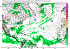
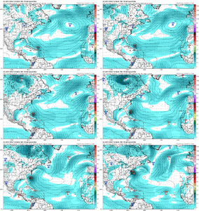
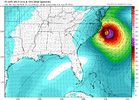
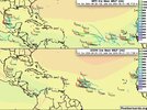
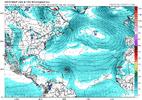
No hurricanes on the 18Z. There is a non tropical low roaming around. The waves continue to come off at 20N and dissipate.


1724109998003.png
 
Last edited:
Bold prediction indeed


But then reposts how shear is way above normal


No hurricanes on the 18Z. There is a non tropical low roaming around. The waves continue to come off at 20N and dissipate.


View attachment 150188

I'm with Danny Morris. I've been watching hurricane season for about 10 years now. It ramps up the last week of August. Thank God if it doesn't. That would be a pleasant fall.
 
Do you remember hearing a lot about SAL back in the 90s/80s or even early 2000s?

It seems to be a major issue almost every year nowadays.
Not to the degree we have recently. I can't find a lot of old SAL.maps for reference so it's all off of memory anyway. I do think these massive hurricane seasons getting projected and using total precip anoms from seasonal models sets the expectations that we will have an active storm everyday so the negating factors get amplified to be more than what is normal.
 
Last edited:
1724173962001.png


1724174022961.png


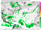
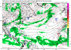
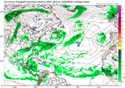
Peak season and the pre-season numbers are getting more more ridiculous. MDR 100% encased in desert air. GFS did manage a Debbie redo but for peak way below avg activity.


1724174639118.png
 
Last edited:
JB says the EURO has a super duper wave train. Doesnt matter though. They can be 940mb lows in Africa and as long as they come off at 20N they will choke on dust. As far as 05/20 as analogs thats laughable at this point


Back
Top