• Hello, please take a minute to check out our awesome content, contributed by the wonderful members of our community. We hope you'll add your own thoughts and opinions by making a free account!

Wintry 1/20 - 1/23 Winter Storm

Actually, for the N. Georgia CAD areas, the ICON was a little too cold with its surface temps right up until verification. The NAM was close. The GFS too warm. Again, speaking of N. Georgia only but since that was what I was keyed in on.

I am not sure about Georgia as a whole; but it took the GFS until 06z (as the event had started) to actually get the temperature profile down around here finally shifting ZR to the correct locations....
 
The energy which is trying to phase into the southern s/w. It looks to be trending faster, as of recent run. If it starts reversing that trend and results into a bigger phase, would that yield results similar to the model runs from earlier Saturday?
 
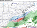
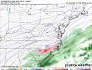
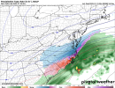
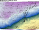
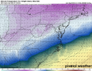
Phasing scenarios are always hard to nail down outside 48hrs, a negative tilt just before the FL Panhandle works for the Coastal Plain. 12z Euro, would like to see more ingest of northern stream energy in the Ark-La-Tex in future runs, but right now I can easily see this being VA through New England :(, with a second system Tues, many details yet to be worked out.96-500hv.conus.png102-500hv.conus.png108-500hv.conus.png
 
One things for sure, this wave has been consistent on it's location moving off the gulf. Screenshot'd some models runs from the second wave when it gets near the general location. Typical Miller A for MS/AL/GA. question is, will cold enough temps overlap our moisture. That's the big IF. Going off our last event, temps trended downward once this thing got sampled. And a general rule of thumb models don't value the cold air well. One thing that will help us is if this low becomes deeper, and from trends it seems to be possibly trending towards deeper, as well that last system trended deeper till only about 12 hours out. Takeaways!!!
1. A trend towards deeper surface low is plausible.
2. Temperatures have proven to be colder from our past event, and models don't forecast it well.
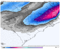
3. Models are very consistent on this being a Miller A for MS/AL/GA.gfs_mslp_pcpn_frzn_seus_22.pnggfs_mslp_pcpn_frzn_seus_24.pnggfs_mslp_pcpn_frzn_seus_27.pnggfs_mslp_pcpn_frzn_seus_26.png
 
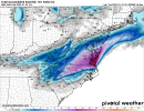
Ugh, this is headed towards another slop fest. If there’s one thing positive about this, the damming is staying put, clear trend on the icon to another highly impactful winter storm View attachment 107400View attachment 107401View attachment 107403
Even with the NW trends look at the strength of the low pressure .. the warm nose response for a 1010+ mb low would not nearly be as strong as the one we just went through which was sub 1000 mb as it was getting going
 
Even with the NW trends look at the strength of the low pressure .. the warm nose response for a 1010+ mb low would not nearly be as strong as the one we just went through which was sub 1000 mb as it was getting going
It’s not a warm nose from the low, it’s a warm nose from the western Atlantic ridge, the low pressure is not the culprit of the warm nose here
 
GSP is leaning toward the GEFS it seems and not buying the Euro suite. I seem to agree at this point. Still not buying the phase, but we'll see.

The models also start disagreeing with the timing of an incoming h5
s/w trof and it`s interaction with the frontal zone Fri thru the
weekend. The GFS soln is faster and has little sfc wave development
along the front, thus less moist adv into the region and much less
chance of wintry precip reaching the FA. The ECMWF and the CMC on
the other hand indicate a slower progression of the upper trof and
more time for a sfc wave to develop and bring a good amt of deep
layered moisture into the area. If this scenario pans out, the
generated precip would interact with a a cold and dry sfc layer,
which would support a period of wintry mix then mostly snow across
most of the FA. Still much uncertainty exists with this system and
the models have been going back and forth on these solns.
Additionally, the GEFS members dont provide a good clue on the
pattern one way or the other. More than half the perturbations
indicate no good chance precip reaching the area and the others are
mostly skimpy on wintry precip amts. Thus, low-end to nil PoPs will
continue to advertised for now with this weekend system.
 
Back
Top