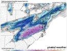
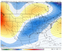
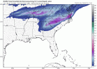
-
Hello, please take a minute to check out our awesome content, contributed by the wonderful members of our community. We hope you'll add your own thoughts and opinions by making a free account!
You are using an out of date browser. It may not display this or other websites correctly.
You should upgrade or use an alternative browser.
You should upgrade or use an alternative browser.
Wintry 1/20 - 1/23 Winter Storm
- Thread starter packfan98
- Start date
iGRXY
Member
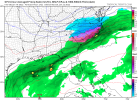
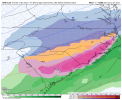
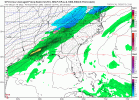
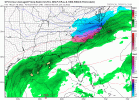
GFS is folding to the NAM/RGEM. More northern stream digging in the short range.
Not getting kicked as hard by the energy in Idaho
iGRXY
Member
It’s not there yet all the way but the trend has started in my opinion.
NBAcentel
Member
Staying up for king euro the 18z run was close to what I think if it holds serve time will tell fkls. 0z gfs still dry upstate sc and western nc not a lot of qpf
Snownut
Member
And GFS won't verify either. It's Been TrashStaying up for king euro the 18z run was close to what I think if it holds serve time will tell fkls. 0z gfs still dry upstate sc and western nc not a lot of qpf
Sent from my SM-A526U using Tapatalk
Cary_Snow95
Member
Downeastnc
Member
iGRXY
Member
What’s funny is the precip shield on the NW side is likely still under modeled
D
Deleted member 609
Guest
neelsamb
Member
It’s definitely a bit west. Compare the next frame after this one as well and you’ll be able to tell the difference a little more.Nothing to different so far at least for central and eastern NC which is what I am looking for
View attachment 108131
brendan123
Member
DT sounds confident
Webber definitely agrees that models are underestimating the NW shield of this thing. I have a feeling Birdman's forecast will bust.
GeorgiaGirl
Member
What’s funny is the precip shield on the NW side is likely still under modeled
Yeah, we might not see what the NAM showed, but the globals are probably a bit off on what they're showing on the NW side.
Downeastnc
Member
Yes please


iGRXY
Member
GFS wasn’t going to start spitting out what the NAM and RGEM are showing in 1 run. These things usually take a few runs of progression but the trend this evening is for more northern stream digging and basically forcing a phase of some kind to occur. GFS moved into that direction in a big way.
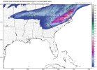
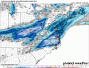
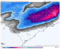
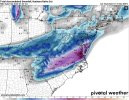
Noticeable expansion on the SW flank , towards Columbia
iGRXY
Member
Snow is pushing further west with each run
confidence wise there is winter storm watch for all counties that border Raleigh NC up into Virginia. Elsewhere is too soon to know. Nail biter for Charlotte could see near zilch or advisory. 50/50 but I would lean against atm.
00z UKMet looks similar to the GFS to me, but it's hard to tell specifics on the early maps. It's a slider, that's for sure
NBAcentel
Member
You know I don't usually try to get into these little petty discussions like this but my post stated amounts increased and the footprint basically unchanged. Yeah amounts did increase slightly into SC and maybe you end up with a foot but look at those totals in upstate SC they go from .4 to .5 and notice in Ga they go from light amounts to nothing, so it's not this noticeable further west expansion with each run. It's just one model run anywaySnow is pushing further west with each run
NBAcentel
Member
Cary_Snow95
Member
NAM is the only one that really makes the triangle sweat. Overall though nice trends for most today. A general footprint from CLT to RDU to SE Virginia is looking great. Maybe a little sleet mixing in se of there but overall a significant winter storm for central and western nc is coming
iGRXY
Member
Uhhh that’s definitely a progression of snow further west and southwest ……You know I don't usually try to get into these little petty discussions like this but my post stated amounts increased and the footprint basically unchanged. Yeah amounts did increase slightly into SC and maybe you end up with a foot but look at those totals in upstate SC they go from .4 to .5 and notice in Ga they go from light amounts to nothing, so it's not this noticeable further west expansion with each run. It's just one model run anyway
OkUhhh that’s definitely a progression of snow further west and southwest ……
Downeastnc
Member
Snow is pushing further west with each run
Going to be a brutal cutoff somewhere west of Raleigh.....right now it looks close to I 77.....typically with true Miller A's the cutoff is soul crushing.....
Cary_Snow95
Member
Footprint is still the same.. which is what he stated. General footprint of heaviest snow is in the exact same spot.Uhhh that’s definitely a progression of snow further west and southwest ……
We still have a solid 3 days of model suits. I wouldn’t coin it “trends” cause a 50-75 mile shift east or north could shut anyone out here below Virginia. There’s a fine line we are walking with advisories vs none vs warnings. The precip shield and amounts may not be known until 36hrs out!
iGRXY
Member
Yes general footprint is the same. I’ve not said the heavier snow would be further west compared to where it is now. I’ve said there would be snow further west than what is being depicted. I promise nobody is trying to take Raleigh’s snow away lolFootprint is still the same.. which is what he stated. General footprint of heaviest snow is in the exact same spot.
brendan123
Member
Snownut
Member
So why did you put out a Totals map yesterday LOLWe still have a solid 3 days of model suits. I wouldn’t coin it “trends” cause a 50-75 mile shift east or north could shut anyone out here below Virginia. There’s a fine line we are walking with advisories vs none vs warnings. The precip shield and amounts may not be known until 36hrs out!
Sent from my SM-A526U using Tapatalk
carolinachaos
Member
I keep seeing people mentioning, looks good for a winter storm for central NC to VA… are we all looking at the same models? or choosing to be selective. It appears to me that this also could be a devastating ice storm for the Midlands and Pee Dee of SC.
Sent from my iPhone using Tapatalk
Sent from my iPhone using Tapatalk
Downeastnc
Member
Footprint is still the same.. which is what he stated. General footprint of heaviest snow is in the exact same spot.
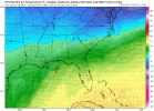
Yeah really its the perfect phase for central and eastern NC.....you can see the phasing actually tucks the 850's in much better probably giving everyone even better ratios thus increasing totals...great run for us.
NBAcentel
Member
The NW trend on the gefs ? I’m still more concerned about a warm nose then suppression
iGRXY
Member
NE NC and SW Virginia are sitting in the sweet spot regardless of most situations. Unless the entire thing just went to hell in a hand basket. That is definitely one thing I’ll agree on. I’d be worried about the inevitable warm nose up that way potentially but that area definitely is sitting perfect as of right now
NBAcentel
Member
Something don’t sit right with both OPs south of there respective ensemble suites with the snow

