-
Hello, please take a minute to check out our awesome content, contributed by the wonderful members of our community. We hope you'll add your own thoughts and opinions by making a free account!
You are using an out of date browser. It may not display this or other websites correctly.
You should upgrade or use an alternative browser.
You should upgrade or use an alternative browser.
Wintry 1/20 - 1/23 Winter Storm
- Thread starter packfan98
- Start date
iGRXY
Member

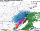
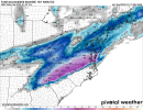
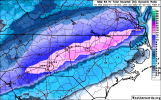
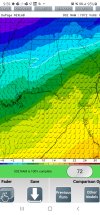
Still snowing along 85 north going through NC but NAM honestly looks like climo.
Hi Res Models need to win this one for the giffer.
We're talking about a foot from Charlotte to RDU northeastward; and there is still ice all the way to the coast. Historic winter storm.
Yeah envisioning that precip shield stretching into parts of NE North Central AL isn't out of historical analogy for these systemsFurther precip on the NW side is just a very likely depiction
Blend of Euro/GFS camp with NAM/RDPS camp is probably a good forecast night now
Yes and it’s a trend that we’re already starting to see on the other models as well… and the HRRR will do even better with it once it gets into rangeFurther precip on the NW side is just a very likely depiction
If the NAM is proven to be correct WOW, just WOW. GSP would obviously break some records with this being their 2nd 6-inch+ snowfall in less than a week. CLT-RDU would finally break their snow drought. I mean, this is just weather porn. Just wish we could be a little less amped so that way this won't strictly be a climo storm. Would love to guarantee folks a good 50 miles south of 85 wouldn't be another sleet fest.
D
Deleted member 609
Guest
That line is south of climo here
Still snowing along 85 north going through NC but NAM honestly looks like climo.
Im throwing all the chips in on hi res. Past Time for a big dog.Blend of Euro/GFS camp with NAM/RDPS camp is probably a good forecast night now
If anything remotely like what the NAM is showing this would be truly historic month for the 85 corridor.
Where are you getting the 0z run so early?00z Icon is hot garbage it looks seems suppressed other then late popups for parts of NC
Cary_Snow95
Member
Monster run. NAM really just took a step towards most guidance tho. It was further se than 18z and faster
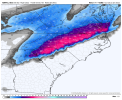
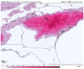
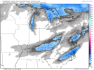
Yep he has the best algorithm from what I’ve seen/read. Has a write up on it on the siteHere is the clown map from weathernerds.org. I think he uses a different precip algorithm that takes more variables into account to calculate snowfall.
View attachment 108097
iGRXY
Member
NAM is like a carbon copy of how overrunning setups look and progress. Hell it even has the Wake county divide. It’s gotta be right if it’s showing that
Fascinating battleground possible setting up between Globals and Meso model??? We shall see what CMC, GFS, Euro do tonight they sorta have played more strung out compared to NAM and RGEM. Does the Euro come back toward the NAM side like it should several times randomly over past 3-4 days
accu35
Member
Storm5
Member
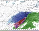
Nam Keeps expanding the NW precip shield
Sent from my iPhone using Tapatalk
Sent from my iPhone using Tapatalk
Tarheelwx
Member
ICON was a bit of a late bloomer compared to the NAM, but still good for much of NC. A long way to go on this one.
TW
TW
Looks identical with p types as the last storm!
i think if the whole grid goes down out there i wont return to weather as a hobby
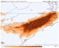
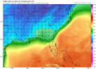
The I20 Corrider is so close to being buried with snow the 850s are just are so close Wesr to East at +1 or +2 a few more degrees and I20 is a snow jobFor what it’s worth, a lot of the ZR around atlanta falls right at 32ish degrees. So probably not an absolute disaster. But I’m not dumb enough to pretend the long range NAM has surface temps nailed. This isn’t pretty for a lot of people thoughJesus
View attachment 108101
Attachments
SnowNiner
Member
View attachment 108086Have mercy
I tried telling everyone west it wasn't over, keep the faith, but yall just wouldn't listen. Lol.
Nah, having the two mesoscale models on your side is something I guess. Just wish all globals didn't look so darn paltry imby. Hope these models hang on to keep that northern stream digging a bit and more interaction.
Cary_Snow95
Member
NAM and euro aren’t too dissimilar. That run was a huge nod to globals. CLT to RDU to SE VA corridorFascinating battleground possible setting up between Globals and Meso model??? We shall see what CMC, GFS, Euro do tonight they sorta have played more strung out compared to NAM and RGEM. Does the Euro come back toward the NAM side like it should several times randomly over past 3-4 days
We have too many different "local regions" and this one shows that big time. We have the NC crew (coast, mid and west) upstate/midlands and coast in SC and all over GA in N FL and back in Bam and MS and TN and we all need certain parts to do this or that with this system..someone is going to lose and get pissed off...lmao
Last edited:
NBAcentel
Member
Happens everytime sadly happens in last system locally for me... 15 miles down road hardly a dusting my area nearly 2 inches for allWe have too many different "local regions" and this one shows that big time. We have the NC crew (coast, mid and west) upstate/midlands and coast in SC and all over GA in N FL and back in Bam and MS and TN and we all need certain parts to do this or that with this system..someone is going to loose and get pissed off...lmao
There is no moisture to work with there. N AL needs it to phase about 200 - 300 miles west of there.The I20 Corrider is so close to being buried with snow the 850s are just are so close Wesr to East at +1 or +2 a few more degrees and I20 is a snow job
bnathanb1982
Member
Yeah and it seems primarily the forecasts and model trends usually are directed to the North Carolina folks. They just seem to have the most members in that region. Can't be mad that they are worried about their area first and foremost but I have learned that just because it's "bad" or trending away from what they want doesn't mean it's bad for us folks back in Alabama and Georgia. Not to mention the models posted a lot of time are only of the time frame pertinent to NC. I'm too dumb to read the maps myself so I have to go with what I read and try and learn from that even if it's not necessarily from my area LOL.We have too many different "local regions" and this one shows that big time. We have the NC crew (coast, mid and west) upstate/midlands and coast in SC and all over GA in N FL and back in Bam and MS and TN and we all need certain parts to do this or that with this system..someone is going to loose and get pissed off...lmao
iGRXY
Member
RGEM going for the phase lol
Iceagewhereartthou
Member
? Oh my; if it weren't the long range NAM I would be EX CIT ED!

