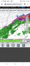
Snow breaking out NC mtns hour 45
-
Hello, please take a minute to check out our awesome content, contributed by the wonderful members of our community. We hope you'll add your own thoughts and opinions by making a free account!
You are using an out of date browser. It may not display this or other websites correctly.
You should upgrade or use an alternative browser.
You should upgrade or use an alternative browser.
Wintry 1/20 - 1/23 Winter Storm
- Thread starter packfan98
- Start date
someone's getting nam'd again. ?
iGRXY
Member
Northern stream digging further SW. where have I seen this before ?
Looks like a worse run. Less consolidation where the phase occurs.
NBAcentel
Member
Yeah that southern stream Interaction is failing now
SnowNiner
Member
Northern stream trying to save the day View attachment 108065
Looked like they shifted positions but stayed equidistant from each other.

iGRXY
Member
Southern stream trended worse for a phase and the northern stream trended better.
NBAcentel
Member
Insentropic upglide printer go brrr 
would rather have the northern stream trend better than the southern stream tbh, northern stream can get the job done on it's own and southerly shifts there would likely lead to less mixing
accu35
Member

Here it comes
NBAcentel
Member
Still like what the northern stream kd doing 
iGRXY
Member
Honestly it still looks good at 60 lol
iGRXY
Member

This still looks good to me
precip further inland at 66, snow western Carolina’s at 69
Looks a bit more amped to me at 66Honestly it still looks good at 60 lol

for those wondering, 850s stink over ga/sc thats why sleet.. at least in earlier frames
Oh my, a beauty at 72. Snow upstate to clt to RDU
iGRXY
Member
It’s phasing lmaooooo
Yea way more precip surface central AL,Ga. 18z had zippo
Yeah that second wave looks good at hour 66.
Nice hit here
NAM is closer to the RDPS look
Nam'd!
.png")
Bombs away on the NAM .. whoever stays all snow is going to get dumped on
NBAcentel
Member

Snowflowxxl
Member
Biblical ice or sleet storm occurring in central GA
Then at hour 69 a big hit for many from Ga to NC.
Ripping at 75, what a run this is. Snow still
Gsp -> clt -> rdu
Gsp -> clt -> rdu
iGRXY
Member
NAM trended like the globals with the SW in the southwest but what we’ve seen for most of the winter is the N/S trending stronger and digging further SW in the short range which is better even if it doesn’t get any interaction with the SW. but the phase is almost being forced regardless of what the SW in the southwest wants to do
Blue_Ridge_Escarpment
Member
That’s a 85 N&W special the NAM just gave
Snow totals will be nuts this run. Still hammering at 81
Dont tell wilks GSP already over half foot, still 2 frames to go
accu35
Member

Lights out
Nam and RDSP onto something or smoking something globals aint.
NBAcentel
Member
Absolute crush job on the NAM, if it’s showing these amped up looks under hour 48 I’d start taking it serious
Bang. 
Good lord temperatures with this look … I think they’re still dropping too .. this is going to be unreal 

iGRXY
Member
Further precip on the NW side is just a very likely depiction