-
Hello, please take a minute to check out our awesome content, contributed by the wonderful members of our community. We hope you'll add your own thoughts and opinions by making a free account!
You are using an out of date browser. It may not display this or other websites correctly.
You should upgrade or use an alternative browser.
You should upgrade or use an alternative browser.
Wintry 1/20 - 1/23 Winter Storm
- Thread starter packfan98
- Start date
GaSnowhound
Member
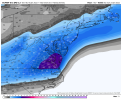
After last weekends near miss for my locale I will take the 3.1” right here and now! I apologize for a dumb question….trying to jump in after not keeping up much last 24 hr but is this continuing to be modeled as strictly an overrunnning scenario or are we looking new phasing at this point?Interesting!View attachment 108006
packfan98
Moderator
I agree, but this system has a different setup because the degree of phasing is what’s driving this. I guess more ridging could come into play once there’s a low to track. If it’s a weak system that’s a late bloomer, there not a large area that would be affected by a NW shift.Yeah I feel like every system we’ve had this year trended south until about 2 days before. Then it would start trending back north. This could be different but that’s been a theme this winter
Sent from my iPhone using Tapatalk
NBAcentel
Member
If I was in van Denton’s shoes (the hardest area to forecast in this storm being on the edge) I would throw down a map saying light to no accumulations for Yadkinville to Greensboro…(dusting to 2”) and then moderate accumulations east of Greensboro (2-4”), and scattered snow showers foothills/mtns dusting to 1”….that way he has wiggle way to add or remove up to 2” and that largely covers all available guidance ?
Blue_Ridge_Escarpment
Member
18Z EPS actually better for WNC than 12Z
brendan123
Member
wake4est
Member
- Joined
- Jan 3, 2017
- Messages
- 52
- Reaction score
- 138
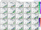
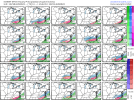
That’s the craziest snow map I’ve ever seen.View attachment 108040View attachment 108041
Northern extent on mean shrunk but southern extent stayed the same. Continues the good EPS trends for NE/Central NC and SE VA.
- Joined
- Jan 23, 2021
- Messages
- 4,602
- Reaction score
- 15,197
- Location
- Lebanon Township, Durham County NC
Snow means increased this run. Not much but an increase
iGRXY
Member
I definitely think NE NC and SE VA are sitting pretty regardless of the progression. But there’s going to be more moisture on the NW side. The main driver of precip is WAA instead of a true LP until it gets going off the NC coast. WAA is the driver here and it going up against CAD screams more moisture. Over running is notorious for having more moisture than model depiction. We also all know a NW trend is likely at some point but it’s just a matter of how much
packfan98
Moderator
Looks pretty standard for a late bloomer system.That’s the craziest snow map I’ve ever seen.
GaSnowhound
Member
Obv I’m no met but I remember reading many stating that NW trend was more of an idea than a reality but……as a 20 year predominantly lurker going back to Talk weather days……it seems that only rarely does a storm not shift nw as models converge. Maybe a cpl of I20 specials/sliders but as a layman observer...NW usually happens to some degree.Exactly… as many mets have noted.. there is nothing to prevent the last minute shift NW that we’ve all grown accustomed to
Yeah man GSP said there might not be much of a lull after the front moves through sounded like there expecting over running more NW up into the MTNS/FoothillsI definitely think NE NC and SE VA are sitting pretty regardless of the progression. But there’s going to be more moisture on the NW side. The main driver of precip is WAA instead of a true LP until it gets going off the NC coast. WAA is the driver here and it going up against CAD screams more moisture. Over running is notorious for having more moisture than model depiction. We also all know a NW trend is likely at some point but it’s just a matter of how much
NBAcentel
Member
iGRXY
Member
A lot of those depict quite a bit more precip than the OP
NBAcentel
Member
GSP is going with the ensembles currently. To much uncertainty with how potent any waves get along the front and how much qpf they throw back.
Iceagewhereartthou
Member
After last weeks system the GFS isn't king of anything. Not sure where that title belongs these days.Euro has caved on the northern stream in the last 24 hours. Gfs is the new king
Sent from my iPhone using Tapatalk
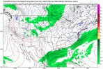
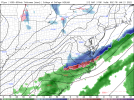
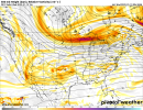
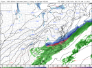
Here's a view of how the GFS and Euro are producing a similar end result, but going about it a bit differently. GFS is farther north with the wave track, but less amplified (best seen by looking at the diff in the height lines thru NC/VA). Both work for the Raleigh to Elizabeth City corridor...but what you don't want in those areas is the GFS track with the Euro amplitude (it would be warmer). Bottom line, if the wave is more amped or has more phasing, it needs to be farther south, and ideally, farther SE.


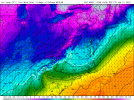
This Arctic front to me is a bit of a wild card in all this. Obviously cold air moving in during the precip is not typically a recipe that works here east of the mountains. This however is a deal where the cold push is coming in straight from the N and NNE.Rap starting to come in range with the Arctic front itself View attachment 108052
The outstanding 18z run of the RDPS only had .6 qpf for mby. 18z GFS the same registered a .6.
Like to see these increase hopefully tonight into tommorow.
Like to see these increase hopefully tonight into tommorow.
But RDPS had more precip to go at the endThe outstanding 18z run of the RDPS only had .6 qpf for mby. 18z GFS the same registered a .6.
Like to see these increase hopefully tonight into tommorow.
Yes, would have got up to 1.0 range most likely with another frame or 2.But RDPS had more precip to go at the end
- Joined
- Jan 23, 2021
- Messages
- 4,602
- Reaction score
- 15,197
- Location
- Lebanon Township, Durham County NC
It definitely isn’t cold air struggling to get over the hills. Usually these fronts, when they come from this direction, can come through fast.This Arctic front to me is a bit of a wild card in all this. Obviously cold air moving in during the precip is not typically a recipe that works here east of the mountains. This however is a deal where the cold push is coming in straight from the N and NNE.
SnowNiner
Member
Are there any other models that phased the streams other than the rgem? The nam looked close and better than any others I can think of. Just trying to figure out my last vestiges hope.
NBAcentel
Member
Yes I seem to remember sometime around 2014 or 2015, one of these coming in this direction and much of NC experienced a 25 degree temperature drop in a matter of a couple hours during the day. Temperatures fell from the mid to upper 50 to low to mid 30s.It definitely isn’t cold air struggling to get over the hills. Usually these fronts, when they come from this direction, can come through fast.
Those were it pretty much. But it's time to pay more attention to them than the globals at this point. If they start leaning toward the globals here shortly its going to be a short night for me. If they hold their ground I may stay up and see if the globals respond.Are there any other models that phased the streams other than the rgem? The nam looked close and better than any others I can think of. Just trying to figure out my last vestiges hope.
iGRXY
Member
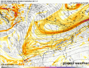
This is just first glance but both streams look slower
The 18z Nam and 18z RDPS where both very similar imo and also more west than the Globals at 18z. See if this happens agan tonight at 0z. The globals shear or are a little to stringy with the energy at h5
Cary_Snow95
Member
I think that was 2015. The wind gusts during the front knocked out powerYes I seem to remember sometime around 2014 or 2015, one of these coming in this direction and much of NC experienced a 25 degree temperature drop in a matter of a couple hours during the day. Temperatures fell from the mid to upper 50 to low to mid 30s.
NBAcentel
Member
Looks like the northern stream is nosing more west this run..
iGRXY
Member
My eyes may be deceiving me but both streams look slower
Doesn't seem to be stalling just slowerMy eyes may be deceiving me but both streams look slower
NBAcentel
Member
iGRXY
Member
NAM is definitely stronger with the N/S and sinking it south

