What is Shetley saying?
-
Hello, please take a minute to check out our awesome content, contributed by the wonderful members of our community. We hope you'll add your own thoughts and opinions by making a free account!
You are using an out of date browser. It may not display this or other websites correctly.
You should upgrade or use an alternative browser.
You should upgrade or use an alternative browser.
Misc Winter Weather Support Group
- Thread starter RBR71
- Start date
Twister
Member
He's saying this winter is a bunch of Shet!What is Shetley saying?
Sent from my SM-S911U using Tapatalk
It's always "in two weeks."
Model chasing is such a sick game.
Model chasing is such a sick game.
Iceagewhereartthou
Member
rburrel2
Member
congrats asheville

 www.ashevillewx.com

AshevilleWX
Located in the heart of Downtown Asheville, this camera is situated on the top of the Grimes Teich Anderson Building and views the entire town. Heavy snowfall and slick road conditions can be seen from this camera in the winter, and wonderful sunset can be found during the evenings!
Relax, we're following right along...oh waitCan we put lipstick on this?
We need to George Costanza this pattern...the exact opposite.
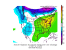
View attachment 142909
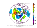
View attachment 142910
I am eating lunch at my desk and checked the GFS and just burst out laughing and then I checked the CMC ensembles...and oh boy...I am getting my golf clubs ready.Relax, we're following right along...oh wait
When we believed this Feb was going to be any different than the last 9 is where we went wrong. Once the first talk of the Pac jet possibly overextended we knew it would. If it can go wrong it willWe have all been through enough "bad" winters to know you don't just reverse out of patterns like this in a few days...
Got to be kidding....where did it all go wrong.
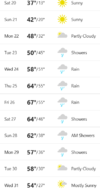
View attachment 142912
D
Deleted member 609
Guest
Someone hold me
NBAcentel
Member
Jet will somehow stay extended forever until the 1st of March. Very logical
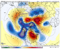
AO bad NAO bad EPO bad PNA badCan we put lipstick on this?
We need to George Costanza this pattern...the exact opposite.
View attachment 142909
View attachment 142910
not sure how we recover in time either Kylo but hey I’m just a middle aged guy tracking snow, or lack thereof, on a weatherboard
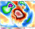
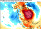
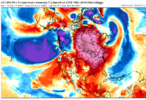
Let's just pretend that the first image is a MSLP anomalyCan we put lipstick on this?
We need to George Costanza this pattern...the exact opposite.
View attachment 142909
View attachment 142910
rburrel2
Member
The start of February has went from looking pretty good, to decent, to questionable, to absolutely awful on the ensembles over the course of the last 3 days.
The good thing is can't trend much worse at this point.
The good thing is can't trend much worse at this point.
When long range ensembles show patterns conducive of Winter weather, we praise them.
When long range ensembles show patterns conducive of Spring weather, we chastise them.
I don't understand?
Can someone explain like I am 5?
Why are they wrong if they show a Spring pattern?
When long range ensembles show patterns conducive of Spring weather, we chastise them.
I don't understand?
Can someone explain like I am 5?
Why are they wrong if they show a Spring pattern?
They are almost never wrong when they show a spring pattern. They are almost never right when they show a winter pattern.When long range ensembles show patterns conducive of Winter weather, we praise them.
When long range ensembles show patterns conducive of Spring weather, we chastise them.
I don't understand?
Can someone explain like I am 5?
Why are they wrong if they show a Spring pattern?
Iceagewhereartthou
Member
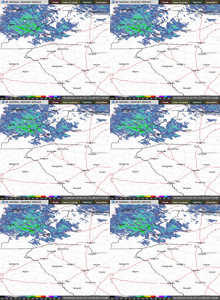
I have decided what I hate the most about winter weather around here; down slopping. Eastern TN getting MORE snow, high mtns getting buried, even foothills getting at least something. Yet here in the upstate we are clear as a bell and in the 40s. I hate down slopping with a passion! This week is a perfect example of why lving in the lee of the mountains is torture for winter weather.
NBAcentel
Member
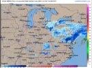
Enjoy the weather, it’s the only weather you getView attachment 142916
I have decided what I hate the most about winter weather around here; down slopping. Eastern TN getting MORE snow, high mtns getting buried, even foothills getting at least something. Yet here in the upstate we are clear as a bell and in the 40s. I hate down slopping with a passion! This week is a perfect example of why lving in the lee of the mountains is torture for winter weather.
rburrel2
Member
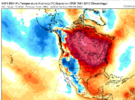
The good news is it literally can't get any warmer than that...any future model runs will be an improvement.
It’s not an official winter, until fights break out in the main threads! Winter is officially here!
It’s not an official winter, until fights break out in the main threads! Winter is officially here!
olhausen
Member
It depends on the sun angle I hear. ?I wonder if the snow will stick to the water.
I think the concern should be less about the pac jet and more about the nao showing no signs of life on the ens. If we start pushing that back we start losing spring it should be pretty stubborn once it gets going
rburrel2
Member
This is a stretch to say the least, but there's a Loyd Christmas level chance that northern stream s/w could drop down and bowling ball over us like March 1, 2009. The GFS has way less west coast ridging and a weaker s/w at hr 240 compared to the euro, but still tries to cut it off over us at hr 276.
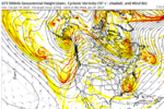
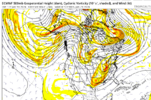


Last edited:
Well it’s official. My very first live weather forecast in southern Illinois. The career has begun for NickyB
Ima need you to update your location sir before people start thinking it's cold in apex
olhausen
Member
rburrel2
Member
The Upstate is going to finish the month with 10-12 inches of liquid and BN temps... and nobody will even sniff a stray sleet pellet.
rburrel2
Member
There is potential to squeeze a winter storm in around January 30th though. I won't give up hope on that just yet. Would nice if at least a few ensemble members started showing something though.
That set up screams Northeast & maybe the Mid Atlantic all over it. It’s a brief window but it’s there.There is potential to squeeze a winter storm in around January 30th though. I won't give up hope on that just yet. Would nice if at least a few ensemble members started showing something though.
Nice pick up burrel. We have it move the way it's been going (ala past 7 days) or it moves east. Note the west ridge placementThis is a stretch to say the least, but there's a Loyd Christmas level chance that northern stream s/w could drop down and bowling ball over us like March 1, 2009. The GFS has way less west coast ridging and a weaker s/w at hr 240 compared to the euro, but still tries to cut it off over us at hr 276.
View attachment 142927
View attachment 142926
I think right now, VA and north is looking real good for that time frame, but I absolutely think western and central NC, SC upstate, and even Northeast GA have a chance. There is a really strong CAD signal at this lead time and with the energy shown flying around, it definitely bears watching.That set up screams Northeast & maybe the Mid Atlantic all over it. It’s a brief window but it’s there.
Hopefully we can get some runs rolling in that timeframe this weekend.I think right now, VA and north is looking real good for that time frame, but I absolutely think western and central NC, SC upstate, and even Northeast GA have a chance. There is a really strong CAD signal at this lead time and with the energy shown flying around, it definitely bears watching.
Yeah that’s how you know it’s bad luck and not some sort of “it just can’t snow anymore here” conspiracy. Ingredients were there. The problem is we have @Rain Cold in the kitchen trying to put it all together for a Michelin star dish.The Upstate is going to finish the month with 10-12 inches of liquid and BN temps... and nobody will even sniff a stray sleet pellet.

