JustinWx24
Member
Can’t wait for the 38 and rain!We will have some cold rain down here tomorrow too.
Can’t wait for the 38 and rain!We will have some cold rain down here tomorrow too.
I don’t miss it.Can’t wait for the 38 and rain!
“Need to get into NAM range to figure out the true CAD strength. Should be several degrees colder verbatim.” - Weenies who are about to get rained onI’m gonna throw out a quote we trademarked in the SE! Precip shield should be much farther NW than modeled, with a low that strong”! -BrickView attachment 139832View attachment 139833
You're living in the perfect area... we get lots of those kind!?My favorite snow fail is when a heavy cloud deck keeps temperatures from dropping ahead of a storm and the precip moves in on top of hot air and it rains for 24 hours straight. I hope we get one of those this year.
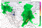
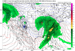
To prove my point, here’s 12z Tuesday Euro vs 0z Wednesday euro run!I’m gonna throw out a quote we trademarked in the SE! Precip shield should be much farther NW than modeled, with a low that strong”! -BrickView attachment 139832View attachment 139833


Pants obliterated!To prove my point, here’s 12z Tuesday Euro vs 0z Wednesday euro run! View attachment 139838View attachment 139839
Ding ding dingThis thread is gonna be jammin here in a few hrs once everyone sees the cave to the GEFS mid month
Step oneSo about that sneaky little system tomorrow.
Y'all know the drill.
1) Watch temps tonight and report back when your backyard has dropped below forecast.
2) Look for that thickening cloud cover to beat the midday sun.
3) Watch the radar and look up every few minutes to confirm it's still virga.
4) When all of the above fails, check the 384-hour GFS.
This is my mission.
This thread is gonna be jammin here in a few hrs once everyone sees the cave to the GEFS mid month
So one run these days is a "cave" especially when the 6z GEFS went toward the 12z EPSThis thread is gonna be jammin here in a few hrs once everyone sees the cave to the GEFS mid month
Pessimism is the cool thing these days, especially when they can see the future!So one run these days is a "cave" especially when the 6z GEFS went toward the 12z EPS
OkThis happens every winter. Then we get the verification scores posted. Then the EPS shows cold again. Then we party. Then it shifts back to a western or Central US trough.
You really should go with the model that shows the trough to the west. For some reason, that's what the atmosphere wants to do year in and year out, with the occasional rare exception. Unless all three suites align with cold in the east, go with the one that dumps the cold out west. It doesn't matter which one it is.
With that, I'm done for the day. Y'all have at it.
This happens every winter. Then we get the verification scores posted. Then the EPS shows cold again. Then we party. Then it shifts back to a western or Central US trough.
You really should go with the model that shows the trough to the west. For some reason, that's what the atmosphere wants to do year in and year out, with the occasional rare exception. Unless all three suites align with cold in the east, go with the one that dumps the cold out west. It doesn't matter which one it is.
With that, I'm done for the day. Y'all have at it.
it just takes one good conjuring, though. i believe in you @ILMRossimmense respect to yourself and webb and myfrotho and all the other long range acolytes because that is a skillset i simply do not have and have no motivation to develop lol. the 300 hr ensembles may as well be an ouija board to me
Mountains are only shot you got for the next few weeks to see snow.I feel a chase
Maybe he wants to go on an ice chase or perhaps drive to the mid Atlantic or Midwest ?Mountains are only shot you got for the next few weeks to see snow.
Still think he will need to go up.Maybe he wants to go on an ice chase or perhaps drive to the mid Atlantic ?
I hear there may be a good snowfall in Illinois or Indiana next week so that may be a possibility.Still think he will need to go up.
Thats a good drive from south Bama but if you want it bad enough i guess you would drive it.I hear there may be a good snowfall in Illinois or Indiana next week so that may be a possibility.
I mean he’s near the MS border so I imagine he is as close to Illinois as he is to a place like Boone.Thats a good drive from south Bama but if you want it bad enough i guess you would drive it.
Please do share; which ones?VR has some good games and videos with snow, Might be the only shot to see it if you live south of Kentucky.
Please do share; which ones?


And we thought we had it bad.

3 things to know ahead of a potential East Coast winter storm this weekend
A winter storm is forecast to hit much of the country through the first two weeks of the year. Learn more about who could be affected by unfavorable weather conditions.www.yahoo.com
View attachment 139858

