• Hello, please take a minute to check out our awesome content, contributed by the wonderful members of our community. We hope you'll add your own thoughts and opinions by making a free account!

Pattern May Discussion

Nice structure west of Charlotte thankfully as of typical this time of year low levels aren't backed enough to really get a big tornado threat going. I'm not sure what gets this far east tonight suspect it's a sputtering ghost unless one of the cells along the VA border turns right.

@metwannabe is in a good spot along with a lot of the charlotte posters
That's a monster. I like a good rain and some thunder, but I'm glad this cell is nowhere near me. No reports on it yet, but it has stayed over rural areas for the most part. If it keeps it's strength and goes into the Charlotte metro area I would not be surprised to hear of a 70+ wind gust and or a report of golfball hail.

Edit: 1 wind and 1 hail report on it now. Still headed towards the Charlotte metro.
 
Last edited:
That's a monster. I like a good rain and some thunder, but I'm glad this cell is nowhere near me. No reports on it yet, but it has stayed over rural areas for the most part. If it keeps it's strength and goes into the Charlotte metro area I would not be surprised to hear of a 70+ wind gust and or a report of golfball hail.

Edit: 1 wind and 1 hail report on it now. Still headed towards the Charlotte metro.
Yeah pretty classic right mover. Looks like it might be starting to wind down as it gets into a slightly worse environment. That said the line segments getting going off the mountains look legit
 
Nice structure west of Charlotte thankfully as of typical this time of year low levels aren't backed enough to really get a big tornado threat going. I'm not sure what gets this far east tonight suspect it's a sputtering ghost unless one of the cells along the VA border turns right.

@metwannabe is in a good spot along with a lot of the charlotte posters
That fizzled fast lol
 
Wonder if this will the second time in a row not getting a storm when under a watch.
Severe Thunderstorm Watch- A statement issued by the National weather Service (NWS) that indicates thunderstorms are possible in your area.


pos·si·bil·i·ty
/ˌpäsəˈbilədē/

noun
  1. a thing that may happen or be the case
 
Severe Thunderstorm Watch- A statement issued by the National weather Service (NWS) that indicates thunderstorms are possible in your area.


pos·si·bil·i·ty
/ˌpäsəˈbilədē/

noun
  1. a thing that may happen or be the case
I know what it means. Just saying often I miss out on storms when under a watch. Just a personal observation, which is something people post about on message boards. So no need to be a jerk.
 
Storms coming over the mountains on the state line now have some legit lightening and wind with them. 3rd time it’s rained today and looks like a solid line coming over down 26. Got a 1.5” from the storms over the weekend and the rain has been needed
 
BULLETIN - IMMEDIATE BROADCAST REQUESTED
SEVERE THUNDERSTORM WARNING
NATIONAL WEATHER SERVICE RALEIGH NC
929 PM EDT TUE MAY 16 2023

THE NATIONAL WEATHER SERVICE IN RALEIGH HAS ISSUED A

* SEVERE THUNDERSTORM WARNING FOR...
SOUTHERN ALAMANCE COUNTY IN CENTRAL NORTH CAROLINA...
SOUTHERN ORANGE COUNTY IN CENTRAL NORTH CAROLINA...
SOUTHEASTERN GUILFORD COUNTY IN CENTRAL NORTH CAROLINA...

* UNTIL 1015 PM EDT.

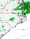
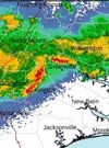
* AT 928 PM EDT, A SEVERE THUNDERSTORM WAS LOCATED 8 MILES SOUTHWEST
OF ELON, OR 10 MILES SOUTHWEST OF BURLINGTON, MOVING EAST AT 45
MPH.

HAZARD...60 MPH WIND GUSTS.

SOURCE...RADAR INDICATED.

IMPACT...EXPECT DAMAGE TO ROOFS, SIDING, AND TREES.

* LOCATIONS IMPACTED INCLUDE...
CHAPEL HILL, BURLINGTON, GRAHAM, HILLSBOROUGH, CARRBORO, MEBANE,
ELON, GIBSONVILLE, HAW RIVER AND SWEPSONVILLE.

PRECAUTIONARY/PREPAREDNESS ACTIONS...

FOR YOUR PROTECTION MOVE TO AN INTERIOR ROOM ON THE LOWEST FLOOR OF A
BUILDING.

STRAIGHT LINE WINDS CAN BLOW DOWN TREES, POWER LINES, AND DAMAGE
MOBILE HOMES AND OTHER BUILDINGS. SEEK SHELTER IN A STURDY STRUCTURE
UNTIL THE STORM HAS PASSED. STAY AWAY FROM WINDOWS AS FLYING DEBRIS
GENERATED BY DAMAGING WINDS CAN BE DEADLY.
 
Hrrr couldn't get a handle on tonight. Earlier it showed the line getting here but as the runs went on through the night it dropped the line. This was the 01z run for 2am versus reality. Big miss 3 hours out.
 

Attachments

  • Screenshot_20230517_014513_Chrome.jpg
    Screenshot_20230517_014513_Chrome.jpg
    255.1 KB · Views: 14
  • Screenshot_20230517_014359_Chrome.jpg
    Screenshot_20230517_014359_Chrome.jpg
    62.3 KB · Views: 14
.62 last night hoping we can hit with the coastal and the incoming trough Sunday on rain next week looks completely dry right now with low dews and highs moderating from the low-mid 70s to mid 80s. Have to have at least some interest in trying to pinch off a subtropical system next week as well off of the SE coast or NE gulf. Long duration stalled front with NE flow inland typically will at least attempt to spin up
 
.62 last night hoping we can hit with the coastal and the incoming trough Sunday on rain next week looks completely dry right now with low dews and highs moderating from the low-mid 70s to mid 80s. Have to have at least some interest in trying to pinch off a subtropical system next week as well off of the SE coast or NE gulf. Long duration stalled front with NE flow inland typically will at least attempt to spin up
Gfs has slowly shifted precip to along the immediate coast east of I 17 for the coastal.
 

Attachments

  • Screenshot_20230518_023326_Chrome.jpg
    Screenshot_20230518_023326_Chrome.jpg
    302.3 KB · Views: 4
Looks wedgey the next day or so for many of us. Not too many of these CAD days left between now and October. Or should I November?? Might as well enjoy them. I know I enjoy them when they first return in the fall and the rare times in the summer.
 
Looking at the 6z GFS it looks cool(ish) for the rest of the month. Here is a spot check at day 10:

View attachment 135219

But the problem with this setup is there may be folks that score great with precip and others that don't. Here's day 14 total QPF:
View attachment 135220
I'll take it. It also shows the heat cranking after Mem Day, but then that's also the norm. Keep it cool as long as possible, but no matter what, we know the oppressive weather is unavoidable. After that, get me to Sept 1 and I can handle it knowing the sun angle will be getting lower quickly and the Fall change will be coming!
 
I'll take it. It also shows the heat cranking after Mem Day, but then that's also the norm. Keep it cool as long as possible, but no matter what, we know the oppressive weather is unavoidable. After that, get me to Sept 1 and I can handle it knowing the sun angle will be getting lower quickly and the Fall change will be coming!

You know it's gonna be muggy until about mid October.


Sent from my iPhone using Tapatalk
 
No thanks!!

wsi_june-aug_0516.png
 
I'll take it. It also shows the heat cranking after Mem Day, but then that's also the norm. Keep it cool as long as possible, but no matter what, we know the oppressive weather is unavoidable. After that, get me to Sept 1 and I can handle it knowing the sun angle will be getting lower quickly and the Fall change will be coming!
If there was ever a summer for us to be BN this is it I think
 
Back
Top