Just wait to winter. We will touch. Lol. Love it!!Can't wait

-
Hello, please take a minute to check out our awesome content, contributed by the wonderful members of our community. We hope you'll add your own thoughts and opinions by making a free account!
You are using an out of date browser. It may not display this or other websites correctly.
You should upgrade or use an alternative browser.
You should upgrade or use an alternative browser.
Pattern May Discussion
- Thread starter RBR71
- Start date
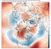
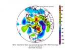
The long range look is nuts.
Iceagewhereartthou
Member
We need the low to meander inland and die if it stays offshore we've got no shot of salvaging Sunday at this point
BHS1975
Member
The long range look is nuts.
Way different than last year.
Sent from my iPhone using Tapatalk
There's a wide range of outcomes here this weekend depending on the sfc low track we could be 80 and humid or 65 and gloomy Sunday
Downeastnc
Member
There's a wide range of outcomes here this weekend depending on the sfc low track we could be 80 and humid or 65 and gloomy Sunday
Yeah and even the Nam's jumping around all over the place with track and timing.....solid 1-3" though on pretty much all of them for MBY
This weather has been unbelievable.
Shaggy
Member
Yeah doesn't get much better than this for MayThis weather has been unbelievable.
Just 24 more days, before the days start getting shorter. Saddle up
Should have windchill in the upper 30s to low 40s tommorow. Wind is gonna be very noticeable
Sctvman
Member
We’re nearing 30 degrees below normal in Charleston. 58 degrees at 4:30pm. AVERAGE high is like 85 or 86.
vsublazer
Member
It really windy here in North Myrtle Beach. Got in this afternoon and the wind hasn’t stopped. Chilly and windy. Currently 61 degrees and a feels like 59. Who would have thought our Spring Break trip in early April was warmer than this. You win some and lose some with beach trips.
NBAcentel
Member
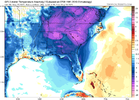
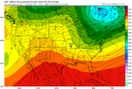
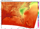
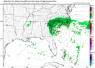
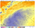
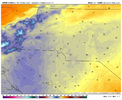
Great pool weather for end of MayEh lowest hrrr shows is low 50s for some of us and mid-upper for mostView attachment 135284View attachment 135285
Iceagewhereartthou
Member
If we had a spring like this every year summer would be a lot easier to take. Normally we would have already taken a beating from early heat and humidity but this may be the most pleasant April and May I can ever remember.This weather has been unbelievable.
Downeastnc
Member
Gonna be 3-4 ft of surge/wind tide on the IBX in NC with this persistent 2 day east wind....
LickWx
Member
Hope stormsfurry will give a recap of his obs after today. See how high a guest they get as gyre scrapes by on SD loop posted above.
LickWx
Member
Maybe lose a couple more homes to the ocean in rodantheGonna be 3-4 ft of surge/wind tide on the IBX in NC with this persistent 2 day east wind....
Ive been typing in all kinds of questions on that chatgpt. It will be amazing if they ever let it get real time. I been asking all kinds of nao enso questions from like winter 2020. It only has access up until 2021. Probably for good reason. It needs to explain how to fix the GFS lol. Love to see this thing be able to access all the wx models real time. Then get webber to chat with it.
Obviously similarities, but the big difference is that in 2012 at this time, the LaNina had extended into the spring and was only headed towards a neutral ENSO. Right now we’re clearly headed for an El Niño.
JHS
Member
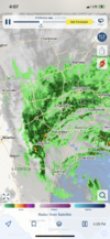
Staying east it looks like. They need to cut precip amounts by 75% or more west of I-77. Way too much dry air to overcome.Where is all the rain I was promised today? I skipped smoking two butts today cause of this.
StoneColdHeel
Member
Is that what the kids call a threesome these days?Where is all the rain I was promised today? I skipped smoking two butts today cause of this.
This didn’t age well. With the way it looks like this is going to pivot, the area between GSP to CLT will end up with the heaviest totalsStaying east it looks like. They need to cut precip amounts by 75% or more west of I-77. Way too much dry air to overcome.
Another example of why you should never rely on any prediction Shetley makes. Never.This didn’t age well. With the way it looks like this is going to pivot, the area between GSP to CLT will end up with the heaviest totals
Shaggy
Member
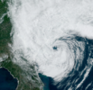
Impressive on visible images
They said on TWC earlier that there forecasts of 3-6” of rain near the coast, was gonna bust hard! Wilmington was up to only 1/2 an inch at 11 AM this morningThis didn’t age well. With the way it looks like this is going to pivot, the area between GSP to CLT will end up with the heaviest totals

