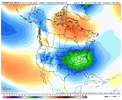
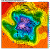
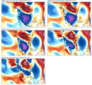
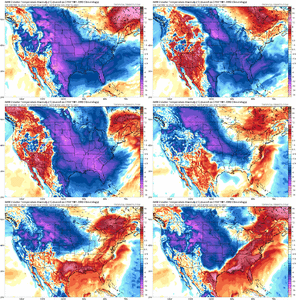
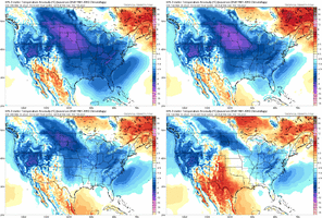
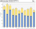
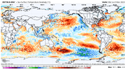
As bad as the GFS is, the Euro isn't that much better when it comes to showing winter storms more than 7 days out that never come to happen.00z euro control from yesterday was off its rocker.
View attachment 133973
-
Hello, please take a minute to check out our awesome content, contributed by the wonderful members of our community. We hope you'll add your own thoughts and opinions by making a free account!
You are using an out of date browser. It may not display this or other websites correctly.
You should upgrade or use an alternative browser.
You should upgrade or use an alternative browser.
Pattern Mega March 2023
- Thread starter SD
- Start date
Dawgdaze22
Member
Wejjjjjes? are coming
iGRXY
Member
NCHighCountryWX
Member
- Joined
- Dec 28, 2016
- Messages
- 698
- Reaction score
- 1,916
Congratulations to Webberweather!
Drizzle Snizzle
Member
Congratulations to Webberweather!
Not surprised at all. He's so smart.
rburrel2
Member
You realize a smoothed mean is really useless for predicting minimum temperatures right?EPS following suit. Keeps our lows around ATL just at or above freezing. Seems like things moderating a bit.
Sent from my iPhone using Tapatalk
Agreed… you really have to look more at 500mb heights and 850mb temps… both of which indicate multiple chances of hard freezes.You realize a smoothed mean is really useless for predicting minimum temperatures right?
ATLwxfan
Member
You realize a smoothed mean is really useless for predicting minimum temperatures right?
I’m paying attention more to trends with the temps. They’ve trended warmer. The 18z GFS was a bit of a warning shot regarding sustained cold.
Sent from my iPhone using Tapatalk
iGRXY
Member
I’m paying attention more to trends with the temps. They’ve trended warmer. The 18z GFS was a bit of a warning shot regarding sustained cold.
Sent from my iPhone using Tapatalk
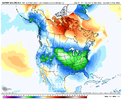 You’ve got to stop using the GFS as a basis for your points. It is a bad model with even more violent swings than any other. Especially the off hour GFS. If The GFS and GEFS were even remotely useful, then I’d have 2 major snows already this season. I’ve had a 4+ inch mean on the GEFS under a 100 hours twice this winter with zero to show for it. The cold isn’t moderating. A 7 day ensemble mean from probably the most reliable long range model we can use is averaging 10-14 degree departs from average on a smooth spread. That is ridiculously cold for this time of year.
No it wasn’t because the GFS is a useless model that the WPC doesn’t use when putting together their outlooks. As I stated above ensembles are showing 500mb heights and 850mb temps that would be conducive for multiple nights of overnight lows well down into the 20s, but if we want to look at surface temperature trends then we can see that the overnight Euro ensemble is showing a widespread 10-14 degrees below average over a 7 day period from 3-12 to 3/19.I’m paying attention more to trends with the temps. They’ve trended warmer. The 18z GFS was a bit of a warning shot regarding sustained cold.
Sent from my iPhone using Tapatalk
NoSnowATL
Member
In the same breath I would say you have to stop using maps 8-15 days out.View attachment 133986 You’ve got to stop using the GFS as a basis for your points. It is a bad model with even more violent swings than any other. Especially the off hour GFS. If The GFS and GEFS were even remotely useful, then I’d have 2 major snows already this season. I’ve had a 4+ inch mean on the GEFS under a 100 hours twice this winter with zero to show for it. The cold isn’t moderating. A 7 day ensemble mean from probably the most reliable long range model we can use is averaging 10-14 degree departs from average on a smooth spread. That is ridiculously cold for this time of year.
I want it to be bitterly cold as much as the next guy, but by the same token, we've seen D7+ cold snaps on the GFS, CMC, and, Euro greatly moderate over and over and over as well. You can't honestly criticize anything while basing the critique on a Day 8-13 model prog.View attachment 133986 You’ve got to stop using the GFS as a basis for your points. It is a bad model with even more violent swings than any other. Especially the off hour GFS. If The GFS and GEFS were even remotely useful, then I’d have 2 major snows already this season. I’ve had a 4+ inch mean on the GEFS under a 100 hours twice this winter with zero to show for it. The cold isn’t moderating. A 7 day ensemble mean from probably the most reliable long range model we can use is averaging 10-14 degree departs from average on a smooth spread. That is ridiculously cold for this time of year.
I agree that it looks like a cool-down is coming, but I'd be hesitant to embrace bitterly cold, well below freezing temps for a widespread region until we get it to show up within 4 or 5 days.
ATLwxfan
Member
Canadian swings back to a pretty darn cold look for early next week.
Sent from my iPhone using Tapatalk
Sent from my iPhone using Tapatalk
NBAcentel
Member
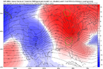
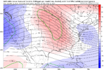
Night overextend to much +AAM going poleward that’s a lot of momentumIf anyone is still looking for snow the cmc was how you would want to get there. There is still a decent amount of noise in that 3/15-18 period but these trends aren't that greatView attachment 133994
View attachment 133995View attachment 133996
I’m noticing in the last couple days of teleconnection updates that the PNA is now look to go positive in the 13-15 timeframe. If that happens, I worry that we may say a set up like around Christmas with such a strong NW flow that any potential energy to produce a storm gets suppressed way too far south.Night overextend to much +AAM going poleward that’s a lot of momentum
tennessee storm
Member
Hard get that setup in March. Like December ….I’m noticing in the last couple days of teleconnection updates that the PNA is now look to go positive in the 13-15 timeframe. If that happens, I worry that we may say a set up like around Christmas with such a strong NW flow that any potential energy to produce a storm gets suppressed way too far south.
NBAcentel
Member
ATLwxfan
Member
Looks like an evolution to more of the same garbage that we've seen through the winter. Meh
View attachment 133997
Probably a pacific pattern but a suppressed ridge. Enjoy 60° and rain.
Sent from my iPhone using Tapatalk
LickWx
Member
It looks like a classic over perform during the day and radiate more during the night setup . Not good for plants really tho . Kinda setup where you get 60/28 days easily .That “extreme cold” is turning into upper 50s over 30s, haha wack View attachment 133998
ATLwxfan
Member
That “extreme cold” is turning into upper 50s over 30s, haha wack View attachment 133998
If you said that three days ago they’d call you crazy. With the exception of the schizo Canadian things really getting muted. Makes sense in the context of climo, sun angle, lack of snow cover, etc.
Sent from my iPhone using Tapatalk
NBAcentel
Member
NBAcentel
Member
NoSnowATL
Member
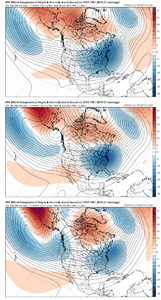
Some saw this coming, some didn’t.This is a huge moderation trend, this is near a Feb 2021 level of fail View attachment 134002
ATLwxfan
Member
Some saw this coming, some didn’t.
The lesson here is maybe the GFS wasn’t completely out to lunch. It was seeing the can being kicked which other models then picked up on. Interesting stuff.
Also it is amazing what we need just to get some BN temps from an MJO and indices standpoint.
Sent from my iPhone using Tapatalk
That damn western trough, is relentless this year! JeezIf anyone is still looking for snow the cmc was how you would want to get there. There is still a decent amount of noise in that 3/15-18 period but these trends aren't that greatView attachment 133994
View attachment 133995View attachment 133996
Gary
Member
At this point, I would take this year round, even if it meant never seeing another flake of snow ? ?“Bitter cold and snow” was never on the table but this will be some nice weather coming up. Cool nights, pleasant days.
View attachment 134003
Used to this would generate excitement, then it dwindled to where it would at least pique my interest, now it just ticks me off.....


I see a tiny bit of noise on the EPS but I don't know that I care
carolinachaos
Member
At this point, I’m resigned to the fact that odds are we will not see any appreciable winter precipitation. Let’s move-on to Spring and hope for the best next season.
Sent from my iPhone using Tapatalk
Sent from my iPhone using Tapatalk
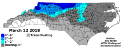
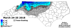
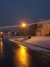
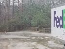
3/12 was nice don't think it was expected to stick them boom. 3/25 was a mush fest2018 had some late March snows...for those that are holding out hope. I am getting old...I don't remember 3/12.
View attachment 134022View attachment 134023
Ifs and buts were candy and nuts......

ATLwxfan
Member
Ifs and buts were candy and nuts......

We’d have peanut m&m’s and no snow.
Sent from my iPhone using Tapatalk
Raleigh has had roughly 3" of snow total the past 4 winters. This is the worst 4 yr stretch since 2005-2008...the worst 5 yr stretch has been roughly 9.5" total. So to even meet that futitlity we would need 6-7" next winter...that seems insurmountable.

