Nomanslandva
Member
And that in the heat island. I bet the suburbs got a bit more. I'll have to check with my kid who is just north of 295. And I rain at 1400 ft...Good morning from Richmond- did not expect this
And that in the heat island. I bet the suburbs got a bit more. I'll have to check with my kid who is just north of 295. And I rain at 1400 ft...Good morning from Richmond- did not expect this
Move to Halifax County. Water water everywhere37 and rain no torch yet.
Only .05 at the house last night. What you gotta do to get a decent rain event

Met, there is a some sleet mixed in at Exit 168 on I-95 in Halifax.Move to Halifax County. Water water everywhere
I still find it odd that the airport didn’t record a trace back on 12/20. There were observations of light sleet/snow mix for several hours all over the southern half of the metro area that afternoon including downtown and locations very close to the airport.0” mean thru mid Feb…. Charlotte shutout chances increasing View attachment 132017
I could be wrong but I think they take obs at the top of every hour. So if Charlotte got a 10 minute hit of flurries in between hours, it wouldn't be recorded.I still find it odd that the airport didn’t record a trace back on 12/20. There were observations of light sleet/snow mix for several hours all over the southern half of the metro area that afternoon including downtown and locations very close to the airport.

Maybe bright banding due to melting snow? Had some of that back over this way.
Something tells me that's your mPING report showing that... thanks for the update. Figured it would be close, I'm at work in Louisburg so just the coldest of rains hereMet, there is a some sleet mixed in at Exit 168 on I-95 in Halifax.
CC on radarscope does look a tad interesting, that line is probably right on the NC/Va border
No… it’s the same as with inter-hour highs and lows. If there is precip during an hour, it’s recorded.I could be wrong but I think they take obs at the top of every hour. So if Charlotte got a 10 minute hit of flurries in between hours, it wouldn't be recorded.
It was 53 degrees at the 12am reading, 45 at 1am, according to their records. Definitely one of those deceptive high temperatures where it doesn’t really reflect how the actual day itself was, though.Greensboro has 53 for the official High Temp yesterday 2/1 and very fishy looking/suspect. It certainly wasn't 53 at midnight when 2/1 officially rolled in. More like 41. No wonder everyone thinks the planet is scorching with record keeping like this. 41 was as high as I recorded.
tological Data for Greensboro Area, NC (ThreadEx) - February 2023
Click column heading to sort ascending, click again to sort descending.
Date Temperature HDD CDD Precipitation Maximum Minimum Average Departure 2023-02-01 53 38 45.5 5.0 19 0 0.17 2023-02-02 M M M M M M M 2023-02-03 M M M M M M M
My friend in Norfolk reported “hail”, which must be sleet or graupel.
Seems odd since there's no automated way to record it like with temperature. Do they designate a 24/7 window/floodlight watcher at the office?No… it’s the same as with inter-hour highs and lows. If there is precip during an hour, it’s recorded.
The panhandle is less offensive to me than Austin and Dallas.Like I said yesterday...I'm moving to Texas. It snows/ices there every week.
Looks like rain to.me. unless you're moving to Amarillo
I'm so ready to see the sun!!Alabama the mud capital of the country.
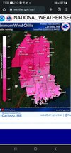
That is Mt Kathadin, tallest peak in Maine and where the Appalachian trail ends. Very exposed up there.One location is predicted to have a windchill of -90. ????
If that's the case then Charlotte & GSP should've both recorded a trace that day.No… it’s the same as with inter-hour highs and lows. If there is precip during an hour, it’s recorded.
Can confirm I'm in aho south east of Boone got a half inch before it quit around 1030.LIGHT SNOW ACROSS THE NORTHERN MOUNTAINS THROUGH NOON....
Rain has changed over to snow across the Northern Mountains of
North Carolina with some accumulation being reported, especially
for elevations above 4000 feet. Accumulations of up to 2 inches of
additional snow is possible before snow tapers off around midday.
For the lower elevations below 4000 feet, up to an inch of
accumulation is possible before the snow ends, but mainly on
grassy or elevated surfaces. Temperatures for elevations below
4000 feet are expected to remain above freezing, so little or no
accumulation is expected on the roads.
That's insane. Hope no one's gonna be hiking there this weekend. Quite literally feeling like Antarctica.That is Mt Kathadin, tallest peak in Maine and where the Appalachian trail ends. Very exposed up there.
GSP did on the 20th. So it has recordable amounts but not measurable snow. And looks to stay that way. CLT has been completely blanked though.If that's the case then Charlotte & GSP should've both recorded a trace that day.
I had snow & sleet for about half an hour.
It was all around GVL county that day.
Hard to believe nothing fell at either airport.

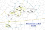
Matter of fact I think the only place that had measurable snow along and south of 85 in GA and the Carolina's is AtlantaGSP did on the 20th. So it has recordable amounts but not measurable snow. And looks to stay that way. CLT has been completely blanked though. View attachment 132027
Mt Washington is forecasting temps to -45 ( with winds well over 100mph) with windchills as low as -100 to -110f. Frostbite in less than a minute possible. Can't imagine what that is like.That's insane. Hope no one's gonna be hiking there this weekend. Quite literally feeling like Antarctica.


I remember when you saw snow in the Texas Panhandle, there seemed to be a good chance there would be some here
I agree… I know I work on the east side of town and saw snow/sleet falling from about 1pm until I was home that evening at 7. Seems strange that CLT didn’t have at least a couple hoursIf that's the case then Charlotte & GSP should've both recorded a trace that day.
I had snow & sleet for about half an hour.
It was all around GVL county that day.
Hard to believe nothing fell at either airport.

The annoying part is it’s been too wet to really enjoy it.Doesn't matter how you slice it, it's been objectively unusually warm/torchy in the SE US. Leaf out is at least 3 weeks early this year.
View attachment 132032
Climate change my Ass!! I guess you believe in global warming tooJust about everywhere in the SE US outside of Florida had a top 10 warmest January on record this year, many locales top 3-5 warmest since record keeping began.
People can deny it all they want to, but objectively this is/has been a torch pattern. These kind of warm patterns (due to climate change) are becoming so frequent nowadays people tend to forget how cold it's actually supposed to be in winter.
View attachment 132029
Climate change my Ass!! I guess you believe in global warming too
Sent from my SM-A526U using Tapatalk
I guess you also have a masters degree in Atmosphere Sciences.Climate change my Ass!! I guess you believe in global warming too
Sent from my SM-A526U using Tapatalk
Common sense goes a long ways. Espeacilly in regards to Climate Hoax. Climate is always changing ,going through cycles.I guess you also have a masters degree in Atmosphere Sciences.
Common sense goes a long ways. Espeacilly in regards to Climate Hoax. Climate is always changing ,going through cycles.
At GSO, we had a -3 Dec, +5.7 Jan. See how Feb shakes out. By Feb 5th we will be Below normal. Should register some AN before Next weekend, then a few days slighly BN. Jan will by far be the warmest month of met winter. Although Feb probably will end up AN here if I was a betting man. Bet the streak!