olhausen
Member

Wow, the 24% is nearly right over me. All in, I guess? ?Hey this is an official source .. so you’re saying there is a chance ?View attachment 132004
Yeah it’s 37 here with mixing. Sfc temps are killer. Radar actually looks good closer to Bristol. We will see how much of that makes it over hereHad some mixing here but upstream radar looks like poop so I guess the first accumulation is not going to be today. Soundings looked pretty good with no warm nose but just a tad too warm at 34.


| Date | Temperature | HDD | CDD | Precipitation | |||
|---|---|---|---|---|---|---|---|
| Maximum | Minimum | Average | Departure | ||||
| 2023-02-01 | 53 | 38 | 45.5 | 5.0 | 19 | 0 | 0.17 |
| 2023-02-02 | M | M | M | M | M | M | M |
| 2023-02-03 | M | M | M | M | M | M | M |
It was over 50 when midnight rolled in at Greensboro and Winston . I checked both . Asheboro was 55 at midnight as wellGreensboro has 53 for the official High Temp yesterday 2/1 and very fishy looking/suspect. It certainly wasn't 53 at midnight when 2/1 officially rolled in. More like 41. No wonder everyone thinks the planet is scorching with record keeping like this. 41 was as high as I recorded.
tological Data for Greensboro Area, NC (ThreadEx) - February 2023
Click column heading to sort ascending, click again to sort descending.
Maximum Minimum Average Departure Date Temperature HDD CDD Precipitation 2023-02-01 53 38 45.5 5.0 19 0 0.17 2023-02-02 M M M M M M M 2023-02-03 M M M M M M M
Greensboro has 53 for the official High Temp yesterday 2/1 and very fishy looking/suspect. It certainly wasn't 53 at midnight when 2/1 officially rolled in. More like 41. No wonder everyone thinks the planet is scorching with record keeping like this. 41 was as high as I recorded.
tological Data for Greensboro Area, NC (ThreadEx) - February 2023
Click column heading to sort ascending, click again to sort descending.
Maximum Minimum Average Departure Date Temperature HDD CDD Precipitation 2023-02-01 53 38 45.5 5.0 19 0 0.17 2023-02-02 M M M M M M M 2023-02-03 M M M M M M M
Thanks, on me thenIt was over 50 when midnight rolled in at Greensboro and Winston . I checked both . Asheboro was 55 at midnight as well

RGEM and HRRR had it. My point and click had mix language yesterday afternoon but they dropped it last night?Wow. Accumulating snow in Christiansburg, Blacksburg and Pearisburg this morning. No one was calling for this.

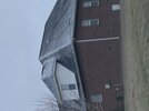
Wow. That dark blue over Christiansburg though.View attachment 132010
I’m ------- done with this bs, sfc temps in the city are killer. Yes it’s majority rain here in the city but all around me in every direction is snow.
Thanks…Wow. That dark blue over Christiansburg though.
What I don't understand is the snow over Bedford, Amherst and Appomattox counties and even Lynchburg. I would expect at least Roanoke county would be snow as well.Thanks…
Good job rubbing it in
No you’re good, your point wasn’t wrong btw about these stations being funky a lot of the time …Thanks, on me then
I think it may be time to make a little YouTube video and explain the several reasons why Roanoke sucks in marginal cold snow events. It’s not just elevation related, a lot of it has to do with the way the mountains are oriented when cold comes from NW.What I don't understand is the snow over Bedford, Amherst and Appomattox counties and even Lynchburg. I would expect at least Roanoke county would be snow as well.
Yea, most of the time it seems like I get mixing longer where I am because the wind pushed that air from the city over me. Wish we could have been under that heavier band just to our south. that may have produced a little slush.View attachment 132010
I’m ------- done with this bs, sfc temps in the city are killer. Yes it’s majority rain here in the city but all around me in every direction is snow.
Certainly a very complex climate in this area. Completely different from Columbia SC where the only variable is the urban heat island.I think it may be time to make a little YouTube video and explain the several reasons why Roanoke sucks in marginal cold snow events. It’s not just elevation related, a lot of it has to do with the way the mountains are oriented when cold comes from NW.
I am 2 miles from tanglewood mall and 400 ft above the river in elevation. Sometimes I do get accumulation when the mall does not. This one is weird because weather stations up at bent mountain/poor mountain are right at 32 and I would expect them to be a bit colder with it 34 here.What I don't understand is the snow over Bedford, Amherst and Appomattox counties and even Lynchburg. I would expect at least Roanoke county would be snow as well.

I am under the northern part of that band and still just nothing but light rain. The heavier echoes must be where it is mixing aloft. Temp down to 36 though so maybe we will get a changeover before the precip shuts off.Yea, most of the time it seems like I get mixing longer where I am because the wind pushed that air from the city over me. Wish we could have been under that heavier band just to our south. that may have produced a little slush.
Even up here, the accumulation is weird. Bare ground at I-81 But just a few miles north near Merrimac, the ground is covered.I am 2 miles from tanglewood mall and 400 ft above the river in elevation. Sometimes I do get accumulation when the mall does not. This one is weird because weather stations up at bent mountain/poor mountain are right at 32 and I would expect them to be a bit colder with it 34 here.
Get the block, you'll shunt the TPV SE into the 50/50 region with a ton of energy flying around in the central US.This can work... and there's some support on the GEFS. If we get some Baffin Bay blocking I think we'll have a good chance.View attachment 132011


 www.ashevillewx.com

 www.resortcams.com
Canonical Nina, I guess.37 and rain no torch yet.
Only .05 at the house last night. What you gotta do to get a decent rain event