• Hello, please take a minute to check out our awesome content, contributed by the wonderful members of our community. We hope you'll add your own thoughts and opinions by making a free account!

Pattern Fail or Fab February 2023 Pattern Thread

Anyone notice how we have pretty good runs at 12z but all the overnight stuff sucks?
Ha ha.. yeah, I'll wake up at night to disappointment, then have the 6z bring something back, then have the 12z show some real promise, which then leads into 18z happy hour.
 
Many gonna have to realize this isn’t a great setup for snow, but rather for sleet/ice. I think I’m down bad to the point where I’d take anything however and be happy
Yeah with SER flexing it’s going to be really hard to get snow… maybe we get lucky and get a strong FGEN band to set up a front end thump, but other than that the big hope would be to keep 925s cold enough to favor more sleet
 
Hopefully the euro and EPS jump on board today, because they were really bad last night with respect to getting a storm/precip. I'm optimistic b/c it seems most models have trended trended better since then but who knows.

These 50-50 lows are so fickle this far out.

Over the years, I’ve noticed models have a habit of being too progressive with big 50-50s like this & it’s one reason why CAD events usually trend better inside the medium range (day 5-7 ish & in)
 
This has the makings of a pretty significant event. Stronger subtropical ridge, the airmass over Southeast Canada is the coldest in the northern hemisphere. Mixing airmasses like that screams precipitation and especially if we can trend our energy stronger and further south as it comes across the plains. If we can get a 1040+ and honestly seeing the GFS spitting out 1050 HP and the CMC have a 1044 the idea of at least a 1040 isn't out of the question. Even in a progressive flow, a deepening 50/50 low will slow things down enough and having that strong of a HP sitting over that type of cold will lock in some pretty cold low level temperatures even with a Sliding east HP. Don't forget that the precipitation also locks in CAD as well. It will be interesting to see if we can get some FGEN driven front end snow as well.
 
This has the makings of a pretty significant event. Stronger subtropical ridge, the airmass over Southeast Canada is the coldest in the northern hemisphere. Mixing airmasses like that screams precipitation and especially if we can trend our energy stronger and further south as it comes across the plains. If we can get a 1040+ and honestly seeing the GFS spitting out 1050 HP and the CMC have a 1044 the idea of at least a 1040 isn't out of the question. Even in a progressive flow, a deepening 50/50 low will slow things down enough and having that strong of a HP sitting over that type of cold will lock in some pretty cold low level temperatures even with a Sliding east HP. Don't forget that the precipitation also locks in CAD as well. It will be interesting to see if we can get some FGEN driven front end snow as well.
Let’s pump the breaks a bit before we start talking about FGEN snow lol.. let’s just see if we can keep the storm signal .. we may have cold but it’s still a delicate balance between perfect amount of cold and storm placement and storm strength .. this could easily be onset ice to rain deal let’s take it one step at a time
 
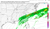
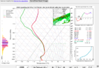
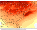
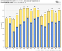
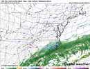
In a broader sense... seems like most of the models have our wetbulb temps around 23-25 Sunday morning thanks to the dry air blast from the wedge/CAD high. As such, even if/when we see the parent high move off the coast... you'd be looking at freezing rain lasting quite a while as we slowly warm from 23-25 to 32 with latent heat release. I don't see any mechanism to scour the remnant wedge so I think we would be in one of those latent heat release warming to end ice situations as it stands.

TLDR, if we actually get steady precip starting Sunday morning, the insitu wedge conditions look to be cold/dry enough for significant ice accretions before warming to freezing. imo (assuming the models/ensembles are right on the CAD strength and cold air transport Saturday).
 
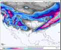
1675566000-OGTWnuR2JzE.png

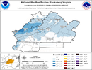
1675566000-wtybZxpfBXY.png

The airmass is so cold we are already well below freezing before the first drop of precip reaches us. Also the first clue of a really good deep cold airmass for CAD is when you have single digit dews on the Va/NC border. That has to happen
 
Let’s pump the breaks a bit before we start talking about FGEN snow lol.. let’s just see if we can keep the storm signal .. we may have cold but it’s still a delicate balance between perfect amount of cold and storm placement and storm strength .. this could easily be onset ice to rain deal let’s take it one step at a time
Nobody is talking about this being a done deal lol. Simply pointing out that tends to be a typical process of overrunning especially with airmasses this cold and WAA being forced over it.
 
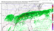
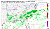
I'm a little worried about relying on the isentropic upglide over a wedge as the main driver of precip Sunday morning. I mean it's certainly possible, but we had a recent wedge event where that was forecasted and wound up never materializing(maybe 2019 or 2020). We were forecasted to get roughly .1-.2 liquid from the upglide before a front pushed through and most places wound up getting either nothing and a trace... when the main front came through 8-10 hours later we had finally warmed to around 32 and that fell as just rain as expected.

Every setup is different though and this one could work out well.
 
Last edited:
I'm a little worried about relying on the isentropic upglide as the main driver of precip Sunday morning. I mean it's certainly possible, but we had a recent wedge event where that was forecasted and wound up never materializing(maybe 2019 or 2020). We were forecasted to get roughly .1-.2 liquid from the upglide before a front pushed through and most places wound up getting either nothing and a trace... when the main front came through 8-10 hours later we had finally warmed to around 32 and that fell as just rain as expected.

Every setup is different though and this one could work out well.
We will need a strong and deepening wave as it comes into the southeast. The CMC showed this. Once you get that you won't have any issues getting isentropic upglide and forcing. Right now the Cold air isn't the issue. We are going to have exceptionally cold air to our north and a H5 pattern that supports CAD. It's really just a matter of getting the energy to dig far enough south and be strong enough to not get squashed by the TPV sliding east.
 
Back
Top