• Hello, please take a minute to check out our awesome content, contributed by the wonderful members of our community. We hope you'll add your own thoughts and opinions by making a free account!

Pattern Fail or Fab February 2023 Pattern Thread

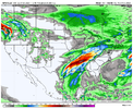
1675641600-NHV298IiyBM.png

By the time the wave makes it to the southeast, our High is about 1000 miles due east of Newfoundland lol
It may very well be right, but is it just me or has the Euro become the model with more of a progressive bias. You used to never see it move features faster than the GFS
 
I'm having a hard time buying the progressive solutions w/ the 50-50 low.

It's a tough sell for me knowing a persistent, shallow, and unusually intense cold air mass sitting east of the Appalachians will tug on/slow down the +PVa aloft more than forecast by NWP (through generation of low-mid level static stability above the CAD dome >> +PV )

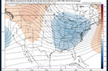
Here's the graphic I made ~ 5 weeks ago to explain how this physical process works:


If we had -NAO over the top, the easterly flow under the ridge would slow this trough down even further, but beggars can't be choosers.
 
Last edited:
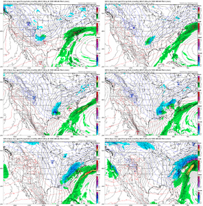
1675641600-YC2CY12vNVs.png

EPS is similar to the OP in lifting the 50/50 out fast. Like Webber said, deepening 50/50 lows slow the progression of the pattern so I am a little skeptical myself. (Those big fantasy runs we had this month was typically due to a deepening 50/50 low that slowed the progression of the N/S). A -NAO would put the 50/50 in neutral. RIght now the EURO and EPS have this thing going 70 mph. A deepening 50/50 with no -NAO will be more like slowing up to 40mph, which is really all we need right now. The trailing wave is only about a day too slow right now which is nothing at this range.
 
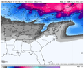
Yea, looks like white rain to me, but it would be the best we've had, so... Im behind and getting caught up and with 4 pages this afternoon, there must be some more excitement ahead.
Definitely hoping for a slight win with this
 
I'm having a hard time buying the progressive solutions w/ the 50-50 low.

It's a tough sell for me knowing a persistent, shallow, and unusually intense cold air mass sitting east of the Appalachians will tug on/slow down the +PVa aloft more than forecast by NWP (through generation of low-mid level static stability above the CAD dome >> +PV )

Here's the graphic I made ~ 5 weeks ago to explain how this physical process works:


If we had -NAO over the top, the easterly flow under the ridge would slow this trough down even further, but beggars can't be choosers.

I seem to remember that around 5-7 days before last years storm on 1/16, the models… I think the Euro and UK especially were trying to move the 50/50 low out to fast. It would make sense that it should slow down and every thing behind if it’s deepening as much as modeled. Your right though that it’s shame we couldn’t get one in place a few weeks back when we had a strong negative NAO
 
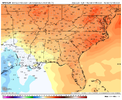
Yeah, that's a sleet sign. How stagnant is it though or is it retreating quickly.
 
Big difference vs the failed 50/50 from jan, was the fact that in that January head fake storm, it was driven off a random piece of energy diving down around Atlantic Canada in a fast progressive pattern, that was limited on cold. this Time we already have tons of cold on top, and a big TPV, but pattern is still somewhat progressive. But a big wound up TPV is harder to move Vs a random piece of N/S energy. H5 imo is better this time.
 

This well known weak subtropical ridge bias in the GFS (which also shows up in the hurricane season and is probably related to the model’s CP scheme) is another reason why I didn’t like this event several days ago. Hopefully a few folks find a way to get some sleet or snow at the onset
 
1675414800-ZHPtWQaNErw.png

1675436400-cd1Gs15Y2MY.png

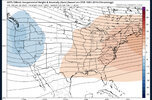
Stronger TPV and one that is further south. Also looks like the 2nd system is coming in faster out of the northwest. That stronger TPV should continue to help slow the progression if this continues in future runs.
 
Back
Top