If that vortex wasn’t so wound up this could have been a doozy up and down the eastern seaboard. I’ll hug my 25 degree night though.
-
Hello, please take a minute to check out our awesome content, contributed by the wonderful members of our community. We hope you'll add your own thoughts and opinions by making a free account!
You are using an out of date browser. It may not display this or other websites correctly.
You should upgrade or use an alternative browser.
You should upgrade or use an alternative browser.
Pattern Fail or Fab February 2023 Pattern Thread
- Thread starter RBR71
- Start date
I will say that with the climo of a La Niña ending, things would favor bouts of cool weather and freezes into April for much of the southeasthighly likely yes, but i'm sure even in the outlying areas there have been a few years where there was no freeze in March or April.
Is the Nina weaker now than it was a month ago?I will say that with the climo of a La Niña ending, things would favor bouts of cool weather and freezes into April for much of the southeast
JLL1973
Member
Two of those have worked out pretty good for me this yearAhh yes, another day 7-10 "threat". Those have worked out pretty well this winter.
Yes… all indicators are right now that we are heading towards are neutral ENSO and then possibly a weak El Niño by the fall.Is the Nina weaker now than it was a month ago?
NoSnowATL
Member
NCHighCountryWX
Member
- Joined
- Dec 28, 2016
- Messages
- 700
- Reaction score
- 1,921
I saw this movie last week.
Drizzle Snizzle
Member
does anyone actually live at the top of Mount Washington ?
WFFaithful
Member
There are people that work in the observatory
Cad Wedge NC
Member
Yes, but only weather personnel and volunteers at the weather observatory.does anyone actually live at the top of Mount Washington ?
Probably not by a long shotcould be the last freeze of the year for some.
This was 12z .. 18z still had a good trough but no snow
Trollcould be the last freeze of the year for some.
Drizzle Snizzle
Member
It's a fact actually. My mom lives in South Georgia and it wouldnt surprise me if her last freeze is this weekend.Troll
Ron Burgundy
Member
That’s not a fact but carry on….It's a fact actually. My mom lives in South Georgia and it wouldnt surprise me if her last freeze is this weekend.
Brent
Member
Ha I remember a few weeks ago when people thought winter was over here... And I'm already hearing chatter of something else in the next 7-10 days
Deep cold right where the Carolinas want it and can’t do a damn thing with it. Pathetic 
SWVAwxfan
Member
Quite an impressive trough next weekend on modeling continues to grow support. Definitely something we can work with if we continue to see a more amplified ridge out west to help energy dive around the base of the trough. At the very least another bud, bug, grass, pollen killing cold shot for the SE
Now that’s a legit southeast ridge that can produce long lasting really warm temperatures. Something that I’ve been expecting to see for a while now with all of its hype for the passed month. Maybe the legit thing is coming soon in the mean time the medium and short range continues to throw us decent troughs. 
2014-15, as well. It was a trash winter with the exception of a two week period in the last half of February that had a big sleet storm and then a 6” event at the end of the month.13-14 would qualify too, if I remember correctly.
Possible, but unlikely. Tallahassee, FL’s average last freeze is in early to mid March.It's a fact actually. My mom lives in South Georgia and it wouldnt surprise me if her last freeze is this weekend.
WEATHERBOYROY
Member
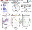
I'm about ready for spring too! However,we've seen similar looks at 300 plus hrs. and 240 it is transient. It seems as the models are almost always returning to Climo feb LA Nina after 300hrs.( Strong SE ridge) I'm sure it must be formatted to be likely in their program so there has to be strong evidence otherwise to see something much different.Now that’s a legit southeast ridge that can produce long lasting really warm temperatures. Something that I’ve been expecting to see for a while now with all of its hype for the passed month. Maybe the legit thing is coming soon in the mean time the medium and short range continues to throw us decent troughs. View attachment 132105
Webberweather53
Meteorologist
Now that’s a legit southeast ridge that can produce long lasting really warm temperatures. Something that I’ve been expecting to see for a while now with all of its hype for the passed month. Maybe the legit thing is coming soon in the mean time the medium and short range continues to throw us decent troughs. View attachment 132105
The same SE ridge that's been sitting over the East Coast this past month?
Yeah that one

BHS1975
Member
this would be horrible for the canes stadium game - 2 weeks away so hopefully this will change significantly. Good thing it’s just one run of the gfs
80s in Feb has been a thing the last few years.
Sent from my iPhone using Tapatalk
NoSnowATL
Member
Hope for it again this year.80s in Feb has been a thing the last few years.
Sent from my iPhone using Tapatalk
rburrel2
Member
Next weekend might be a good chance to chase flow snow in the mountains before the season is over. 

Cold winter morning
rburrel2
Member
GEFS is crushing the mountains... also some noise for Southern VA/NC coastal plain.
WEATHERBOYROY
Member
It's actually modelling a little cooler in Bham this year for a 3rd year la nina. In feb 1976( a 3rd year la nina) we were dominated by upper 60s to upper 70s for the whole month . We had 14 days above 70 and only had 5 days with highs under 60 degrees the whole month. The next winter was brutally cold!80s in Feb has been a thing the last few years.
Sent from my iPhone using Tapatalk
rburrel2
Member
That was actually a big bump up for everybody with next weekend's system. Maybe we can trend towards pinching this trough off down our way.
Flotown
Member
you know theres gonna be atleast one crazy model run with next weekend system..lol
Wind chill got down to 14 this morning
BHS1975
Member
you know theres gonna be atleast one crazy model run with next weekend system..lol
Yeap that 7 day weenie run is due.
Sent from my iPhone using Tapatalk
Quite a few interesting GEFS members at 06z for next weekend .. no crazy big storm but if we can get the trough orientation right and give some energy enough time to round the bend there’s certainly a chance to see some snow. Maybe a snow squall type of scenerio. But likely another decent cold shot on the way!
Wonder what these will look like as we head into the medium range. 


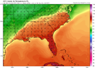
Wonder what these will look like as we head into the medium range. View attachment 132117View attachment 132118View attachment 132119

J1C1111
Member
I'll take it any way I can get it.Quite a few interesting GEFS members at 06z for next weekend .. no crazy big storm but if we can get the trough orientation right and give some energy enough time to round the bend there’s certainly a chance to see some snow. Maybe a snow squall type of scenerio. But likely another decent cold shot on the way!