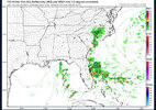
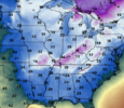
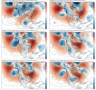
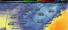
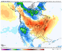
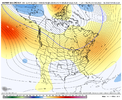
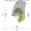
I tend to agree with this, as I thought a couple weeks back that the week we are going into now would have widespread 70s throughout the Carolinas east of the mountains and that it wouldn’t be last for a significant stretch. However that doesn’t seem to be the case and it looks fairly likely that there will be a reasonable shot of cold again next weekend… not as chilly as this weekend, but certainly a few degrees below average.
-
Hello, please take a minute to check out our awesome content, contributed by the wonderful members of our community. We hope you'll add your own thoughts and opinions by making a free account!
You are using an out of date browser. It may not display this or other websites correctly.
You should upgrade or use an alternative browser.
You should upgrade or use an alternative browser.
Pattern Fail or Fab February 2023 Pattern Thread
- Thread starter RBR71
- Start date
Flotown
Member
gfs trying to make thus weekend a bigger deal
We need that piece of energy coming out of Canada to dive as deep as possible to give some people in the south the best shot at some winter weather.
NBAcentel
Member
These cold weekends are getting old. Torch the weekends away and cool the weekdays down
Downeastnc
Member
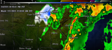
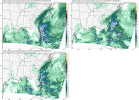
3K gives me damn near 2" of rain Sunday into Mon....


I told my wife if we get lucky there might be some rain tomorrow. I also told her if we were really lucky the temps would have a hard time getting above 40....... She about cried...3K gives me damn near 2" of rain Sunday into Mon....

Downeastnc
Member
LOL...
LOL...
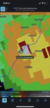
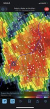
Here’s the picture I got a couple hours ago.
Attachments
olhausen
Member
We just had 3 days in a row of freezing rain ending in sleet and snow on Wednesday night. Today is the first day since Monday that everything wasn’t cased in ice. I’m not sure you really live where you say you do. The temps got out of the 30s today for the first time since Monday.starts to warm up rains, cool back down or get little colder it dries up no moisture.... no severe weather no winter storms... wash lather rinse repeat pattern can winter please go ahead and end. this may need to go to the banter thread lol sorry
3k is impressive tomorrow
View attachment 020423.mp4
View attachment 020423.mp4
Ugh3k is impressive tomorrow
View attachment 132135
iGRXY
Member
It’s pretty breezy here too quite chilly outside
Still in the 30s during peak heating in this swealtering pattern?
Webberweather53
Meteorologist
Outside of a random cold shot or two, the western trough parade we've seen this winter will continue for the foreseeable future.
Flotown
Member
been busy ,whats euro look like for next weekend??
Nothing special. Short cold shot then warm up ahead of another frontbeen busy ,whats euro look like for next weekend??
Flotown
Member
crazy,12 z gfs looked pretty freaking awesome,guess we will see who cavesNothing special. Short cold shot then warm up ahead of another front
All the models show something fairly similar. Big cold shot next weekend but dry as of right nowcrazy,12 z gfs looked pretty freaking awesome,guess we will see who caves
NBAcentel
Member
ATLwxfan
Member
The “trough” next weekend is so quick it doesn’t even show up on 7 day means, that’s hilarious, it’s in and out in like 2 days. Wake me up when there’s something legit, the next 10 days average, is AN View attachment 132141View attachment 132140
You might be asleep for a year.
Sent from my iPhone using Tapatalk
NBAcentel
Member
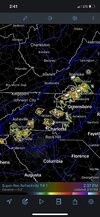
Some winter precip we can always count on. Gorilla hail
Webberweather53
Meteorologist
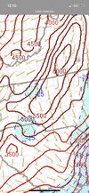
I guess it's possible to get a window end of the month beginning of March if this is right and we can get it out of 4,5 and 6 by months end. But a warming planet along with La Nina doesn't exactly scream March snow. I guess we'll see
View attachment 132153
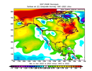
Almost everything except the actual La Niña in the equatorial Pacific is near-above average this winter
Webberweather53
Meteorologist
Better luck next year.
Flotown
Member
geez at the difference between 12z gfs and 18z gfs..lol fwiw 18 icon looks deeper at 500 mb
What about the massive sswe happening
Better luck next year.
Better luck next year.
What’s interesting about that is bouts of fairly cold temperatures… especially compared to average continued into April in 1989.
Iceagewhereartthou
Member
Sorry if already posted but looks like the record for Mt Washington got all the way to -110! ?

 nypost.com

Mount Washington as cold as Mars with record-breaking wind chills of 110 below
New Hampshire’s Mount Washington felt more like Mars than planet Earth on Friday as wind chills dipped below an unfathomable -110 degrees, a new record for the coldest wind chill ever recorded in t…
ATLwxfan
Member
Better luck next year.
This is why I don’t anticipate a cold spring.
Sent from my iPhone using Tapatalk
Stormlover
Member
January was below normal worldwide https://www.drroyspencer.com/2023/0...Y34UoJPA-kUDX5Kf6cnkmuQp1eCnzkGtpMentbRzYcUSYAlmost everything except the actual La Niña in the equatorial Pacific is near-above average this winter
View attachment 132154
I’m fully expecting a cold spring. The weather has spit in my eye concerning the tons of rain for the winter as a snow lover, so I expect it to do the same as a nice weather/severe storm lover in the Spring.This is why I don’t anticipate a cold spring.
Sent from my iPhone using Tapatalk

