Shaggy
Member
Suspect by the weekend we will start seeing plenty of missions over the western Atlantic to start data collection to help the models.
Ascat disagreesThe LLC is now completely removed from the deep convection. A downgrade to a TD seems likely to me once recon gets a look this afternoon.
Ehh on visible it's pretty decoupled at this point with the llc about 2-3 degrees west of the mlc and convection. Pretty important part of the life cycle now imo between the llc or mlc winning out and the eventual track. If the llc wins and the mlc dies off the westward cmc suite has a chance to be correct. If the mlc grabs the llc and pulls it back or the llc spins down and a new llc reforms back under the mlc a strong solution like the gfs may verifyAscat disagrees
Yeah not to sound cliche here but this one will be hard to pin down until we see a clear trend on intensity.Ehh on visible it's pretty decoupled at this point with the llc about 2-3 degrees west of the mlc and convection. Pretty important part of the life cycle now imo between the llc or mlc winning out and the eventual track. If the llc wins and the mlc dies off the westward cmc suite has a chance to be correct. If the mlc grabs the llc and pulls it back or the llc spins down and a new llc reforms back under the mlc a strong solution like the gfs may verify
Just coming on here to say this, it's weaker earlier, further south before finally starting to get it's act together and come up through the Bahamas. Very close to Fl @216Euro is going to be a US may run the EC
Looks like landfall at D9.5 north of Miami around 990

That would be a big mess for the east coast with the pressure gradient and onshore flow along with the huge PRE that is likelyThis might wake up the TC crowd lol


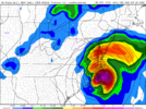
It's remarkable how many of these systems hug the contour of the coastline as the trough works in just in the nick of time.GFS rides just offshore Lookout to Hatteras as a Cat3/4...would wreck the OBX but nothing much in NC probably west of Hwy 17.....very classic near miss for the OBX, something like that but 100 miles further west then up the coast would be worse case for this track type....very Floyd/Bertha/Irene etc....
View attachment 121482
It's remarkable how many of these systems hug the contour of the coastline as the trough works in just in the nick of time.
It's funny you mentioned the F factor and North Carolina. I just got off the phone with a buddy of mine who loves watching the weather as I do and he brought up the fact that storms that begin with F like visiting North Carolina. Fiona will have to be watched in the coming days not just for North Carolina but the entire east coast. If the latest GFS run were to pan out it would bring the first Category 4 storm to hit the Carolina coast since Hazel in 1954 over the Outer Banks.Yep, and how just a few miles means a big difference with impacts in NC especially....but it does seem like the ridges breaks down just enough to keep many of these offshore.....that said NC like Sept hurricanes with a F name.....Fran, Floyd, Florence.
Looks like it’s stronger storm, more East track, like the GFS. VSGFS is way east and much strongerView attachment 121490
Euro and GFS getting closer together.Euro would have been threatening the coast if it went out past 240 hours. That's still an eternity away in terms of weather.
Yeah the gfs did a similar West turn a few runs ago so that's something the models are waffling on so we wait and see.Euro and GFS getting closer together.
Still very lopsided as the western part of the LLC still exposed but you're right, it is fighting and continues to have thunderstorm blowups right over the eastern edge of the LLC. This thing would take off in a hurry if shear relaxed and of course would also rocket ots. Still long ways to go with this one though as it continues to move west at a pretty good clipFiona is doing a better job of fighting off the westerly shear this AM. Yesterday, I really thought it had decoupled so much it may have never recovered.
