Update from NWS Raleigh:
.NEAR TERM /THIS AFTERNOON THROUGH TONIGHT/...
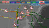
As of 955 AM Thursday...
...No changes to the current Winter Storm Warning and Winter Weather
Advisories.
Icing has been limited to mostly elevated surfaces, thus far. Most
of the significant icing reports of 0.1 to 0.18 have been from
Forsyth, Guilford, Granville, Vance, and Person Counties (in the
heart of the Winter Storm Warning). The temperatures have been
rather marginal again, with mostly readings in the 30-32 range in
the Warning Area, thus limiting the icing especially on roads. The
temperatures bottomed out around daybreak and have been steady or
slowly been creeping back toward 32 in the Warning area. However,
there continued to be a feed of dry and cold air from northern and
central VA into north-central NC. This is courtesy of the parent
high pressure of nearly 1030 mb located over NY/NJ, extending south
deep into our Piedmont damming region. Low level near surface
trajectories continue to be directed from where temperatures were in
the mid 20s in central VA.
Radar showed showery precipitation with large gaps in the heavier
rates, reducing to drizzle in the gap areas. Thus, it will take a
much of the day for the ice to reach Warning criteria on average
(0.25 or greater) in the heart of the Warning. That will be
challenging given the solar insolation and the temperatures so close
to 32. Some of the heavier showers will contain some thunderstorms
(as there is some instability noted aloft). In addition, some ice
pellets will be mixed with the heavier rain rates in the showers.
It appears that the icing will be a self limiting event in the
Advisory area (Albemarle to Raleigh to near Roanoke Rapids) where
readings should teeter between 32-33 with the CAA at the surface and
the solar insolation / higher rain rates offsetting and limiting
icing to north facing and elevated surfaces.
Models continue to show a lull late morning and much of the
afternoon in the west or northwest, with the steady and heavier
precipitation shifting into the east. Then, another wave aloft will
bring renewed precipitation later this afternoon and evening. Temps
should still be 32 or 31 over portions of the Warning area, thus
additional ice accrual is expected.
The Advisory area is in question unless we can tap into the low
level cold air a bit more in the next few hours
The flash flooding risk appears lower now - given the heavy QPF will
likely be in the south and east (lower end of the main stem rivers),
with lighter QPF of 0.25 to 0.50 over much of the Piedmont.