Brent
Member
folks all hell is breaking lose and i am scared 2005 redux part 2
The last time we had a long track hurricane in the Caribbean in July was 2005, just keep that in mind haha. Might have a few chances at that hereYeah there's still a month til the season usually really begins makes you wonder
The last time we had a long track hurricane in the Caribbean in July was 2005, just keep that in mind haha. Might have a few chances at that here


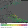
I found themA whole bunch of majors on this afternoon's 12z EPS. A couple of Hugo's mixed in. Curious if anybody has the 15 day EPS spaghetti plots from Weathermodels.com? @CyclonicFury ?View attachment 44688View attachment 44689
Here's the compilation of the minimum ensemble members:View attachment 44691
I found them
View attachment 44694
I have a feeling that in a two to three months we are going to wish this season did not happen even though it is fun to track at the moment.
Yeah my view on hurricanes have changed a lot since I moved to the coast.Yeah 2005 was fun for awhile and then...
We're still ahead on named storms as long as Gonzalo forms in the next couple of days and even Hanna is possible not counting that long range Euro storm
Yeah my view on hurricanes have changed a lot since I moved to the coast.
Some of the models are predicting this will become a tropical cyclone sometime next week.A tropical wave near the coast of Africa is expected to move
westward across the tropical Atlantic for the next several days.
Some development of this system is possible when it reaches the
western tropical Atlantic early next week.
* Formation chance through 48 hours...low...near 0 percent.
* Formation chance through 5 days...low...20 percent.
From the looks of it, the EPS is much less extreme than the Euro. the CTRL is a solid dud.
So we got 1 plane down in the Virgin islands now and one plane in Hawaii both probably flying soon into the storms approaching those locations. At the moment I'm more interested in Douglas as a hurricane hasn't struck Hawaii in some time.
And theres plenty of water area for the storm to trek missing the islands.We have a Douglas thread further down but I would be shocked if Douglas didn't significantly weaken before Hawaii remember Lane and Iselle
Lane was a cat 5 300 miles from Hawaii and fell apart at one point the forecast had a hurricane just west of Honolulu and it didn't even get close to that
Iselle was supposed to make it as a hurricane from the east much like this and it was 60 mph(a record for the Big Island)
Not to say there can't be significant impact but I highly doubt it's much over a very weak hurricane just based on history
the worst hurricanes in Hawaii have come from the south(Iniki and Iwa)


I've got a real sinking feeling about this wave leaving the coast of Africa, especially if it develops east of the Lesser Antilles like most models are hinting at. It's worth noting that in the 2000s, that nearly half of all "I" named storms got retired, and nearly all of those retired I storms formed east of the Antilles.
View attachment 44867
This wave is a total beast
View attachment 44868
Already has a 30% chance of genesis from the NHC
View attachment 44869

A few Euro ens have a storm in the SW Bahamas looking to go west of 75W which is the "oh crap" benchmark for the SE because once past 75W its got to go east to miss Hatteras.
View attachment 44872
I am staying in a house on Bogue Sound Sept 3-8th if NC takes a hit it will be then....
SW Bahamas is one of my personal benchmarks, the image just updated on that site kinda ominous for the SE...
View attachment 44874

