• Hello, please take a minute to check out our awesome content, contributed by the wonderful members of our community. We hope you'll add your own thoughts and opinions by making a free account!

Wintry February 19-21, 2020 Winter Storm

He’s been a metrologist for a long time. Based on his experience i would say


Sent from my iPhone using Tapatalk
My experience with brad says he downplays any winter threat (often excessively) on purpose until it’s beyond obvious that it’s actually going to snow. He will rarely stray too far from NWP models as most predictably do, and he often gets burned for that. He’s not horrible with winter storms but this is a very predictable pattern from Brad, in a few days he almost certainly won’t be singing the same tune if NWP evolves like I think they will going forward.

He’s still better than NWS GSP who’s had a god awful track record of late, completely whiffing on at least 2 storms this winter in the southern mountains of NC and going full on weenie in Dec 2018 over CLT when it was apparent we’d have considerable mixing issues here. Thank goodness for NWS RAH & FFC...

Yeah, Jan 2018 is a big case for Brad going to low, then as it started snowing he started saying things like “it won’t let up, there may be more snow than forecasted” when models were already showing a solid event
 
Plenty cold though, just need a little more moisture.... I think verbatim that was a raging virga storm up this way, maybe a renegade flake or two make it to the surface.

1581963304233.png
 
Still looks too flat and a tick SE this go.... still in the ball park of doable however.

View attachment 34920
I see a trend with better looks earlier in the run, but it ends up too flat by the time the system arrives. I think a little more improvement with the trough axis early on will result in a better look when the system arrives. There has to be enough of a trough for it to turn north a bit more. Hopefully the usual NW trend will happen...
 
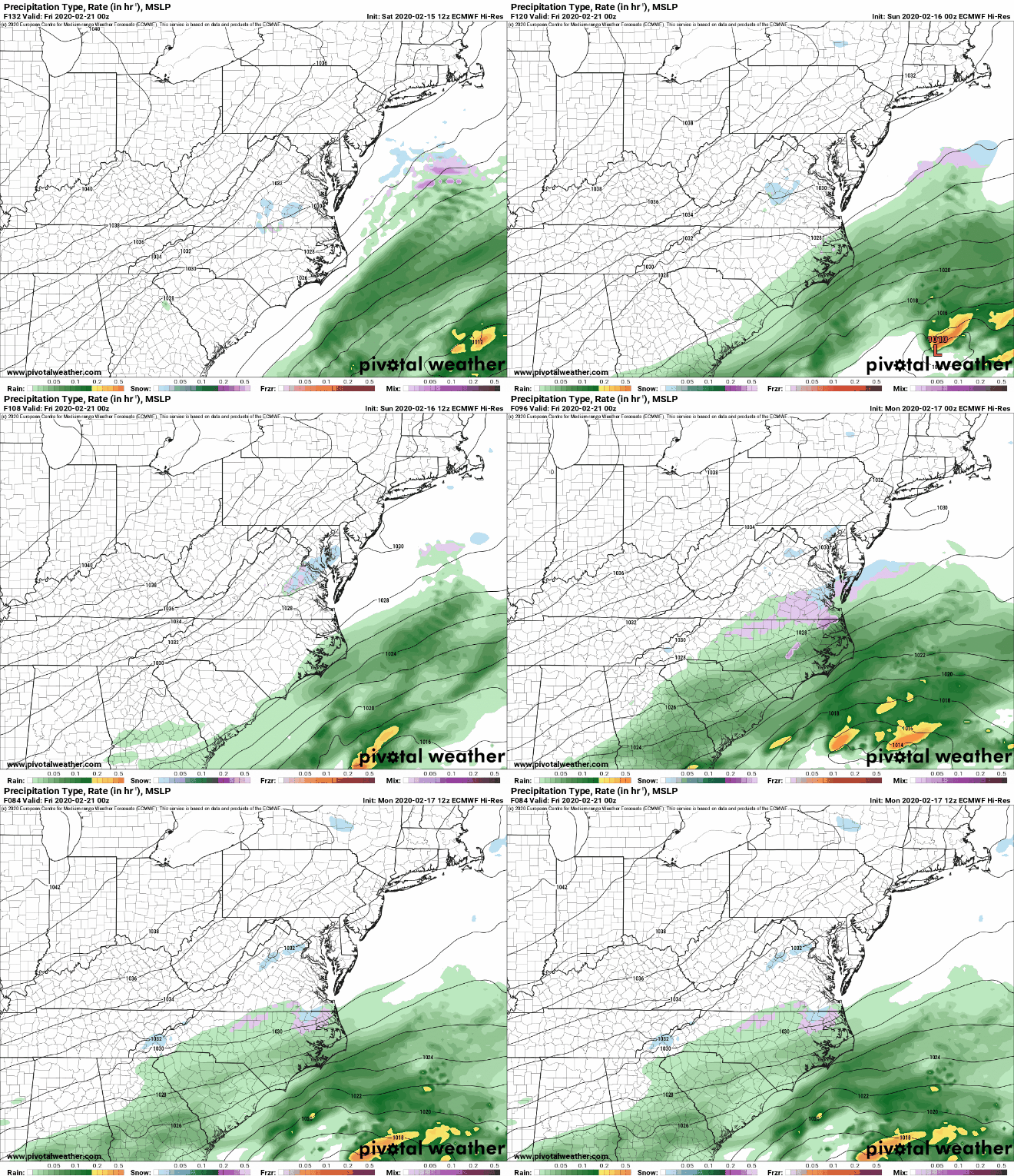
per tarheelsnow on amwx. euros trend westward with precip over the past few runs.
Euro.gif.12b3715e6ec2ea7368875d3a9e99848f.gif
 
per tarheelsnow on amwx. euros trend westward with precip over the past few runs.
Euro.gif.12b3715e6ec2ea7368875d3a9e99848f.gif
No question it has but it did tick slightly SE at 12z compared to 0z, still this isn't a bad look at all with just over 72 hrs to go

edit: was it a slight improvement over the 06z?
 
No question it has but it did tick slightly SE at 12z compared to 0z, still this isn't a bad look at all with just over 72 hrs to go

edit: was it a slight improvement over the 06z?
Euro continues to show us struggling to saturate the layers between 850 and 925 even when its showing precipitation reaching the sfc.
 
Back
Top