B
Brick Tamland
Guest
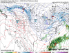
Yeah now that models are consistently trending we can really focus on the traditional gfs, U.K., euro group.
It’s nice to have other models support them but not necessary.
In fact, with a storm like this it’s possible even up to game time we have a random model showing nothing and others a big storm.
That’s what happened in 2010. Models didn’t get it right until 24-36 hrs out.
Trying to recall which model was the first one to start shifting NW with the storm then.


")

.gif")
