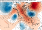
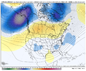
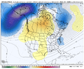
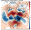
Yeah even the RMM charts show are in fairly good agreement of things going low amp or even CODThe Indian Ocean is about to lose influence completely. Might be a KW left over in the southern IO but that’s about it, all MJO forcing looks to move into the pacific, and the VP maps even show it in the general vicinity of the whem threshold, the RMM phase maps don’t tell everything and I see it posted often, but it doesn’t tell the full story. Normally when we get majority of forcing past the dateline is when good stuff starts happening so I’m shocked that we don’t have the best looks right now.
But there’s a lot of stuff weighing into the pacific jet, +EAMT/upcoming +AAM/MJO moving east, that’s a lot of momentum, maybe too much at once. This is a El Niño look though for sure, but rather a early cool season Nino look View attachment 142863View attachment 142864
-
Hello, please take a minute to check out our awesome content, contributed by the wonderful members of our community. We hope you'll add your own thoughts and opinions by making a free account!
You are using an out of date browser. It may not display this or other websites correctly.
You should upgrade or use an alternative browser.
You should upgrade or use an alternative browser.
Misc Winter Weather Support Group
- Thread starter RBR71
- Start date
rburrel2
Member
Are we gonna have a big piece of the south finish BN for January or are we about to blow it in the 4th quarter again?
I’m not really sure. Does anyone have a current MTD temperature anamoly map? I can never get it to load. If I had to take guess, it’s definitely going to take a big hit next week, but then CAD areas might have the torch cut short a bit.Are we gonna have a big piece of the south finish BN for January or are we about to blow it in the 4th quarter again?
D
Deleted member 609
Guest
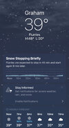
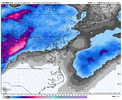
Take us out on your yacht?Even the fish and sharks are getting 6-8” with this event next couple of days. Mother Nature definitely trolling us now.
View attachment 142879
I got a buddy that captains charter boats out of Morehead City… that would an interesting chase.Even the fish and sharks are getting 6-8” with this event next couple of days. Mother Nature definitely trolling us now.
View attachment 142879
Drizzle Snizzle
Member
I wonder if the snow will stick to the water.Even the fish and sharks are getting 6-8” with this event next couple of days. Mother Nature definitely trolling us now.
View attachment 142879
NoSnowATL
Member
YepI wonder if the snow will stick to the water.
SimeonNC
Member
This literally pisses me off, as I said earlier how is it possible for LES to occur in the small ass lakes of North Texas but not off of Lake Norman which is pretty frickin big.
Is it an elevation thing, is it because the air was just THAT cold?
Is it an elevation thing, is it because the air was just THAT cold?
SimeonNC
Member
Weird nerd rage aside, I hope CLT doesn't make it out of the 20s Saturday. That would be cool.
I don’t think that will happen but if the winds calm early enough Saturday evening, there’s a shot at single digit lows Sunday morning. GSP has a low forecast of 13 right now but the wind not calming until laterWeird nerd rage aside, I hope CLT doesn't make it out of the 20s Saturday. That would be cool.
I’m gonna say that here Tuesday! ?was really hoping I’d get to hear someone say my favorite line “Cold air shouldn’t be an issue with this one.” right before getting warm nosed. Looks like I’ll have to wait til next year
While I’m watching rain wash my chair!
I don’t know how you go from low of -10 on Sunday night, to rain on Tuesday! ?
Things don’t work like they used to on SundayI’m gonna say that here Tuesday! ?
While I’m watching rain wash my chair!
I don’t know how you go from low of -10 on Sunday night, to rain on Tuesday! ?
Prestige Worldwide
Member
He needs more subscriptions to get him through summer!
Windergawx
Member
Never would have thought

 wlos.com

Multi-million-dollar loss for Asheville as flawed electric buses sit idle
The city of Asheville's purchase of five electric buses in 2018 has turned into a multi-million-dollar loss.
Brent
Member
This literally pisses me off, as I said earlier how is it possible for LES to occur in the small ass lakes of North Texas but not off of Lake Norman which is pretty frickin big.
Is it an elevation thing, is it because the air was just THAT cold?
Both times I've heard of it in Dallas yeah it was extremely cold
And as far as Sunday Night went there just happened to be a disturbance aloft apparently
NBAcentel
Member
SimeonNC
Member
3K NAM and HRRR only has CLT reaching 30 for a couple of hours Saturday afternoon. The northern parts of town and anywhere that isn't completely covered in concrete has a legit shot of not making to 30.I don’t think that will happen but if the winds calm early enough Saturday evening, there’s a shot at single digit lows Sunday morning. GSP has a low forecast of 13 right now but the wind not calming until later
It's wild how some of us made very early calls that February was falling apart and got blasted for it, told how it's wrong.
Yet professional forecasters are saying the same thing more and more every day.
Hm.
Yet professional forecasters are saying the same thing more and more every day.
Hm.
Twister
Member
Some on here was even praising highly how the end of Jan and early Feb was going to be the best pattern with best shot at winter weather. Yeah that's gonna work out great for themIt's wild how some of us made very early calls that February was falling apart and got blasted for it, told how it's wrong.
Yet professional forecasters are saying the same thing more and more every day.
Hm.
Sent from my SM-S911U using Tapatalk
I was one of the latter. Globally things looked okay, but nope. Looks like it's all falling apart now.Some on here was even praising highly how the end of Jan and early Feb was going to be the best pattern with best shot at winter weather. Yeah that's gonna work out great for them
Sent from my SM-S911U using Tapatalk
Now we are trying to find how if we get lucky, maybe we can see something vs. a great pattern.
rburrel2
Member
Wxprn
Definitely aliens mating. You heard it here first….
Well if it makes anyone feel any better, it's snowing again in Nashville.
Warm regards,
Warm regards,
We are going to have to pull a late February 2015. We are going to nuke our continent with pacific garbage because of these Arctic shots. What is discouraging is that we never recovered from it when the same thing happened in Late December 2022. We ended up losing the next few weeks because of it & then the ridge took over. I can see things coming together right at the tail end of Winter with some chances in early to mid Feb. We need an harambe size late Feb 2004 storm to save us all.lol how would we even get out of this? Double whammy up top. This is that ‘nail in the coffin’ kind of look imoView attachment 142888
Come on Jimmy. You can roll the model forward and see the action to get out of it. The only real issue for the first part of Feb is the pac jet everything else went as expectedlol how would we even get out of this? Double whammy up top. This is that ‘nail in the coffin’ kind of look imoView attachment 142888
Drizzle Snizzle
Member
Somehow we got blanked in Feb 2015. I guess the pattern wasn’t good for the I-20 corridor.We are going to have to pull a late February 2015. We are going to nuke our continent with pacific garbage because of these Arctic shots. What is discouraging is that we never recovered from it when the same thing happened in Late December 2022. We ended up losing the next few weeks because of it & then the ridge took over. I can see things coming together right at the tail end of Winter with some chances in early to mid Feb. We need an harambe size late Feb 2004 storm to save us all.
Come on Jimmy. You can roll the model forward and see the action to get out of it. The only real issue for the first part of Feb is the pac jet everything else went as expected
Yeah I can easily think of a pattern much worse than an over active jet; a big old SE heat dome. That said, that sounds ok right now.
I got blanked here in Columbia too. But in general, it was a really great pattern. Right up the road in the Northern Midlands, they had a really bad ice storm at like 31-32 degrees. Wild little stretch that basically saved what was a pretty lackluster Winter during the rest of the time.Somehow we got blanked in Feb 2015. I guess the pattern wasn’t good for the I-20 corridor.
SnowNiner
Member
lol how would we even get out of this? Double whammy up top. This is that ‘nail in the coffin’ kind of look imoView attachment 142888
Retract the jet, the pacific low follows west. The ridge pops west and the east gets troughed. What do I win? ?
The writing is on the wall. I see nothing that gives optimism except the unknown from models weeks 3-4.lol how would we even get out of this? Double whammy up top. This is that ‘nail in the coffin’ kind of look imoView attachment 142888

