This is clearly just a guess with no scientific evidence but I've noticed over the years that some dates really stick out when it comes to getting storms. For example December 7th thru 10th and December 18th-20th and January 20th along with Valentines day. Idk why but those are the dates I typical see snow in the Mtns/foothills. Call me crazy but even the other day on the 18 if we just had more cold it would have been a monster. So just going off old intuition and webbs analysis I think mid to late January will produce. Around the 20th book it!!!!
-
Hello, please take a minute to check out our awesome content, contributed by the wonderful members of our community. We hope you'll add your own thoughts and opinions by making a free account!
You are using an out of date browser. It may not display this or other websites correctly.
You should upgrade or use an alternative browser.
You should upgrade or use an alternative browser.
Wintry Winter Discussion 2023/24
- Thread starter Rain Cold
- Start date
packfan98
Moderator
Couple of hum dingers in there and a several members were setting up for more at the end of the run.

Flotown
Member
may mean nothing but boy thats a signal right thereCouple of hum dingers in there and a several members were setting up for more at the end of the run.
SnowNiner
Member
GEFS looks pretty great the beginning of January. EPS looks good too, but starts to get funky at the end imo with an Aleutian ridge. Hope that doesn't hold. Maybe that's the Midwest snow pack pattern. ?

NBAcentel
Member
It likely is. That evolution will probably occur given what’s going on subseasonal wise, we eventually go into a -PNA, but the southeast ridge will likely be muted especially since the mean ridge is in Canada, which will excite the -NAO, we go for another extension mid-late jan, then we see the typical canonical Feb Nino pattern. First week into the second of January is a preview with a favorable H5 pattern, but are we cold enough, do we score ? I think we have a shot, but we need some helpGEFS looks pretty great the beginning of January. EPS looks good too, but starts to get funky at the end imo with an Aleutian ridge. Hope that doesn't hold. Maybe that's the Midwest snow pack pattern. ?
View attachment 138878
SnowNiner
Member
It likely is. That evolution will probably occur given what’s going on subseasonal wise, we eventually go into a -PNA, but the southeast ridge will likely be muted especially since the mean ridge is in Canada, which will excite the -NAO, we go for another extension mid-late jan, then we see the typical canonical Feb Nino pattern. First week into the second of January is a preview with a favorable H5 pattern, but are we cold enough, do we score ? I think we have a shot, but we need some help
I think the only way we score with the loathsome -pna, is a true to form -ao and -nao, with a classic 50/50 that provides confluence. Not the fake greenland ridge that doesnt do much.That would need to be our cold source and keep the track south. I guess that's for the second week, the first week seems more classic opportunity if we can just get cold enough.
tennessee storm
Member
I can’t not believe we do this to ourselves every winter season, least some do.worry bout this n that to get the pattern we need. Personally I’m looking forward to spring severe chase season already. Know that s not going be a popular post …. But with a developing La Niña this spring I’m intrigued . Hopefully we can score a big winter storm or even two….I think the only way we score with the loathsome -pna, is a true to form -ao and -nao, with a classic 50/50 that provides confluence. Not the fake greenland ridge that doesnt do much.That would need to be our cold source and keep the track south. I guess that's for the second week, the first week seems more classic opportunity if we can just get cold enough.
Last edited:
ATLwxfan
Member
I can’t not believe we do this to ourselves every winter season, least some do.worry bout this n that to get the pattern we need. Personally I’m looking forward to spring severe chase season already. Know that s not going be a popular post …. But with a developing La Niña this spring I’m intrigued . Hopefully we can score a bi go winter storm or even two….
It would be helpful for us to get cold up here in the western Great Lakes and upper Midwest and even get some snow cover to help source some cold for you guys. It’s been abysmal. We are pushing 60° on Christmas Eve!
Sent from my iPhone using Tapatalk
Last edited:
Dec 22 - my thoughts on the pattern ahead

Euro Control looked purty awesome tooCouple of hum dingers in there and a several members were setting up for more at the end of the run.


- Joined
- Jan 23, 2021
- Messages
- 4,604
- Reaction score
- 15,203
- Location
- Lebanon Township, Durham County NC
Not to mention we barely whiffed 36 hours earlier that runEuro Control looked purty awesome too
The models are struggling with next week's trough. Not surprising since by then we're on the cusp of a major pattern change.
ICON says don't sleep on the end of December.

ICON says don't sleep on the end of December.
I thought the end is January was when Webb said we should have our best shot?Dec 22 - my thoughts on the pattern ahead
Blue_Ridge_Escarpment
Member
Interesting that you should mention that. The GFS just took the 500mb from Chicago at the 6Z run to Memphis on the 12Z run for 12/28.The models are struggling with next week's trough. Not surprising since by then we're on the cusp of a major pattern change.
ICON says don't sleep on the end of December.
I don’t think I’ve ever seen that before.Something like this? ?

Not to mention 24 hours ago, the GFS had a closed UUL on the south shore of Hudson Bay lol.Interesting that you should mention that. The GFS just took the 500mb from Chicago at the 6Z run to Memphis on the 12Z run for 12/28.

Iceagewhereartthou
Member
That would probably get me excited if I were in the mountains but alas... even the humdingers don't look too promising for many.Couple of hum dingers in there and a several members were setting up for more at the end of the run.
- Joined
- Jan 23, 2021
- Messages
- 4,604
- Reaction score
- 15,203
- Location
- Lebanon Township, Durham County NC

Meh, too far south, we toss! ?Euro Control looked purty awesome too
packfan98
Moderator
Maybe there’s a chance the MJO does a loop in the COD and avoids the bad phases?
.png)
NBAcentel
Member
Unfortunately no, it looks like it on the RMM charts but trop forcing will eventually settle around the Indian Ocean for a minute after the current MJO pulse leaves, which will set the pacific jet retraction in motion, can see it easily on VP charts Vs the RMM. Looks like we’ll have favorable MJO propagation again sometime around the 2nd-3rd week of January, and we might start seeing downwelling effects of the possible SSW coming up. It’s worth noting that while we may get into a -PNA pattern due tropical forcing, it’s also is what is likely gonna start a legitimate period of -NAO.Maybe there’s a chance the MJO does a loop in the COD and avoids the bad phases?
Basically my thinking.
week 1-1.5 of jan = favorable pattern, questionable cold, but we could make something happen, need certain things in the overall longwave pattern to go right (deep northern stream trough over the NE US/SE Canada, trailing wave(s) associated with wavebreaking from the GOAK longwave trough)
- Week 1.5-3 of jan might get mild/lackluster because the MJO will finally encourage -PNA/western troughing, which should kickstart a favorable Atlantic pattern
-week 3 of jan we make a favorable flip and probably see the most favorable pattern since January 2022

packfan98
Moderator
Great analysis! I hope that it pans out. I’m afraid many of us are going to get a little squirrelly if we have to wait until the 2nd half of January, but the evolution of the pattern definitely looks promising.Unfortunately no, it looks like it on the RMM charts but trop forcing will eventually settle around the Indian Ocean for a minute after the current MJO pulse leaves, which will set the pacific jet retraction in motion, can see it easily on VP charts Vs the RMM. Looks like we’ll have favorable MJO propagation again sometime around the 2nd-3rd week of January, and we might start seeing downwelling effects of the possible SSW coming up. It’s worth noting that while we may get into a -PNA pattern due tropical forcing, it’s also is what is likely gonna start a legitimate period of -NAO.
Basically my thinking.
week 1-1.5 of jan = favorable pattern, questionable cold, but we could make something happen, need certain things in the overall longwave pattern to go right (deep northern stream trough over the NE US/SE Canada, trailing wave(s) associated with wavebreaking from the GOAK longwave trough)
- Week 1.5-3 of jan might get mild/lackluster because the MJO will finally encourage -PNA/western troughing, which should kickstart a favorable Atlantic pattern
-week 3 of jan we make a favorable flip and probably see the most favorable pattern since January 2022View attachment 138883
Great read!!! The type of -PNA that you’re talking about during that time is also one that doesn’t necessarily mean a torch. The ridge over Canada should keep the SER very muted and the models keep wanted to set that vortex up over Baffin Bay… that’s a pattern that CAD areas could still score in with good timing.Unfortunately no, it looks like it on the RMM charts but trop forcing will eventually settle around the Indian Ocean for a minute after the current MJO pulse leaves, which will set the pacific jet retraction in motion, can see it easily on VP charts Vs the RMM. Looks like we’ll have favorable MJO propagation again sometime around the 2nd-3rd week of January, and we might start seeing downwelling effects of the possible SSW coming up. It’s worth noting that while we may get into a -PNA pattern due tropical forcing, it’s also is what is likely gonna start a legitimate period of -NAO.
Basically my thinking.
week 1-1.5 of jan = favorable pattern, questionable cold, but we could make something happen, need certain things in the overall longwave pattern to go right (deep northern stream trough over the NE US/SE Canada, trailing wave(s) associated with wavebreaking from the GOAK longwave trough)
- Week 1.5-3 of jan might get mild/lackluster because the MJO will finally encourage -PNA/western troughing, which should kickstart a favorable Atlantic pattern
-week 3 of jan we make a favorable flip and probably see the most favorable pattern since January 2022View attachment 138883
NBAcentel
Member
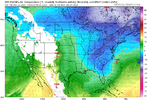
really good GEFS run here at 18z. There has been a notable trend to getting this ridge more poleward/towards Alaska, that pacific look is probably the best look I’ve honestly seen since 2022, and similar in a lot of ways in regards to positioning of the ridge axis. But we unloaded a crap ton of cold in NW Canada that December leading up 

packfan98
Moderator
The STJ seems to keep the moisture rolling through too. Just about all of the players are there and we are looking to at least be in the game.really good GEFS run here at 18z. There has been a notable trend to getting this ridge more poleward/towards Alaska, that pacific look is probably the best look I’ve honestly seen since 2022, and similar in a lot of ways in regards to positioning of the ridge axis. But we unloaded a crap ton of cold in NW Canada that December leading up View attachment 138885View attachment 138884
SnowNiner
Member
really good GEFS run here at 18z. There has been a notable trend to getting this ridge more poleward/towards Alaska, that pacific look is probably the best look I’ve honestly seen since 2022, and similar in a lot of ways in regards to positioning of the ridge axis. But we unloaded a crap ton of cold in NW Canada that December leading up View attachment 138885View attachment 138884
I'm just excited to see that the purplest vortex is actually on our side of the earth, and not in Siberia. Feels like it's been a minute.
I can't imagine that look wouldn't snow on us if we get the timing right.
This is just a dumb 384 18z GFS 500mb height image. I haven't looked at the surface, although i did peek at the 850s, which looked just about like i thought they would.
Who knows if it will end close to this, but it's at least pleasant to see these kinds of images showing up regularly now. That said, if and when the actual pattern evolves like this, somebody in the Southeast is getting a snowstorm before all is said and done. You can take that to the bank.
Who knows if it will end close to this, but it's at least pleasant to see these kinds of images showing up regularly now. That said, if and when the actual pattern evolves like this, somebody in the Southeast is getting a snowstorm before all is said and done. You can take that to the bank.
Last edited:
BHS1975
Member
This is just a dumb 384 18z GFS 500mb height image. I haven't looked at the surface, although i did peek at the 850s, which looked just about like i thought they would.
Who knows if it will end close to this, but it's at least pleasant to see these kinds of images showing up regularly now. That said, if and when the actual pattern evolves like this, somebody in the Southeast is getting a snowstorm before all is said and done. You can take that to the bank.
Siberian express.
Sent from my iPhone using Tapatalk
Avalanche
Member
The deer are thicker around here this winter, for what it’s worth….where’s Corey the critter guy?
Heelyes
Member
Not possible in this climateSiberian express.
Sent from my iPhone using Tapatalk
Avalanche
Member
Feels like I am still paying the price for the historic Jan 2000 stormNot possible in this climate
iGRXY
Member

I got a feeling if this run went further you would see a snow storm in the south. Very well established cold feed with 850’s sub freezing past the gulf coast and a nice trailing wave sliding down the ridge in the Rockies. Keep the TPV near the border and this would’ve been a big boy I think.
NBAcentel
Member
This gefs run is the first banger of the winter 


NBAcentel
Member
Euro is going for it ?
NBAcentel
Member
IS THIS GOOD 


NBAcentel
Member
Euro was a good example of what can go right in this pattern, NE US vortex for confluence/cold feed, and a trailing wave that came in at the right time from a GOAK wavebreak, and far enough south due to the suppressive track
Key is getting some energy left in Canada to dive down into the longwave trough into the eastern US. Injects more cold into the pattern, and strengthens the long wave trough. All key things that’s around day 5-7
NBAcentel
Member
Interesting how this EPS run goes. At day 7 looks very similar to the OP euro 

The GEFS members that hit looked oddly similar to the 00z euro. We sniff. We wait. We ponder.Interesting how this EPS run goes. At day 7 looks very similar to the OP euro View attachment 138909View attachment 138910