Here you go for all wanting … watch out in that bullseye .. I’m confident someone gets a tornado In there 

What do the colors represent? I don't see a legend.Here you go for all wanting … watch out in that bullseye .. I’m confident someone gets a tornado In there View attachment 88505View attachment 88506
Here's one with a legendWhat do the colors represent? I don't see a legend.

That forecast projection pretty much hit the bullseye on Elsa tropical tornadoesHere you go for all wanting … watch out in that bullseye .. I’m confident someone gets a tornado In there View attachment 88505View attachment 88506
It's Fred dood lolBased on current position the N/E quad of Frank looks to squarely hit upstate SC and go into the mtns/foothills of NC.
I think that’s why we are seeing favorable upslope and longer period of Atlantic moisture coming ashore. Perfect track for a mess.Fred has been tracking well west of what the UKMET showed on runs the last few days. They had him go NNE from the far SW corner of GA to east of ATL. Not a good performance at all on the track to this point.
Fred has been tracking well west of what the UKMET showed on runs the last few days. They had him go NNE from the far SW corner of GA to east of ATL. Not a good performance at all on the track to this point.


 oth starting to get some rotating showers
 Damn even gives wake county a couple waves of storms .. I doubt we can get into that main line but I’ll hope we can get a sniffThat’s a nasty QLCS on the hrrr later View attachment 88520oth starting to get some rotating showers View attachment 88518View attachment 88519
Was way hing that one. It's a nasty one. They extended the tornado warningTornado in Banks county.View attachment 88517
That tornado is still on the ground. It's actually looking a little healthier than me. A tiny CC dot is poking out. But how high the radar beams are hitting doesn't give it a good representation. Because it's picking up higher on the storm cause the radar is far away.

Damage reports already in Banks county.That tornado is still on the ground. It's actually looking a little healthier than me. A tiny CC dot is poking out. But how high the radar beams are hitting doesn't give it a good representation. Because it's picking up higher on the storm cause the radar is far away.


24HR totals from MRMS
View attachment 88526
I honestly think these radar estimates tend to underestimate tropical rainfall totals since it tends to be more efficient than your typical rainfall from a front or extra-tropical cyclone.
Yeah that seems to be the case. Supposedly the experimental mrms data cut that bias a good bit. I'm not sure how the map I posted compares to observational data or if the mrms I have access to is the latest and greatestI honestly think these radar estimates tend to underestimate tropical rainfall totals since it tends to be more efficient than your typical rainfall from a front or extra-tropical cyclone.
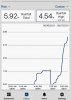
looks like MRMS was a little shortyes I think so in this instance. I am in Cornelia and my rain gauge is overflowing and it is a 6" gauge.


 Based on current position the N/E quad of Frank looks to squarely hit upstate SC and go into the mtns/foothills of NC.
