NBAcentel
Member
Yeah, I really don't trust the American models at this point anymore now that I think of it
 6Z looks a little better! Nice 1040 high in a good spot. Low goes near ATL to off MYB. Baby steps! Frozen looks a little more S than 0z
It’s a touch north (the high) but the air is very dry and it’s a pretty strong high. It looks pretty good. Bring it south a tad and we’re golden. As long as the precipitation shows up.View attachment 102646Z looks a little better! Nice 1040 high in a good spot. Low goes near ATL to off MYB. Baby steps! Frozen looks a little more S than 0z
It’s a touch north (the high) but the air is very dry and it’s a pretty strong high. It looks pretty good. Bring it south a tad and we’re golden. As long as the precipitation shows up.
Love the trends as if late.
-GFS and GEFS caving to the euro.
-Euro Op and EPS trending stronger w/CAD.
-GFSFV3 is an outlier due to amping wave.
-Virtually all other models agree with suppression.
-Euro and EPS wetter with each run over Central NC

Maybe he forgot to check the Euro this morning, LOL.
See the 6z GFS and 0z EuroWell is the models showing anything any different. I really don’t see any accumulating snow outside the mountains. I think upstate and ne ga sees snow/sleet to start changing to rain relatively quickly
Sent from my iPhone using Tapatalk
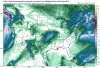
Any one have gefs snow map

WTF?
Yeah the GEFS has spoken. WNC and MA threatLooks like GEFS members are zeroing in on a Western NC storm. Anyone have the EPS members?
See the 6z GFS and 0z Euro
Well is the models showing anything any different. I really don’t see any accumulating snow outside the mountains. I think upstate and ne ga sees snow/sleet to start changing to rain relatively quickly
Sent from my iPhone using Tapatalk
Why?


Yes. Thanks. I think True Weather is the only sight with good maps for the UKMET.
Yuck..... how does the Ukie usually do with surface temps? I know the Euro can tend to be a degree or two warm, that map is a degree or 2 away from an icy mess.
Yuck..... how does the Ukie usually do with surface temps? I know the Euro can tend to be a degree or two warm, that map is a degree or 2 away from an icy mess.
Thanks.... kinda thought that may be the case, although the hp still a little too far north it's not in the most terrible position and very dry airmass to work with. That could spell troubleIt runs warm at the surface.
So the 6z ICON and the 6z GFS regular have a 1040+ high just north of the border throughout the storm, weakening it as the storm leaves. This would be a big winter storm for the upper SE.
The Euro has a 1038ish high just north of the border throughout the storm, weakening it as it leaves. This would also be a big winter storm for the upper SE, assuming there's enough precip.
The Canadian has a 1041 high but farther north. Storm farther north. More rain.
The 6z GFS extra crispy has a 1044 high way north. Storm farther north. More rain.
The UK looks like it has a mid 1030s high with warm surface temps (probably too warm). Looks like a decent hit for the upper SE.
Bottom line, a high of 1040 mb or stronger that only slightly weakens but stays in place just north of the border (or south) will result in a big winter storm, assuming there is good precipitation. Some of the models still have the high too far north. That would be ice to rain. RAH says it will be 0z Friday before all of the pieces are well sampled by the models. So, we'll have to wait to see how things shake out. I would root for a more suppressive and stronger high at this range, given how we see things usually trend.
Correct me if I'm wrong Cyclogent, going south puts us closer to the game.12z ICON coming in south guys...


We're very much in the game as is on the front end, our issue is just getting precip in here before WAA takes over. Pretty much anything that falls Friday night into early Saturday morning is going to be snow. Further south would help us pick up more precip from the initial band ahead of the main wave. The 6z FV3 for example has all of the precip from the initial band passing just to our north. Thermals are supportive of snow, just need the precip.Correct me if I'm wrong Cyclogent, going south puts us closer to the game.


Why? Back it up with reasoning.Outside the mountains in North Carolina will do well. I should of specified upstate sc and ne ga brief mix changing to rain. It’s all subject to change it’s only Tuesday.
Sent from my iPhone using Tapatalk
Why? Back it up with reasoning.
Sent from my SM-G955U using Tapatalk
So that would be a meso high into the mid atlantic?12z NAM vs 6z GFS vs 6z new GFS (all same time of 00z Saturday)
Can you see the difference??
View attachment 10276View attachment 10277View attachment 10278